Skip to main content
Advanced Search Objects: results
Close
Refine Results
Show Only Public Domain
Format
*
Map
(23)
Date
to
Names
Faden William, 1749-1836
(6)
Wm. Faden
(4)
Turner, Enoch, 1792-1866
(3)
Unknown
(3)
Howard, John George, 1803-1890
(2)
Bennett, John
(2)
Robert Sayer and John Bennett (Firm)
(2)
Wilkinson, W. C.
(2)
Walker, John, 1786-1873
(2)
Sayer, Robert, 1725-1794
(2)
Load all
Subject
History
(23)
Maps
(22)
War of 1812
(9)
Revolution, 1775-1783
(7)
Homes and haunts
(3)
Cartography
(2)
Colonies
(2)
Historical geography
(2)
Administrative and political divisions
(1)
Boundaries
(1)
Load all
Collection
Baldwin Collection of Canadiana
(23)
Language
English
(23)
City, town or township
Châteauguay
(1)
Saint-Hyacinthe
(1)
Sort:
Relevance
Date (Older First)
Date (Newer First)
Title (A–Z)
Title (Z–A)
Last Updated (Ascending)
Last Updated (Descending)
List
Images
Table
/ 2
Next
Advanced Search
Filters
Title
Names
Subject
Call Number / Accession Number
Date Range
to
Collection
All
Archives of Ontario
Arthur Conan Doyle Collection
Arts department
Baldwin Collection of Canadiana
Business, Science, and Technology department
Chinese Canadian Archive
City of Toronto Archives
Humanities and Social Sciences department
IBBY Collection for Young People with Disabilities
Languages and Literature department
Local History Collection, Annette branch
Local History Collection, Beaches branch
Local History Collection, Bloor/Gladstone branch
Local History Collection, Dufferin/St. Clair branch
Local History Collection, Gerrard/Ashdale branch
Local History Collection, Leaside branch
Local History Collection, North York Central Library branch
Local History Collection, Northern District branch
Local History Collection, Palmerston branch
Local History Collection, Parkdale branch
Local History Collection, Riverdale branch
Local History Collection, Sanderson branch
Local History Collection, Weston branch
Local History Collection, Wychwood branch
Merril Collection of Science Fiction, Speculation and Fantasy
Ontario History Quest
Osborne Collection of Early Children's Books
Special Collections in the Arts
Toronto Public Library Archives
Toronto Reference Library
Toronto Star Photograph Archive
zTEST
Formats
All
Artifact (an object in our collections)
Book
Ephemera
Fonds
Manuscript
Map
Photo Album
Picture
Language
All
Abenaki
Algonquin (other)
Athapascan
Beothuk
Catalan
Chinese
Chinook jargon
Cree
Croatian
Dakota
Danish
Dene Suline
Dené
Dogrib
Dutch
English
French
Gaelic, Scottish
German
Greek, Ancient (to 1453)
Greek, Modern (1453- )
Haida
Haudenosaunee
Hungarian
Innu-aimun
Inuktitut
Irish
Italian
Japanese
Language
Latin
Maliseet–Passamaquoddy
Miꞌkmaq
Mohawk
No linguistic content
Norwegian
Ojibwa
Oneida
Portugese
Russian
Seneca
Serbian
Siksika
Spanish
Swedish
Tsimshian
Ukrainian
Welsh
Wendat
Yiddish
Clear
23 for
Subject
:
History
Map
Clear All Filters
Map of the seat of Riel's insurrection showing the connection of Prince Albert with other points in the North West
1885
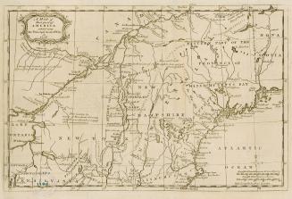
A general map of the northern British colonies in America
1776
A general map of the middle British colonies, in America
1776
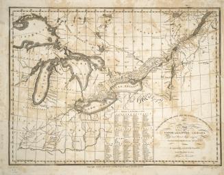
To the officers of the Army and the citizens of the United States This map of Upper and Lower Canada and United States contigious Contracted from the (...)
1812
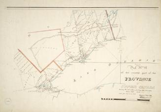
Part of the central part of the province of Upper Canada shewing the seat of War in the Years 1812, 1813 & 1814
1819
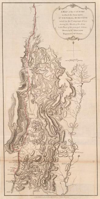
A map of the country in which the army under Lt. General Burgoyne acted in the campaign of 1777
1780
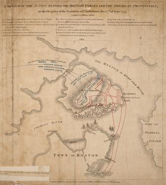
A sketch of the action between the British forces and the American provincials, on the Heights of the Peninsula of Charlestown, the 17th of June 1775
1775
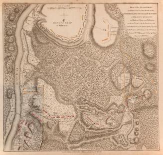
Plan of the Encampment and Position of the Army under His Excellency Lt
1780
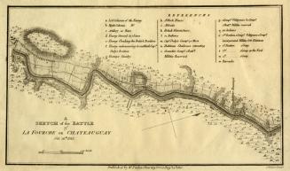
A sketch of the Battle of La Fourche or Chateauguay Oct
1815
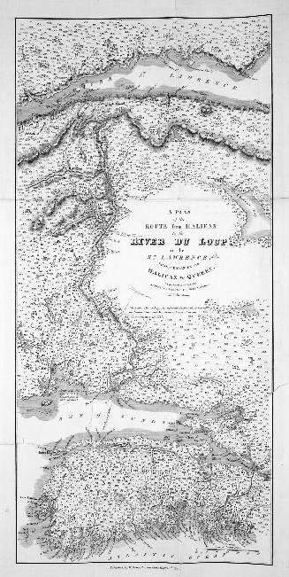
A Plan of the Route from Halifax to the River du Loup on the St
1815
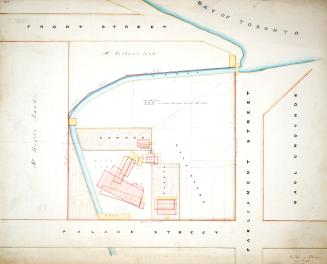
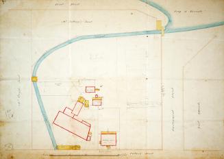
Plan of property belonging to Enoch Turner, Esq
1850-06-01
Plan of property belonging to Enoch Turner, Esq
185?
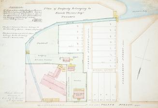
Plan of property belonging to Enoch Turner, Esq
1854-09-19
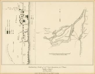
Explanatory Sketch of Coll. Gore's Operations at St. Denis (Quebec), 23rd Novr 1837
1840
A map of that part of America which was the principal seat of war in 1756
1756
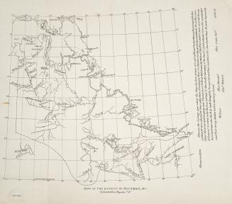
Map of the district of Assiniboia, 1811
1811
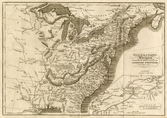
United States of America exhibiting the seat of war on the Canadian frontier from 1812 to 1815
1816-08-05
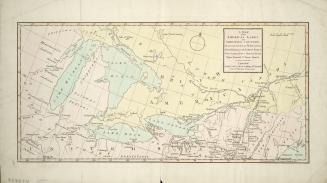
A map of the American Lakes and Adjoining Country, the present Seat of War between Great Britain & the United States
1813
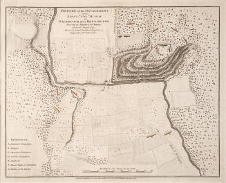
Position of the detachment under Lieut t Col l Baum at Walmscock near Bennington shewing the attacks of the Enemy on the 10th August 1777
1780
A new correct map of the seat of war in Lower Canada protracted from Holland's large map compiled from actual survey made to order of the Provincial G(...)
1814
/ 2
Next
RDF
XML
JSON