Skip to main content
Advanced Search Objects: results
Close
Refine Results
Show Only Public Domain
Format
Map
(1,135)
Book
(67)
Ephemera
(16)
Manuscript
(7)
Picture
(5)
Date
to
Names
Goad, Charles E.
(188)
Chas. E. Goad, Ltd.
(186)
Unknown
(71)
Burland Lithographic Co.
(37)
Boulton, W. S. (William Sommerville), 1830-1860
(32)
Ellis, J.
(32)
Boulton, H. C. (Henry Carew), 1833-1898
(31)
Ontario. Department of Crown Lands
(31)
Copp Clark Company
(29)
Jefferys, Thomas, -1771
(27)
Load all
Subject
Maps
(1,230)
Fire insurance
(187)
Maps and surveys
(141)
Land subdivision
(102)
Railroads
(65)
Roads
(61)
Real property
(45)
Discovery and exploration
(43)
History
(42)
Cities and towns
(33)
Load all
Collection
Baldwin Collection of Canadiana
(1,209)
Humanities and Social Sciences department
(8)
Toronto Public Library Archives
(4)
Osborne Collection of Early Children's Books
(3)
Toronto Star Photograph Archive
(2)
Archives of Ontario
(1)
Arthur Conan Doyle Collection
(1)
Local History Collection, Leaside branch
(1)
Special Collections in the Arts
(1)
Language
English
(1,106)
French
(70)
Latin
(28)
German
(15)
Italian
(11)
No linguistic content
(4)
Language
(3)
Spanish
(3)
Dutch
(2)
Building, monument or park
Toronto Harbour
(16)
Fort York
(8)
Toronto Public Library. Wychwood Branch
(2)
Canadian National Exhibition (CNE)
(1)
Fort Frontenac
(1)
Fort George
(1)
Fort Ticonderoga (N.Y.)
(1)
Louisbourg (N.S.)
(1)
Moulthorp Lumber Company
(1)
Osgoode Hall (Toronto, Ontario)
(1)
Load all
City, town or township
Toronto
(405)
Montréal
(13)
Québec
(13)
Ottawa
(6)
Belleville
(5)
Kawartha Lakes
(4)
King (Ont. : Township)
(4)
Vaughan
(4)
Ameliasburgh (Ont.: Township)
(3)
Hamilton
(3)
Load all
Neighbourhood
Harbour
(49)
Railway Lands
(35)
Garrison
(33)
King-Spadina
(32)
Downtown
(29)
St. Lawrence
(24)
Financial District
(23)
Toronto Islands
(21)
Exhibition
(20)
Cabbagetown
(19)
Load all
North-south street
Yonge Street
(12)
Bathurst Street
(7)
Dovercourt Road
(5)
Dufferin Street
(5)
Bay Street
(3)
Christie Street
(3)
Leslie Street
(3)
Lippincott Street
(3)
Peter Street
(3)
Sherbourne Street
(3)
Load all
East-west street
Bloor Street West
(22)
College Street
(7)
Davenport Road
(7)
Dundas Street West
(5)
Front Street West
(5)
Queen Street West
(5)
King Street West
(4)
Kingston Road
(4)
Bloor Street East
(3)
Dupont Street
(3)
Load all
Sort:
Relevance
Date (Older First)
Date (Newer First)
Title (A–Z)
Title (Z–A)
Last Updated (Ascending)
Last Updated (Descending)
List
Images
Table
Previous
/ 62
Next
Advanced Search
Filters
Title
Names
Subject
Call Number / Accession Number
Date Range
to
Collection
All
(not assigned)
Archives of Ontario
Arthur Conan Doyle Collection
Arts department
Baldwin Collection of Canadiana
Business, Science, and Technology department
Chinese Canadian Archive
City of Toronto Archives
Humanities and Social Sciences department
IBBY Collection for Young People with Disabilities
Languages and Literature department
Local History Collection, Annette branch
Local History Collection, Beaches branch
Local History Collection, Bloor/Gladstone branch
Local History Collection, Dufferin/St. Clair branch
Local History Collection, Gerrard/Ashdale branch
Local History Collection, Leaside branch
Local History Collection, North York Central Library branch
Local History Collection, Northern District branch
Local History Collection, Palmerston branch
Local History Collection, Parkdale branch
Local History Collection, Riverdale branch
Local History Collection, Sanderson branch
Local History Collection, Weston branch
Local History Collection, Wychwood branch
Merril Collection of Science Fiction, Speculation and Fantasy
Ontario History Quest
Osborne Collection of Early Children's Books
Special Collections in the Arts
Toronto Public Library Archives
Toronto Reference Library
Toronto Star Photograph Archive
Formats
All
Artifact (an object in our collections)
Book
Ephemera
Manuscript
Map
Photo Album
Picture
Language
All
Abenaki
Algonquin (other)
Athapascan
Beothuk
Catalan
Chinese
Chinook jargon
Cree
Croatian
Dakota
Danish
Dene Suline
Dené
Dogrib
Dutch
English
French
Gaelic, Scottish
German
Greek, Ancient (to 1453)
Greek, Modern (1453- )
Haida
Haudenosaunee
Hungarian
Innu-aimun
Inuktitut
Irish
Italian
Japanese
Language
Latin
Maliseet–Passamaquoddy
Miꞌkmaq
Mohawk
No linguistic content
Norwegian
Ojibwa
Oneida
Portugese
Russian
Seneca
Serbian
Siksika
Spanish
Swedish
Tsimshian
Ukrainian
Welsh
Wendat
Yiddish
Clear
1,230 for
Subject
:
Maps
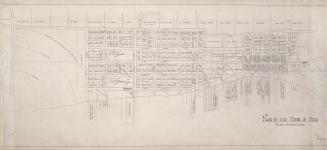
Atlas of the City of Toronto and suburbs : founded on registered plans and special surveys showing plan numbers, lots & buildings (volume I)
1912
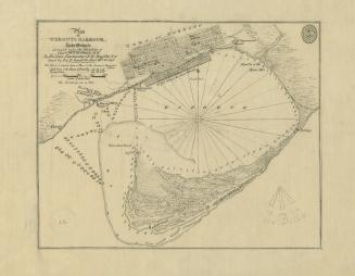
(1828) Plan of Toronto Harbour, Lake Ontario surveyed under the direction of Captn W.F.W. Owen, R.N
Approximately 1908
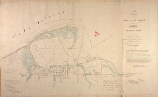
(1833) No. 1 plan of the town and harbour of York Upper Canada and also of the Military Reserves
1907
Illustrated historical atlas of the county of Peel, Ont.
1877
Electoral atlas of the Dominion of Canada: as divided for the revision of the voters' lists made in the year 1894
1895
Plan of esplanade in connection with the Grand Trunk and other railways
1853
Coast telegraph chart of the Gulf and lower St. Lawrence and Maritime Provinces
1881
Map of Canada West exhibiting all the post offices, counties, railroads, and free grant roads, republished by authority 1863
1863
Belt line map shewing northern suburbs of Toronto
1890
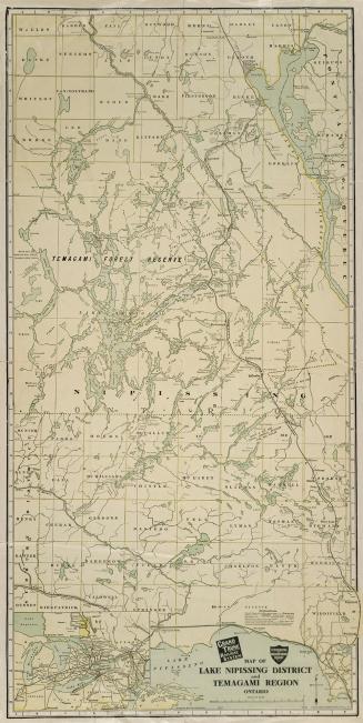
Map of Lake Nippissing District and Temagami Region Ontario
Approximately 1905
(1818) Plan of the Town of York
Approximately 1910
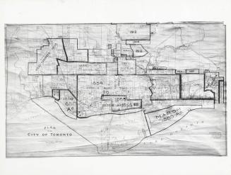
Plan of the City of Toronto, with additions up to 1925
1930 circa
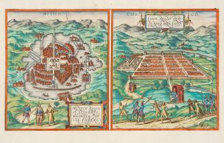
Mexico regia et celebris Hispaniae Novae civitas.
1572
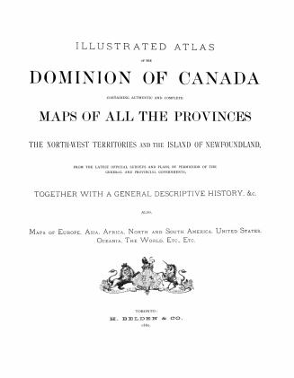
Illustrated atlas of the Dominion of Canada, containing authentic and complete maps of all the provinces, the North-west territories and the island of Newfoundland, from the latest official surveys and plans, by permission of the general and provincial governments, together with a general descriptive history, &c., also maps of Europe, Asia, Africa, North and South America, United States, Oceania, the world, etc. ... Lanark County
1880
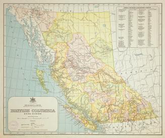
British Columbia mining divisions
Approximately 1914
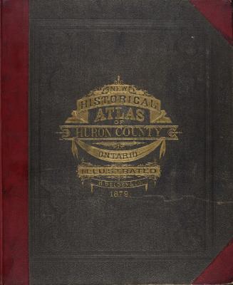
Illustrated historical atlas of the county of Huron, Ont., compiled, drawn and published from personal examinations and surveys
1879
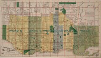
Foster's vest pocket map of Toronto indexed
1895
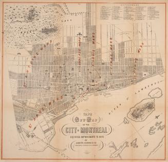
1870 new map of the City of Montreal showing improvements to date
1870
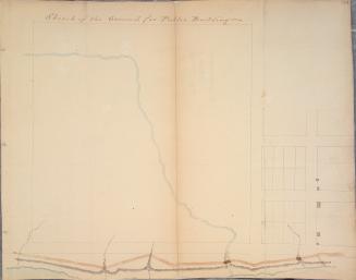
Sketch of the ground for public buildings
1796
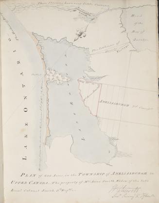
Plan of 600 acres in the township of Ameliasburgh in Upper Canada - the property of Mrs
1802
Previous
/ 62
Next
RDF
XML
JSON