Skip to main content
Advanced Search Objects: results
Close
Refine Results
Show Only Public Domain
Format
Picture
(36)
Book
(6)
Map
(3)
Ephemera
(1)
Date
to
Names
*
Unknown
(46)
Baldwin, Robert, 1804-1858
(1)
Canada. Crown Lands Department
(1)
Charlton Simplified Road Map Co.
(1)
Massachusetts. Land Office
(1)
Home Smith & Co.
(1)
Kay, William Porden, active 1834-1835
(1)
Price, James Hervey
(1)
Ontario. Laws, etc.
(1)
Russell, S., active 1836
(1)
Load all
Subject
Roads
(46)
Design and construction
(29)
Maps
(4)
Streets
(4)
Finance
(2)
Road maps
(2)
Boundaries
(1)
Description and travel
(1)
Election districts
(1)
Finance, Public
(1)
Load all
Collection
Baldwin Collection of Canadiana
(46)
Language
English
(45)
French
(1)
City, town or township
Toronto
(37)
Neighbourhood
Swansea
(16)
Bloor West Village
(4)
North Toronto
(3)
Rosedale-Moore Park
(3)
Beach
(2)
Lambton
(2)
East York
(1)
High Park
(1)
Highland Creek
(1)
Humber Valley Village
(1)
Load all
North-south street
Yonge Street
(6)
Bathurst Street
(1)
East-west street
Bedford Park Avenue
(1)
Cummer Avenue
(1)
Davenport Road
(1)
Dundas Street East
(1)
Dundas Street West
(1)
Eglinton Avenue East
(1)
Kingston Road
(1)
Lawrence Avenue
(1)
York Mills Road
(1)
Sort:
Relevance
Date (Older First)
Date (Newer First)
Title (A–Z)
Title (Z–A)
Last Updated (Ascending)
Last Updated (Descending)
List
Images
Table
/ 3
Next
Advanced Search
Filters
Title
Names
Subject
Call Number / Accession Number
Date Range
to
Collection
All
Archives of Ontario
Arthur Conan Doyle Collection
Arts department
Baldwin Collection of Canadiana
Business, Science, and Technology department
Chinese Canadian Archive
City of Toronto Archives
Humanities and Social Sciences department
IBBY Collection for Young People with Disabilities
Languages and Literature department
Local History Collection, Annette branch
Local History Collection, Beaches branch
Local History Collection, Bloor/Gladstone branch
Local History Collection, Dufferin/St. Clair branch
Local History Collection, Gerrard/Ashdale branch
Local History Collection, Leaside branch
Local History Collection, North York Central Library branch
Local History Collection, Northern District branch
Local History Collection, Palmerston branch
Local History Collection, Parkdale branch
Local History Collection, Riverdale branch
Local History Collection, Sanderson branch
Local History Collection, Weston branch
Local History Collection, Wychwood branch
Merril Collection of Science Fiction, Speculation and Fantasy
Ontario History Quest
Osborne Collection of Early Children's Books
Special Collections in the Arts
Toronto Public Library Archives
Toronto Reference Library
Toronto Star Photograph Archive
zTEST
Formats
All
Artifact (an object in our collections)
Book
Ephemera
Fonds
Manuscript
Map
Photo Album
Picture
Language
All
Abenaki
Algonquin (other)
Athapascan
Beothuk
Catalan
Chinese
Chinook jargon
Cree
Croatian
Dakota
Danish
Dene Suline
Dené
Dogrib
Dutch
English
French
Gaelic, Scottish
German
Greek, Ancient (to 1453)
Greek, Modern (1453- )
Haida
Haudenosaunee
Hungarian
Innu-aimun
Inuktitut
Irish
Italian
Japanese
Language
Latin
Maliseet–Passamaquoddy
Miꞌkmaq
Mohawk
No linguistic content
Norwegian
Ojibwa
Oneida
Portugese
Russian
Seneca
Serbian
Siksika
Spanish
Swedish
Tsimshian
Ukrainian
Welsh
Wendat
Yiddish
Clear
46 for
Subject
:
Roads
Unknown
Clear All Filters
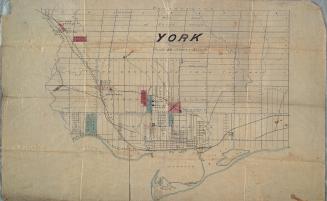
York
Approximately 1872
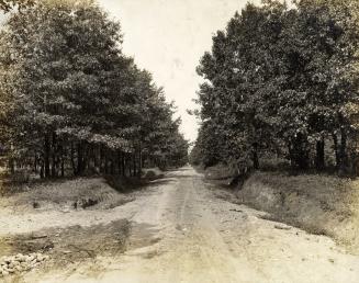
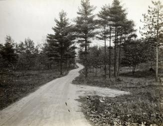
Yonge Street looking east on York Mills Road
Approximately 1907
An act for granting to His Majesty a certain sum of money out of the funds applicable to the uses of this province, to defray the expences [sic] of am(...)
1814?
Charlton's simplified road maps of Ontario
n.d.
Yonge Street looking north from north of Glengrove Avenue
1922
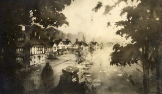
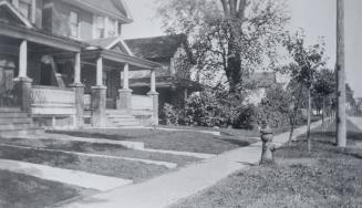
Houses to Be Constructed During 1913 on Baby Point Road, Toronto, Ontario
1912?
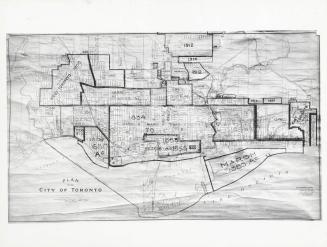
Plan of the City of Toronto, with additions up to 1925
1930 circa
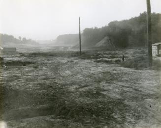
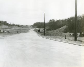
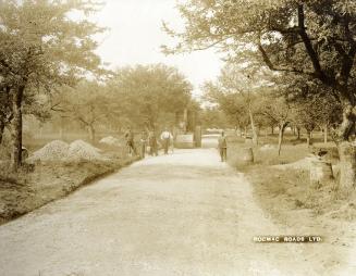
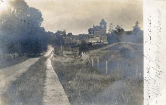
Kingsway South, looking south from Mayfield Avenue
1931
Kingsway South, looking south from Mayfield Avenue
1931
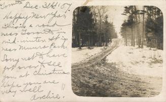
Unnamed road near Munro Park
Approximately 1910
Eglinton Avenue East, north side, looking east from opposite Dunfield Avenue, shows Henry E. Stevenson's house in centre, Toronto, Ontario
1916
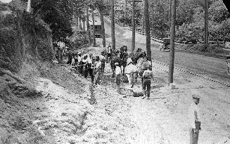
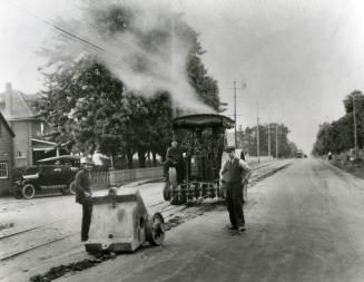
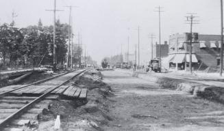
Yonge Street, looking south at Cummer Avenue, showing road construction, Toronto, Ontario
1922
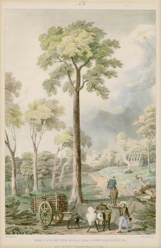
Elm Tree on the Royal Road (near Marysville?), New Brunswick
1836
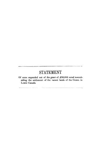
Statement of sums expended out of the grant of 30,000 voted towards aiding the settlement of the vacant lands of the Crown in Lower Canada, under the act 16th Victoria
1855
Baby Point Roadé Toronto, Ontario
1913 circa
Baby Point Road, looking west from west of Jane St
1913 circa
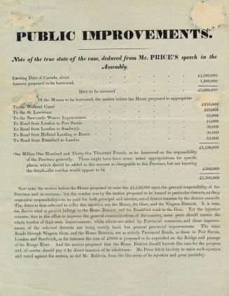
Public improvements. Note of the true state of the case, deduced from Mr. Price's speech in the Assembly
184-?
Yonge Street looking north from Bedford Park Avenue, Toronto, Ontario
1921
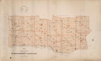
Map of the counties of Dundas, Stormont and Glengarry
Approximately 1880
Baby Point Road, looking east from eastern end, Toronto, Ontario
1913 circa
/ 3
Next
RDF
XML
JSON
![An act for granting to His Majesty a certain sum of money out of the funds applicable to the uses of this province, to defray the expences [sic] of am(...)](/internal/media/filedispatcher/737863/thumbnail)