Skip to main content
Advanced Search Objects: results
Close
Refine Results
Show Only Public Domain
Format
Picture
(73)
Date
to
Names
Salmon, James V. (James Victor)
(39)
Gamble, William
(9)
Unknown
(8)
Valentine & Sons
(5)
Williams, Charles A., active 1897-1962
(3)
Chirnside, Ted
(2)
Thompson, Stuart Logan, 1885-1961
(2)
Staples, Owen, 1866-1949
(2)
Baigent, Richard, 1830-1890
(1)
Ameline, Yves, 1939-
(1)
Load all
Subject
*
Parks
(73)
Streets
(73)
Bridges
(51)
Factories
(12)
Hurricane Hazel, 1954
(11)
Mills and mill-work
(9)
Disasters
(8)
Design and construction
(6)
Portraits
(3)
Steam-boilers
(3)
Load all
Collection
Baldwin Collection of Canadiana
(71)
Local History Collection, Bloor/Gladstone branch
(1)
Local History Collection, Riverdale branch
(1)
Language
English
(70)
No linguistic content
(3)
Building, monument or park
Edwards Gardens
(2)
Queen's Park (Toronto, Ont.)
(2)
Gamble Mill (Toronto, Ontario)
(1)
City, town or township
Toronto
(64)
Brampton
(1)
Cambridge
(1)
Hamilton
(1)
Kitchener
(1)
Neighbourhood
Kingsway
(17)
Bloor West Village
(15)
York Mills
(12)
Cabbagetown
(5)
Rexdale
(4)
Bridle Path-Sunnybrook
(3)
Lambton
(2)
Regent Park
(2)
Riverdale
(2)
Swansea
(2)
Load all
North-south street
Old Mill Road
(11)
Yonge Street
(11)
Bartlett Avenue
(1)
Bayview Avenue
(1)
East-west street
Old Mill Road
(5)
Bloor Street West
(3)
Lawrence Avenue East
(3)
Old Dundas Street
(2)
Queen Street East
(2)
Sort:
Relevance
Date (Older First)
Date (Newer First)
Title (A–Z)
Title (Z–A)
Last Updated (Ascending)
Last Updated (Descending)
List
Images
Table
/ 4
Next
Advanced Search
Filters
Title
Names
Subject
Call Number / Accession Number
Date Range
to
Collection
All
Archives of Ontario
Arthur Conan Doyle Collection
Arts department
Baldwin Collection of Canadiana
Business, Science, and Technology department
Chinese Canadian Archive
City of Toronto Archives
Humanities and Social Sciences department
IBBY Collection for Young People with Disabilities
Languages and Literature department
Local History Collection, Annette branch
Local History Collection, Beaches branch
Local History Collection, Bloor/Gladstone branch
Local History Collection, Dufferin/St. Clair branch
Local History Collection, Gerrard/Ashdale branch
Local History Collection, Leaside branch
Local History Collection, North York Central Library branch
Local History Collection, Northern District branch
Local History Collection, Palmerston branch
Local History Collection, Parkdale branch
Local History Collection, Riverdale branch
Local History Collection, Sanderson branch
Local History Collection, Weston branch
Local History Collection, Wychwood branch
Merril Collection of Science Fiction, Speculation and Fantasy
Ontario History Quest
Osborne Collection of Early Children's Books
Special Collections in the Arts
Toronto Public Library Archives
Toronto Reference Library
Toronto Star Photograph Archive
zTEST
Formats
All
Artifact (an object in our collections)
Book
Ephemera
Fonds
Manuscript
Map
Photo Album
Picture
Language
All
Abenaki
Algonquin (other)
Athapascan
Beothuk
Catalan
Chinese
Chinook jargon
Cree
Croatian
Dakota
Danish
Dene Suline
Dené
Dogrib
Dutch
English
French
Gaelic, Scottish
German
Greek, Ancient (to 1453)
Greek, Modern (1453- )
Haida
Haudenosaunee
Hungarian
Innu-aimun
Inuktitut
Irish
Italian
Japanese
Language
Latin
Maliseet–Passamaquoddy
Miꞌkmaq
Mohawk
No linguistic content
Norwegian
Ojibwa
Oneida
Portugese
Russian
Seneca
Serbian
Siksika
Spanish
Swedish
Tsimshian
Ukrainian
Welsh
Wendat
Yiddish
Clear
73 for
Subject
:
Streets
Parks
Clear All Filters
Old Mill Rd., looking west to bridge across Humber River between Catherine St. & Old Mill Rd., with Bloor St. bridge in background, taken from west end of Lessard Ave., showing Belt Line right-of-way in foreground, Toronto, Ontario
1925-09
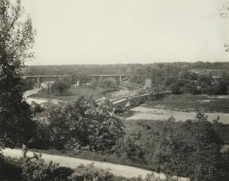
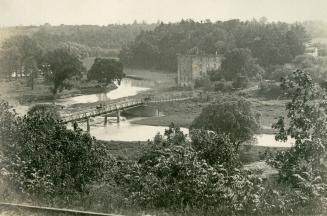
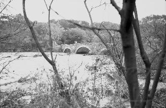
Old Mill Road, looking west, showing bridge across Humber River and Gamble mill, Toronto, Ontario
approximately 1918
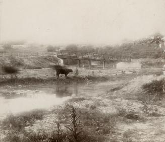
Old Mill Road, looking west from bridge across Humber River, Toronto, Ontario
1919?
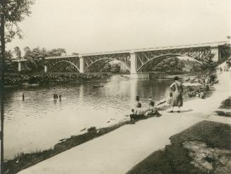
Bloor Street West, bridge over Humber River, looking northwest, Toronto, Ontario
1925 circa
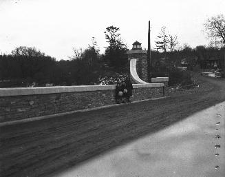
Old Mill Road, bridge across Humber River between Catherine St
1905 circa
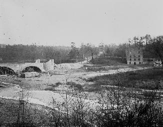
Old Mill Road, bridge across Humber River between Catherine St. and Old Mill Road, looking north east, Toronto, Ontario
1900 circa
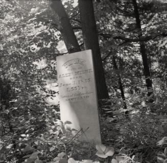
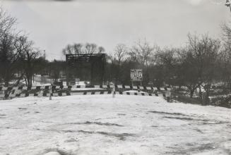
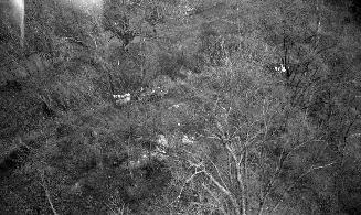
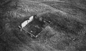
Milne Cemetery, Edwards Gardens, Lawrence Ave. E., south side, between The Bridle Path and Leslie Street, Toronto, Ontario
7/3/1955
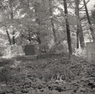
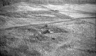
Milne Cemetery, Edwards Gardens, Lawrence Ave. E., south side, between The Bridle Path and Leslie Street, Toronto, Ontario
7/3/1955
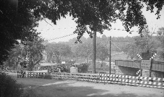
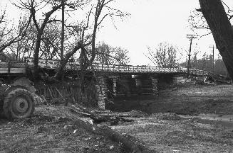
Old Dundas St., bridge over Humber River, looking east. Toronto, Ontario
2/6/1955
Winchester Street, bridge over Don R
1953
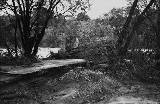
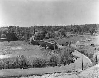
Humber River, looking west to Old Mill Road bridge
10/16/1954
Humber River, looking east to Old Mill Road bridge
10/16/1954
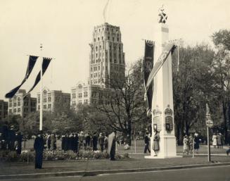
George VI, visit to Toronto, 22 May 1939, decorations, Queen's Park
1939
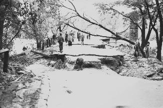
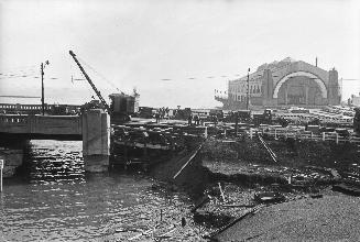
Lakeshore Boulevard W., bridge over Humber River, looking south. Toronto, Ontario
1954
Yonge Street, looking northwest to temporary bailey bridge over West Don River
12/1/1954
Old Mill Road, bridge across Humber River between Catherine St
5/7/1921
Humber River, looking southeast to Old Mill Road bridge, Toronto, Ontario
10/16/1954
Van Nostrand, Cornelius, York Hill Steam Mills, Yonge Street, west side, south of Macdonald-Cartier Freeway bridge, looking southeast from bridge
1952-12
Van Nostrand, Cornelius, York Hill Steam Mills, Yonge Street, west side, south of Macdonald-Cartier Freeway bridge, looking southeast from bridge
1952-12
Van Nostrand, Cornelius, York Hill Steam Mills, Yonge Street, west side, south of Macdonald-Cartier Freeway bridge, looking southeast from bridge
1952-12
/ 4
Next
RDF
XML
JSON