Skip to main content
Advanced Search Objects: results
Close
Refine Results
Show Only Public Domain
Format
Picture
(18)
Date
to
Names
Salmon, James V. (James Victor)
(11)
Unknown
(2)
Blakey, Joseph Adamson, 1870-1937
(1)
D.C. Grose
(1)
Grand Trunk Railway Company of Canada
(1)
Moore & Nixon-James
(1)
Williams, Charles A., active 1897-1962
(1)
Taylor Brothers (Firm)
(1)
Turner, Stanley F., 1883-1953
(1)
Parshall, Terry, 1756-1808
(1)
Load all
Subject
*
Bridges
(18)
Winter
(18)
Parks
(9)
Railroad yards
(4)
Reservoirs
(2)
Design and construction
(1)
Dogs
(1)
Factories
(1)
Family
(1)
Paper mills
(1)
Load all
Collection
Baldwin Collection of Canadiana
(18)
Language
English
(18)
Building, monument or park
Edwards Gardens
(2)
City, town or township
Toronto
(16)
Matapédia
(1)
Neighbourhood
Kingsway
(4)
Leaside
(4)
Bloor West Village
(2)
Bridle Path-Sunnybrook
(2)
Deer Park
(2)
Rosedale-Moore Park
(2)
East York
(1)
Lambton
(1)
North-south street
Leslie Street
(2)
Mount Pleasant Road
(1)
Old Mill Road
(1)
East-west street
Lawrence Avenue East
(2)
Summerhill Avenue
(2)
Dundas Street West
(1)
Sort:
Relevance
Date (Older First)
Date (Newer First)
Title (A–Z)
Title (Z–A)
Last Updated (Ascending)
Last Updated (Descending)
List
Images
Table
/ 1
Advanced Search
Filters
Title
Names
Subject
Call Number / Accession Number
Date Range
to
Collection
All
Archives of Ontario
Arthur Conan Doyle Collection
Arts department
Baldwin Collection of Canadiana
Business, Science, and Technology department
Chinese Canadian Archive
City of Toronto Archives
Humanities and Social Sciences department
IBBY Collection for Young People with Disabilities
Languages and Literature department
Local History Collection, Annette branch
Local History Collection, Beaches branch
Local History Collection, Bloor/Gladstone branch
Local History Collection, Dufferin/St. Clair branch
Local History Collection, Gerrard/Ashdale branch
Local History Collection, Leaside branch
Local History Collection, North York Central Library branch
Local History Collection, Northern District branch
Local History Collection, Palmerston branch
Local History Collection, Parkdale branch
Local History Collection, Riverdale branch
Local History Collection, Sanderson branch
Local History Collection, Weston branch
Local History Collection, Wychwood branch
Merril Collection of Science Fiction, Speculation and Fantasy
Ontario History Quest
Osborne Collection of Early Children's Books
Special Collections in the Arts
Toronto Public Library Archives
Toronto Reference Library
Toronto Star Photograph Archive
zTEST
Formats
All
Artifact (an object in our collections)
Book
Ephemera
Fonds
Manuscript
Map
Photo Album
Picture
Language
All
Abenaki
Algonquin (other)
Athapascan
Beothuk
Catalan
Chinese
Chinook jargon
Cree
Croatian
Dakota
Danish
Dene Suline
Dené
Dogrib
Dutch
English
French
Gaelic, Scottish
German
Greek, Ancient (to 1453)
Greek, Modern (1453- )
Haida
Haudenosaunee
Hungarian
Innu-aimun
Inuktitut
Irish
Italian
Japanese
Language
Latin
Maliseet–Passamaquoddy
Miꞌkmaq
Mohawk
No linguistic content
Norwegian
Ojibwa
Oneida
Portugese
Russian
Seneca
Serbian
Siksika
Spanish
Swedish
Tsimshian
Ukrainian
Welsh
Wendat
Yiddish
Clear
18 for
Subject
:
Winter
Bridges
Clear All Filters
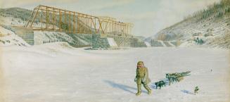
Construction of Intercolonial Railway Bridge at Matapédia, Québec
1875?
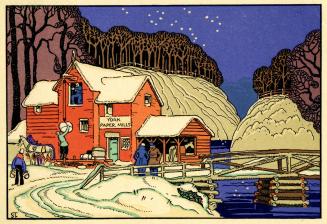
York Paper Mills (Toronto, c.1830)
1830 circa
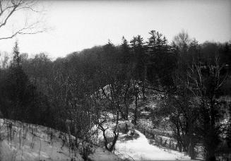
Humber River, looking west, north of Old Mill Road bridge, Toronto, Ontario
1919?
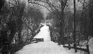
Summerhill Avenue, west of Mt. Pleasant Road., showing site, Toronto, Ontario
1949
Summerhill Avenue, looking west towards site of bridge over stream in Reservoir Park, Toronto, Ontario
1949
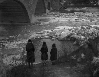
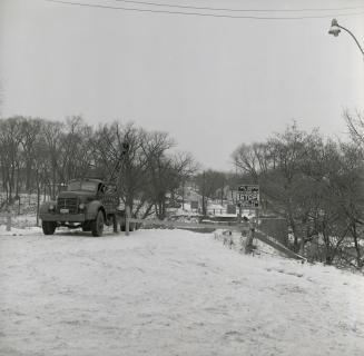
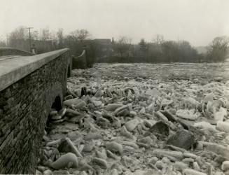
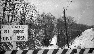
Old Dundas St., looking east across Humber River, showing truck drawing up sections of bridge after it was toppled into the river
1/4/1957
Governor's Bridge, between Astley Road & Governor's Road, looking southeast, Toronto, Ontario
1923
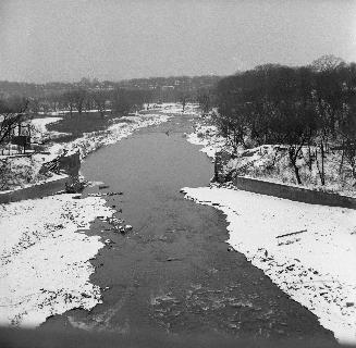
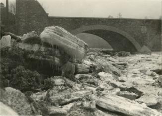
Humber River, looking south from Dundas St
1/4/1957
Humber River, looking south to Old Mill Road bridge, Toronto, Ontario
1923
Humber River, looking west from east end of bridge between Catherine St. & Old Mill Rd., Toronto, Ont.
1929-03
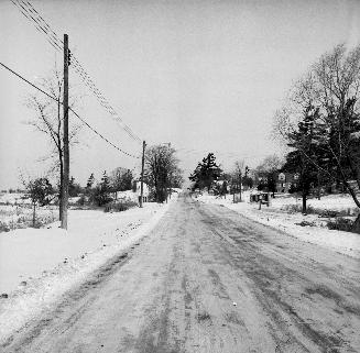
Royal York Road., looking north to Lawrence Avenue West in background
1956
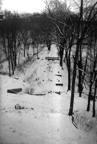
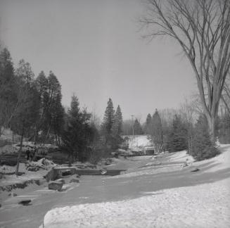
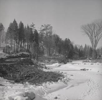
Edwards Gardens, Lawrence Ave. s. side, between Bridle Path & Leslie St.; looking n. up Wilket Creek towards Lawrence Ave. E., Toronto, Ontario
1958
Edwards Gardens, Lawrence Ave. s. side, between Bridle Path & Leslie St.; looking n. up Wilket Creek towards Lawrence Ave. E., Toronto, Ontario
1958
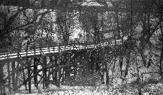
Heath St. E., bridge over G.T.R. Belt Line, between Hudson Drive & Brendan Rd.; looking east, Toronto, Ontario
2/19/1952
Heath St. E., bridge over G.T.R. Belt Line, between Hudson Drive & Brendan Rd.; looking west, Toronto, Ontario
2/19/1952
Heath St. E., bridge over G.T.R. Belt Line, between Hudson Drive & Brendan Rd.; looking west, Toronto, Ontario
2/19/1952
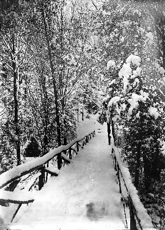
HIGH PARK
1905
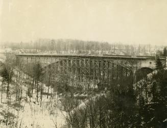
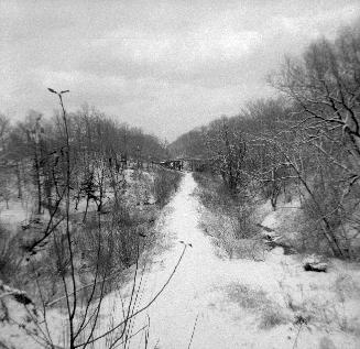
G.T.R. Belt Line, right-of-way, at Moore Avenue, showing Heath Street East bridge in background, Toronto, Ontario
1956?
/ 1
RDF
XML
JSON