Skip to main content
Maps in French
Close
Refine Results
Show Only Public Domain
Format
Map
(3)
Date
to
Names
*
Tardieu, P. F.
(3)
Picquet, Charles
(1)
Pachoux, J.J.
(1)
Subject
Maps
(2)
First Nations
(1)
Indians of North America
(1)
Portages
(1)
Roads
(1)
Collection
Baldwin Collection of Canadiana
(3)
Language
French
(3)
English
(1)
Sort:
Relevance
Date (Older First)
Date (Newer First)
Title (A–Z)
Title (Z–A)
Last Updated (Ascending)
Last Updated (Descending)
List
Images
Table
/ 1
Filters
3
Tardieu, P. F.
Clear All Filters
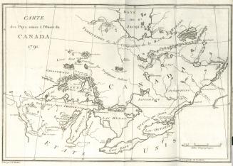
Carte des pays situes à l'ouest du Canada 1791
1794
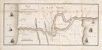
Plan de la cataracte de Niagara et l'isthme qui separe les Lacs Erie et Ontario.
1801
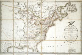
Map of the United States and Canada, New Scotland, New Brunswick and Newfoundland
1806
/ 1
RDF
XML
JSON