Skip to main content
Toronto
Close
Refine Results
Show Only Public Domain
Format
Picture
(97)
Map
(18)
Ephemera
(17)
Book
(1)
Date
to
Names
Unknown
(48)
Toronto Star (Firm)
(15)
Valentine & Sons
(13)
Unwin, Browne & Sankey
(8)
Salmon, James V. (James Victor)
(5)
International Stationery Co., Picton Canada
(4)
Rumsey & Co.
(4)
Toronto Public Library
(4)
Beaty, Keith
(3)
Maclear & Co.
(3)
Load all
Subject
Streets
(29)
Maps
(18)
Land subdivision
(16)
Maps and surveys
(16)
Real estate
(13)
Real property
(13)
Cities and towns
(12)
Universities and colleges
(11)
Mineral baths
(8)
Swimming pools
(8)
Load all
Collection
Baldwin Collection of Canadiana
(104)
Toronto Star Photograph Archive
(15)
Local History Collection, Bloor/Gladstone branch
(5)
Toronto Public Library Archives
(4)
Local History Collection, Palmerston branch
(2)
Special Collections in the Arts
(2)
Local History Collection, Annette branch
(1)
Language
English
(122)
No linguistic content
(9)
Chinese
(1)
Building, monument or park
Gamble Mill (Toronto, Ontario)
(5)
Victoria College (Toronto, Ont.)
(2)
Church of the Redeemer (Toronto, Ont. : opened 1879)
(1)
Honest Ed's
(1)
Markham Village Plaza
(1)
Provincial Lunatic Asylum
(1)
University of Toronto. McMaster Hall
(1)
City, town or township
Orillia
(1)
Neighbourhood
Yorkville
(28)
University
(23)
Annex
(20)
Dufferin Grove-Bickford Park
(16)
Palmerston-Sussex Ulster
(14)
Downtown
(12)
High Park
(12)
Seaton Village
(12)
Kingsway
(10)
Brockton
(9)
Load all
North-south street
Yonge Street
(13)
Dufferin Street
(8)
Bathurst Street
(7)
Avenue Road
(6)
Gladstone Avenue
(6)
Dovercourt Road
(5)
Bay Street
(4)
Spadina Avenue
(4)
St. George Street
(4)
Huron Street
(3)
Load all
East-west street
*
Bloor Street West
(133)
College Street
(5)
Davenport Road
(4)
Dundas Street West
(3)
Annette Street
(2)
Bloor Street East
(2)
Dupont Street
(2)
Queen Street West
(2)
St. Clair Avenue East
(2)
St. Clair Avenue West
(2)
Load all
Sort:
Relevance
Date (Older First)
Date (Newer First)
Title (A–Z)
Title (Z–A)
Last Updated (Ascending)
Last Updated (Descending)
List
Images
Table
/ 7
Next
Filters
133
Bloor Street West
Clear All Filters
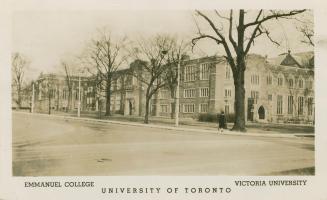
Emmanuel College, Victoria University, University of Toronto
1911
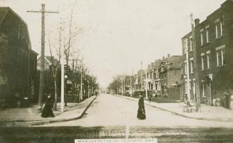
Margueretta St., Toronto, Ont.
Approximately 1914
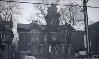
Hamilton, George R., house, Bloor St. West, north side, west of Spadina Road
1952-11
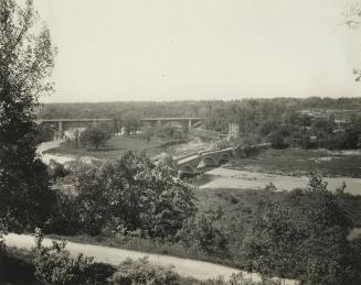
Old Mill Rd., looking west to bridge across Humber River between Catherine St. & Old Mill Rd., with Bloor St. bridge in background, taken from west end of Lessard Ave., showing Belt Line right-of-way in foreground, Toronto, Ontario
1925-09
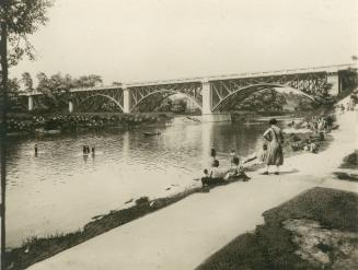
Bloor Street West, bridge over Humber River, looking northwest, Toronto, Ontario
1925 circa
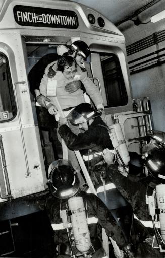
Passenger with a simulated head wound is taken from a tour-car train on the Spadina subway line during a mock emergency
18 October 1981
Trinity Methodist (United) Church, Bloor Street West, southwest corner Robert St
189-?
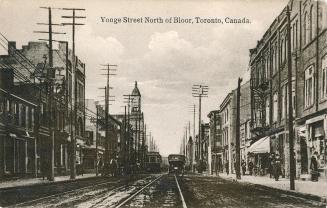
Yonge Street north of Bloor, Toronto, Canada
Approximately 1910
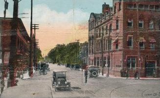
Bloor Street at corner of Yonge, Toronto, Canada
1918
Bloor Street from Yonge, Toronto, Canada
1918
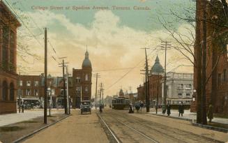
College Street at Spadina Avenue, Toronto, Canada
1913
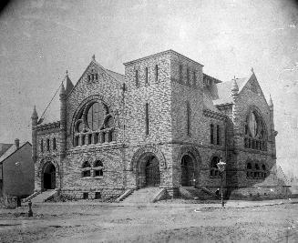
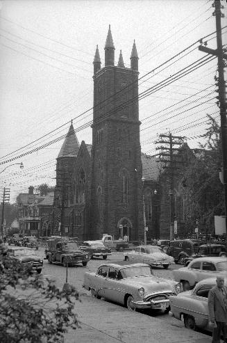
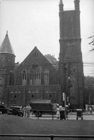
Bloor St. Presbyterian (United) Church (opened 1892), Bloor Street West, northwest corner Huron St., aftermath of fire
1954-08
Bloor St. Presbyterian (United) Church (opened 1892), Bloor Street West, northwest corner Huron St., aftermath of fire
1954-08
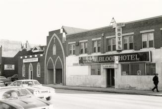
Bloor Street West, south side, between Lansdowne Avenue and St. Helens Avenue, Toronto, Ont.
1980
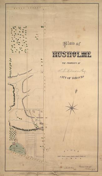
Plan of Rusholme the property of G.T. Denison Esq. city of Toronto
1862
Plan of villa lots for sale, part of lots nos. 36 & 37, con. 2 from bay, in the township of York
1890
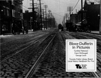
Bloor-Dufferin in pictures
1986
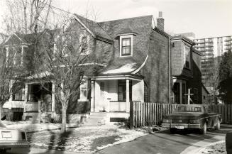
Havelock Street, east side, between Hepbourne Street and Bloor Street West, Toronto, Ont.
1980
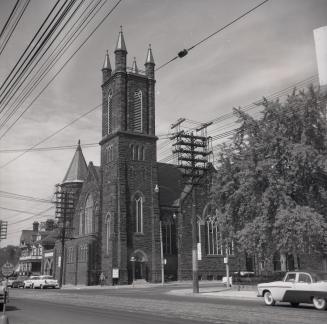
Bloor St. Presbyterian (United) Church (opened 1892), Bloor Street West, northwest corner Huron St
8/26/1956
Map of Yorkville and its vicinity
1878
/ 7
Next
RDF
XML
JSON