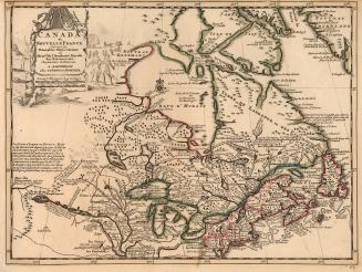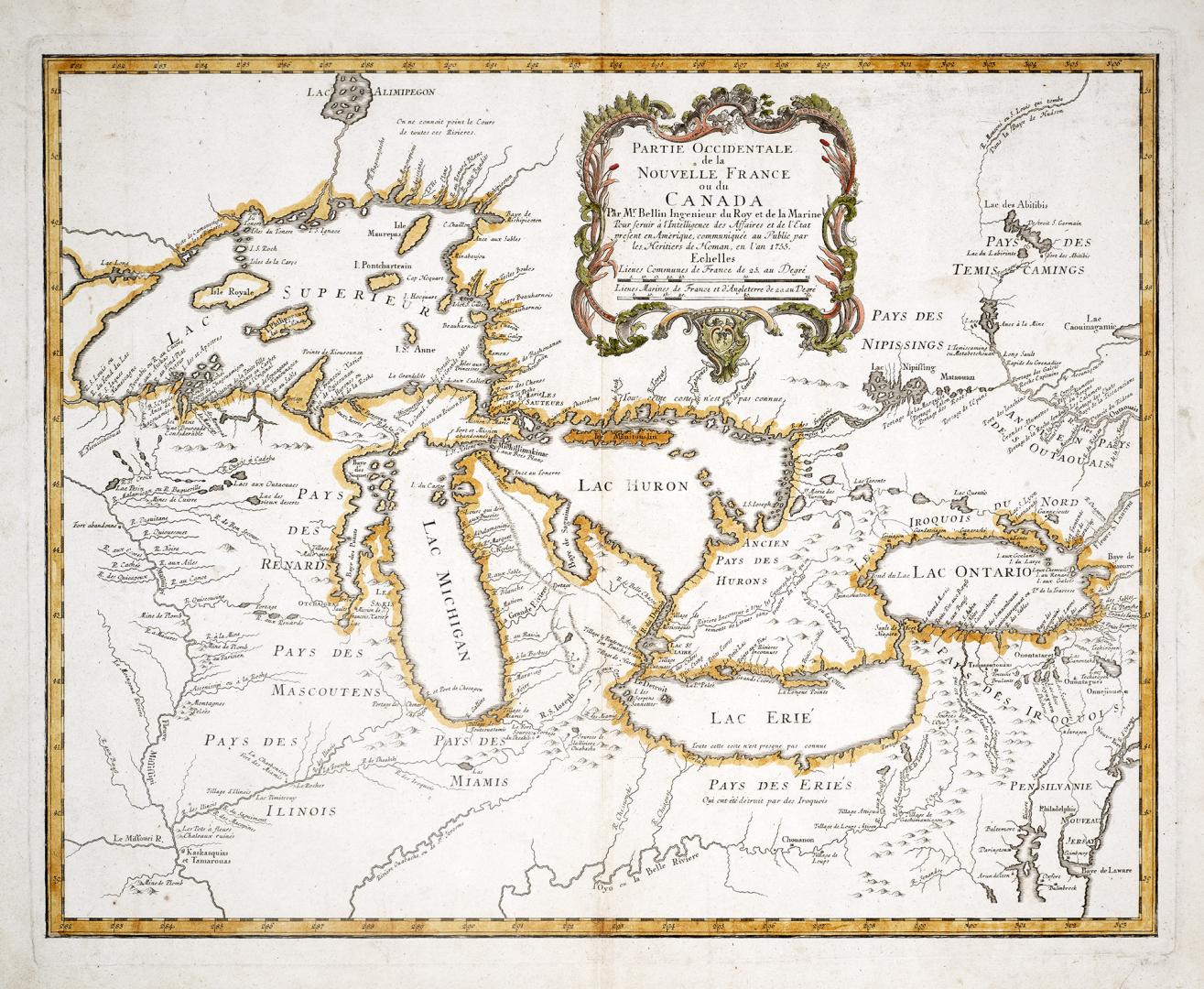

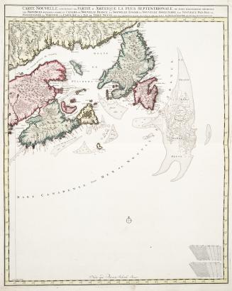
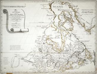
Partie occidentale de la Nouvelle France ou Canada
Date1755
Names
Bellin, Jacques Nicolas, 1703-1772
(cartographer)
Homann Erben
(publisher)
Homann Erben (Firm)
(contributor)
FormatMap
NotesFirst issued by Bellin in 1745 and re-issued by Homann Heirs on the eve of the French & Indian War; 1755 Nuremberg, Homann Erben Atlas compendiarivs book. Map depicts fictitious islands in Lake Superior: Isle Philippeaux, Isle
Pontchartrain, Maurepas and Isle St. Anne.
These fictional islands were copied on maps of the region for almost one
hundred years.
Subject
Dimensions53.3 cm x 43.1 cm (21 in. x 16 15/16 in.)
ScaleBar scales
Language
CollectionBaldwin Collection of Canadiana
Usage Rights
Public Domain
(Learn More)
Object Number912-713-B25-MEDIUM
Lotter, Tobias Conrad, 1717-1777
Approximately 1756
Robert de Vaugondy, Gilles, 1688-1766
1755
Visscher, Nicolas, -1702
Approximately 1700
L'Isle, Guillaume de, 1675-1726
1745
Amherst, Jeffery Amherst, Baron, 1717-1797
1753
Dudley, Robert, Sir, 1574-1649
Approximately 1661