
Map of part of the Province of Ontario Canada
Date1872
Names
Holwell, W.J.S.
(surveyor)
McKellar, Archibald, 1816-1894
(contributor)
FormatMap
Dimensions51.5 cm x 75 cm (20 1/4 in. x 29 1/2 in.)
Scale20 miles to 1 inch
Language
CollectionBaldwin Collection of Canadiana
Usage Rights
Public Domain
(Learn More)
Object Number912-713-O566-MEDIUM
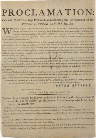
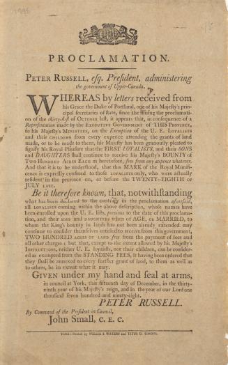
Russell, Peter, 1733-1808
1798
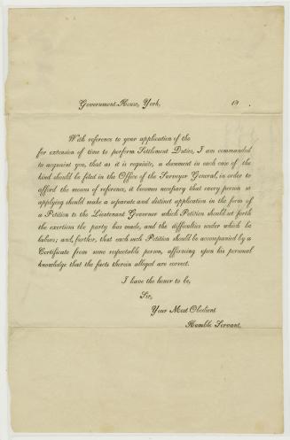
Office of the Lieutenant Governor (York, Ont.)
Approximately 1820
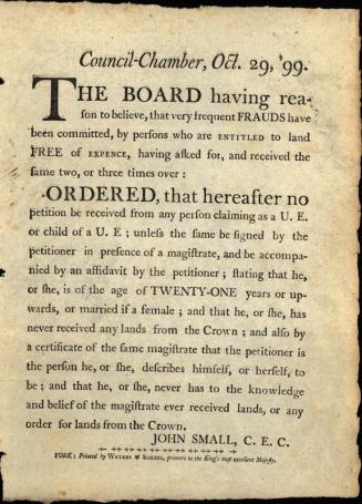
Ontario. Executive Council
1798
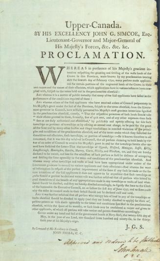
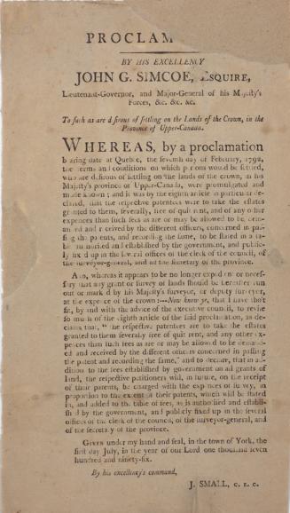
Ontario. Lieutenant Governor (1791-1796 : Simcoe)
1796
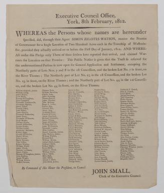
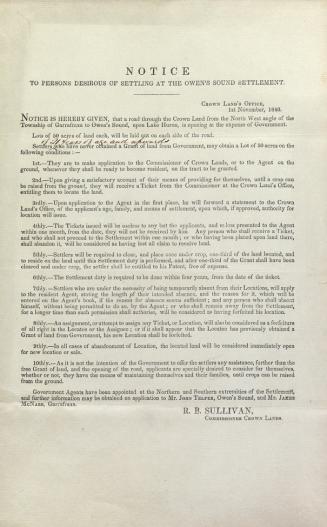
Canada. Crown Lands Department
1840