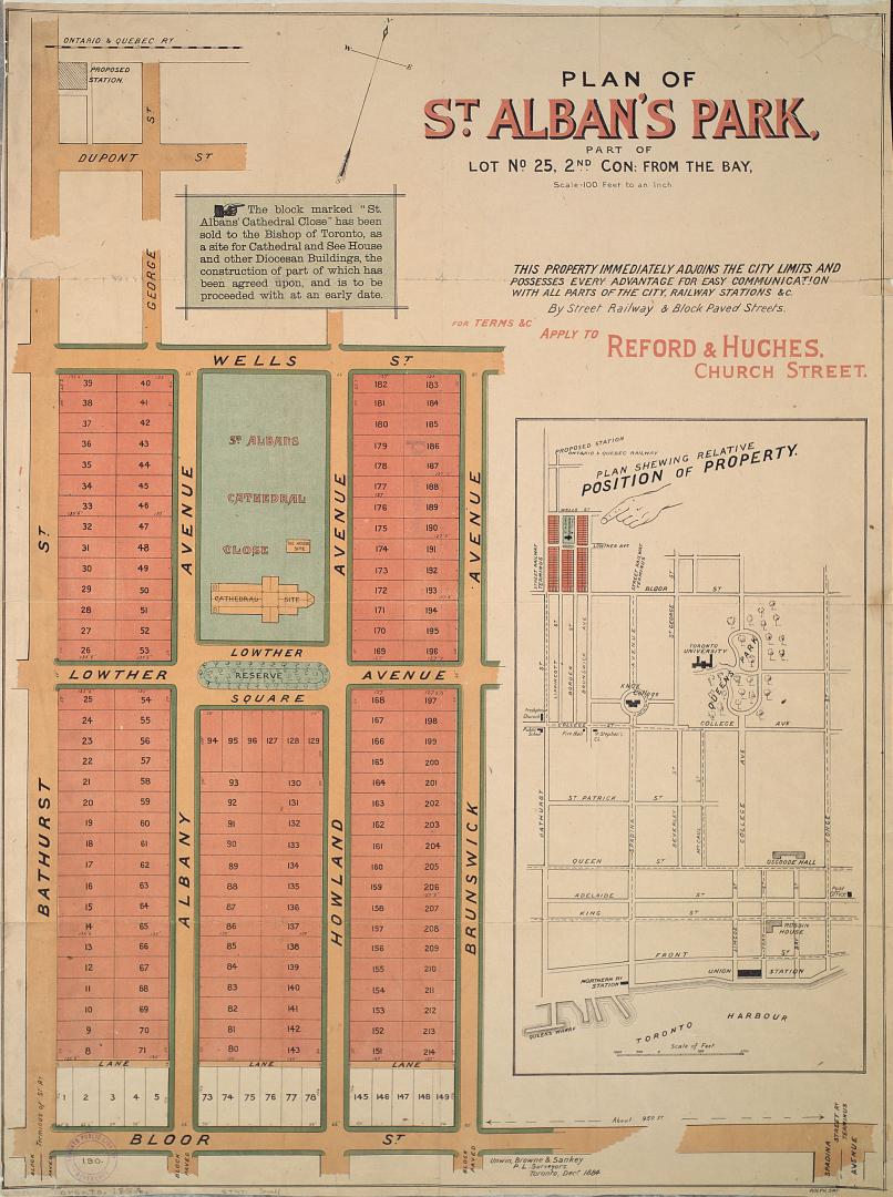

Plan of St. Alban's Park, part of lot no. 25, 2nd con: from the Bay
Date1884
Names
Unwin, Browne & Sankey
(cartographer)
Rolph, Smith & Co.
(lithographer)
Rolph, Smith & Co.
(printer)
FormatMap
Dimensions75.5 cm x 55 cm (29 3/4 in. x 21 5/8 in.)
Scale1 inch = 100 feet
Language
CollectionBaldwin Collection of Canadiana
Usage Rights
Public Domain
(Learn More)
Object NumberT-1884-1-SMALL

Alexander & Cable Lithographing Co. Ltd
1890
Unwin, Browne & Sankey
1886
Unwin, Browne & Sankey
1880
Alexander & Cable Lithographing Co. Ltd
1884

Alexander & Cable Lithographing Co. Ltd
1885

Alexander & Cable Lithographing Co. Ltd
1910

Browne, John Ownsworth, 1808-1881
1855