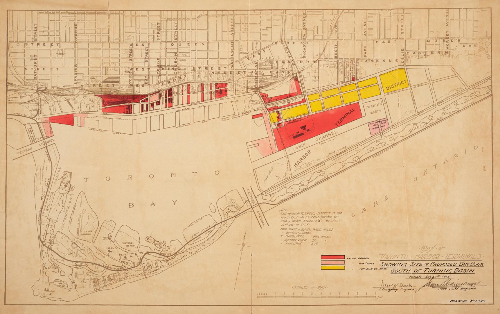

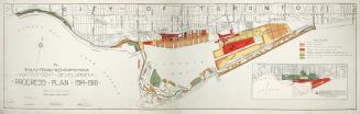
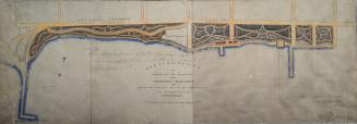
Plan of Toronto Harbor Terminals showing site of proposed dry dock south of turning basin
Date1918
Names
Toronto Harbour Commissioners
(author)
Format
Country:Canada
City, town or township:Toronto
Neighbourhood:Harbour
Province or state:Ontario
Medium
Dimensions43.5 x 70 cm
Extent
- 43.5 x 70 cm
Language
CollectionBaldwin Collection of Canadiana
Usage Rights
Public Domain
(Learn More)
Call Number / Accession NumberT-1918-3-5-SMALL
Between 1914 and 1918

Approximately 1908