
Atlas of the City of Toronto and suburbs founded on registered plans and special surveys showing plan numbers, lots & buildings
Date1910
Names
Chas. E. Goad, Ltd.
(publisher)
Goad, Charles E.
(author)
FormatMap
Medium
Dimensions50 x 76 cm
Language
CollectionBaldwin Collection of Canadiana
Usage Rights
Public Domain
(Learn More)
Object NumberM912_7135_G57_1910

Star Eng. Co. (Toronto, Ont.)
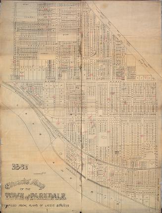
1887
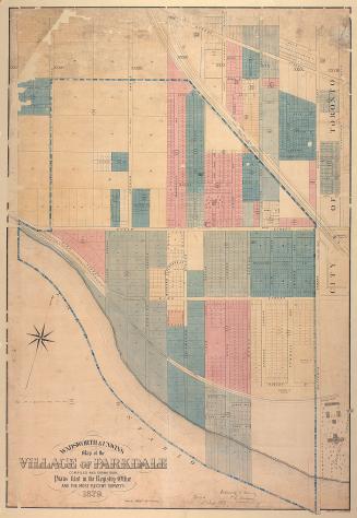


Alexander & Cable Lithographing Co. Ltd
1890

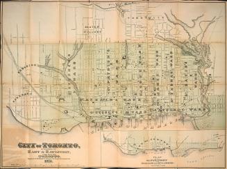
Browne, John Ownsworth, 1808-1881
1855