Skip to main content
All Items
Close
Refine Results
Show Only Public Domain
Format
Picture
(493)
Book
(121)
Ephemera
(71)
Map
(15)
Date
to
Names
Unknown
(125)
Ward's Island Association
(118)
Toronto Star (Firm)
(78)
Centre Island Association
(60)
Valentine & Sons
(55)
Salmon, James V. (James Victor)
(31)
Photogelatine Engraving Company
(17)
International Stationery Co., Picton Canada
(13)
Bluebell (Ship)
(12)
Spremo, Boris
(12)
Load all
Subject
Periodicals
(118)
Community newspapers
(61)
Lagoons
(47)
Bridges
(34)
Parks
(29)
Harbour
(28)
Ferries
(27)
Boats and boating
(24)
Factories
(24)
Yacht clubs
(24)
Load all
Collection
Baldwin Collection of Canadiana
(559)
Toronto Star Photograph Archive
(78)
Humanities and Social Sciences department
(62)
Chinese Canadian Archive
(1)
Language
English
(681)
No linguistic content
(19)
Building, monument or park
Centre Island
(176)
Hanlan's Point (Centre Island)
(89)
Toronto Harbour
(9)
Fort York
(2)
Union Station (Toronto, Ont. : 1873-1927)
(1)
City, town or township
Toronto
(696)
Neighbourhood
*
Toronto Islands
(700)
Harbour
(76)
Garrison
(9)
Exhibition
(8)
Port Lands
(7)
Railway Lands
(7)
St. Lawrence
(5)
Financial District
(2)
Cabbagetown
(1)
Downtown
(1)
Load all
North-south street
Bay Street
(1)
Leslie Street
(1)
Main Street
(1)
Parliament Street
(1)
Yonge Street
(1)
East-west street
Front Street East
(1)
King Street East
(1)
Queen Street East
(1)
Sort:
Title (A–Z)
Date (Older First)
Date (Newer First)
Title (Z–A)
Last Updated (Ascending)
Last Updated (Descending)
List
Images
Table
/ 35
Next
Filters
700
Toronto Islands
Clear All Filters
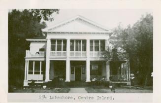
254 Lakeshore, Centre Island
approximately 1940
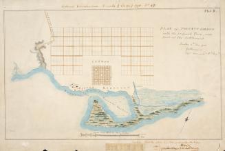
(1788) Plan of Toronto Harbour with the proposed town and part of the settlement, Québec 6th Dec. 1788, Gothermann, Capn. Commandg. Rl. Engrs. Colonial Correspondence Canada (Québec) 1790 no. 47 Plan B
Approximately 1908
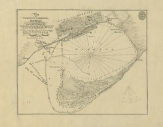
(1793) Plan of York harbour surveyed by order of Lieut. Govr. Simcoe by A. Aitken
1908
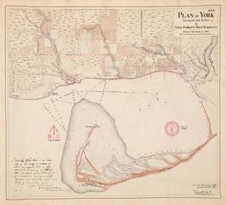
(1814) Plan of the town and harbour of York
Approximately 1908
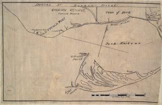
(1816) Garrison reserve and Town of York
Approximately 1908
(1816) Plan of the harbour, fort and town of York, the capital of Upper Canada, March 16th 1816
Approximately 1908
(1818) Plan of York surveyed and drawn by Lieut. Phillpotts Royal Engineers
1907
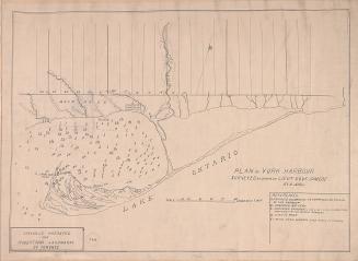
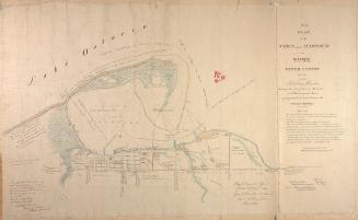
(1828) Plan of Toronto Harbour, Lake Ontario surveyed under the direction of Captn W.F.W. Owen, R.N
Approximately 1908
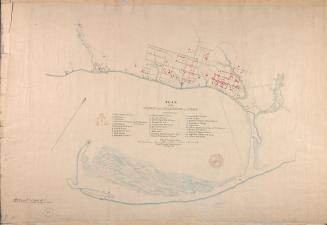
(1833) No. 1 plan of the town and harbour of York Upper Canada and also of the Military Reserves
1907
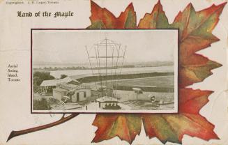
Aerial Swing, Island, Toronto
approximately 1908
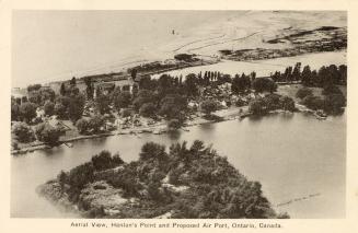
Aerial View, Hanlan's Point and Proposed Air Port, Ontario, Canada.
Approximately 1935
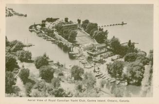
Aerial view of the Royal Canadian Yacht Club, Centre Island, Ontario, Canada
Approximately 1942
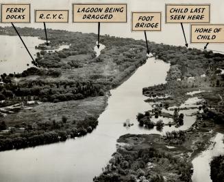
Aerial view shows Centre Island
6 December 1950
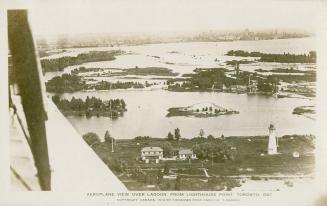
Aeroplane view over lagoon from Lighthouse Point, Toronto, Ont
Approximately 1919
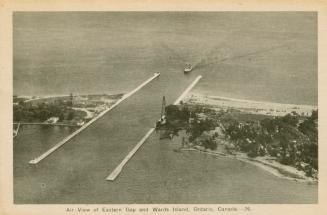
Air view of Eastern Gap and Ward's Island, Ontario, Canada
Approximately 1930
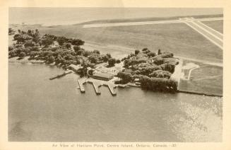
Air view of Hanlan's Point, Centre Island, Ontario, Canada
Approximately 1940
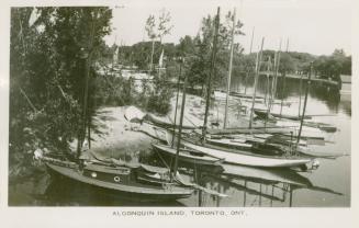
Algonquin Island, Toronto, Ont
Approximately 1925
Alice Aitken, 88, oldest Toronto Islander
26 July 1992
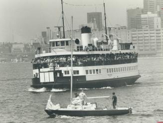
All aboard
13 September 1979
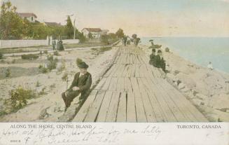
Along the shore, Centre Island, Toronto, Canada
Approximately 1906
/ 35
Next
RDF
XML
JSON