Skip to main content
Alexander & Cable Lithographing Co. Ltd
Close
Refine Results
Show Only Public Domain
Format
Map
(7)
Ephemera
(1)
Date
to
Names
Alexander & Cable Lithographing Co. Ltd
(8)
Unwin, Browne & Sankey
(2)
City Engineer's Office
(1)
B. Sawden
(1)
Wadsworth & Unwin
(1)
Ough, Richard
(1)
Unwin, Foster & Proudfoot
(1)
Rust, C. H. (Charles Henry), 1852-1927
(1)
Speight & Van Nostrand
(1)
Unknown
(1)
Load all
Subject
*
Maps
(8)
Maps and surveys
(8)
Land subdivision
(7)
Real estate
(5)
Real property
(5)
Roads
(2)
Annexation (Municipal government)
(1)
Architecture
(1)
Resorts
(1)
Collection
Baldwin Collection of Canadiana
(8)
Language
English
(8)
City, town or township
Toronto
(8)
Neighbourhood
Brockton
(2)
Bloor West Village
(1)
Deer Park
(1)
Dufferin Grove-Bickford Park
(1)
East York||Fairbank
(1)
Junction
(1)
Long Branch
(1)
Palmerston-Sussex Ulster
(1)
Parkdale
(1)
Seaton Village
(1)
Load all
North-south street
Christie Street
(1)
Dovercourt Road
(1)
Manning Avenue
(1)
Rusholme Road
(1)
Yonge Street
(1)
East-west street
Bloor Street West
(2)
College Street
(1)
Dupont Street
(1)
Yarmouth Road
(1)
Sort:
Title (A–Z)
Date (Older First)
Date (Newer First)
Title (Z–A)
Last Updated (Ascending)
Last Updated (Descending)
List
Images
Table
/ 1
Filters
8
Maps and surveys
Clear All Filters
Belt line map shewing northern suburbs of Toronto
1890
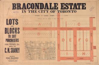
Bracondale estate in the city of Toronto lots or blocks to suit purchasers
1900
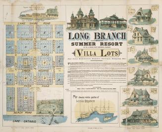
Long Branch Summer Resort lot no. 9, broken front concession, Etobicoke villa lots for villa residence, summer cottages, camping, etc.
1887
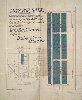
Plan of lots for sale in Dovercourt
1883
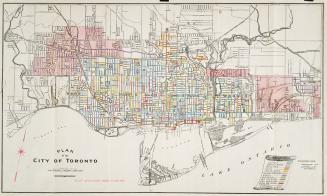
Plan of the City of Toronto
1909
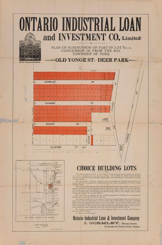
Plan of the subdivision of part of lot no. 21, concession III from the bay, township of York. - Old Yonge St. - Deer Park
1885
Plan of villa lots for sale, part of lots nos. 36 & 37, con. 2 from bay, in the township of York
1890
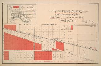
Runnymede Estate; a subdivision of the westerly parts of lots 39 and 40, con. 2 from the bay, township of York
1884
/ 1
RDF
XML
JSON