Skip to main content
Chewitt, William, 1753-1849
Close
Refine Results
Show Only Public Domain
Format
Map
(16)
Manuscript
(7)
Date
to
Names
Chewitt, William, 1753-1849
(23)
Smyth, David William, Sir, 1764-1837
(8)
W.C. Chewett
(2)
Allan, William, 1822-1901
(1)
Russell, Peter, 1733-1808
(1)
Robertson, J. Ross (John Ross), 1841-1918
(1)
Unknown
(1)
Subject
Maps
(20)
Land subdivision
(11)
Dwellings
(5)
Land use
(5)
Estates
(4)
Maps and surveys
(3)
Roads
(3)
Fortification
(2)
Capitulations, Military
(1)
Gardens
(1)
Load all
Collection
Baldwin Collection of Canadiana
(23)
Language
English
(23)
City, town or township
Toronto
(6)
Ameliasburgh (Ont.: Township)
(2)
Neighbourhood
Financial District
(2)
King-Spadina
(2)
Railway Lands
(2)
St. Lawrence
(2)
Harbour
(1)
North-south street
Bay Street
(1)
John Street
(1)
Peter Street
(1)
Yonge Street
(1)
East-west street
Front Street East
(1)
Front Street West
(1)
King Street East
(1)
King Street West
(1)
Sort:
Title (A–Z)
Date (Older First)
Date (Newer First)
Title (Z–A)
Last Updated (Ascending)
Last Updated (Descending)
List
Images
Table
/ 2
Next
Filters
23
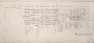
(1818) Plan of the Town of York
Approximately 1910
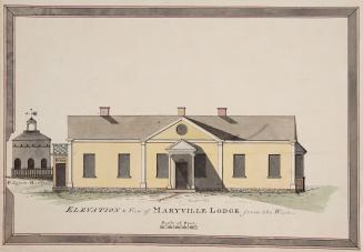
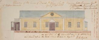
Elevation & View of Maryville Lodge from the West
1802
His Honor the Presdt approval of the town plot of York. 2nd addition
1798
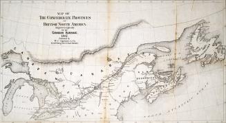
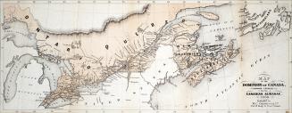
Map of the Confederate Provinces of British North America engraved expressly for the Canadian Almanac 1867
1868
Map of the Dominion of Canada, engraved expressly for the Canadian Almanac, 1868
1868
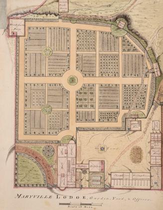
Maryville Lodge, Garden, Yard & Offices
1802
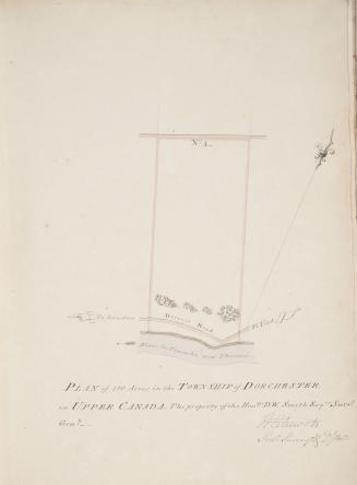
Plan of 120 acres in the township of Dorchester in Upper Canada the property of the Honble
1802
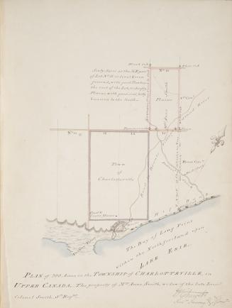
Plan of 200 acres in the township of Charlotteville in Upper Canada the property of Mrs
1802
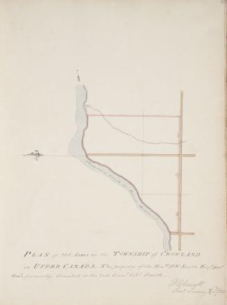
Plan of 200 acres in the township of Crowland in Upper Canada The property of the Honble D
1802
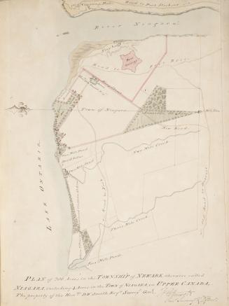
Plan of 206 acres in the Township of Newark otherwise called Niagara including 4 acres in the town of Niagara in Upper Canada, the property of the Hon. D W Smith Esqre. Surveyr. Genl.
1802
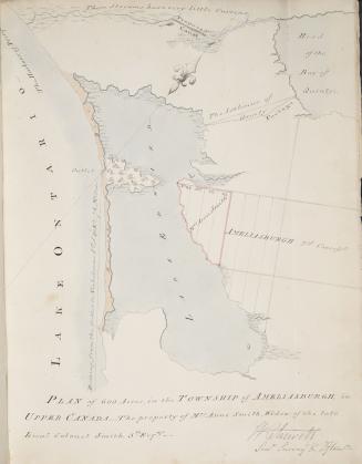
Plan of 600 acres in the township of Ameliasburgh in Upper Canada - the property of Mrs
1802
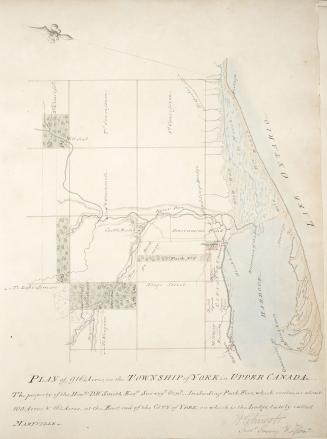
Plan of 916 1/4 acres, in the Township of York in Upper Canada
1802
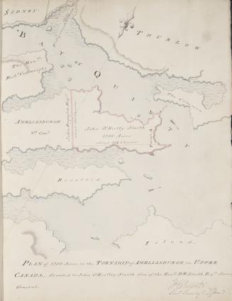
Plan of 1200 acres in the township of Ameliasburg in Upper Canada granted to John O'Reilly Smith Son of the Honble
1802
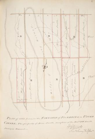
Plan of 1200 acres in the township of Pickering in Upper Canada, The property of Anne Smith daughter of the Honble
1802-04-28
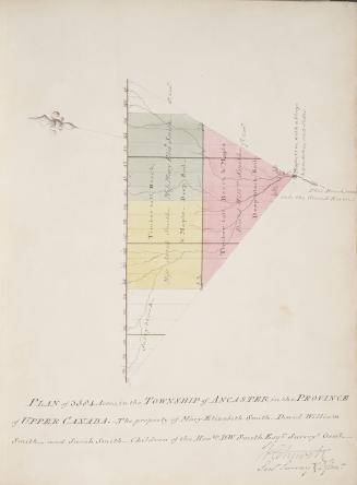
Plan of 3584 acres in the township of Ancaster in Upper Canada the property of Mary Elizabeth Smith, David William Smith and Sarah Smith children of the honble. D. W. Smith Esqre. Surveyr. Genl.
1802
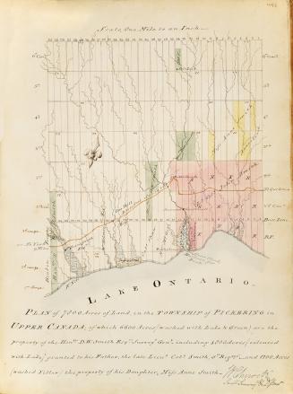
Plan of 7800 acres of land in the township of Pickering in Upper Canada of which 6600 acres property of D
1802
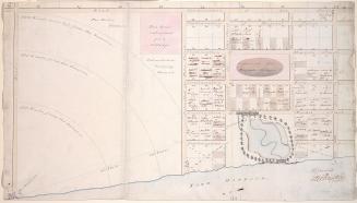
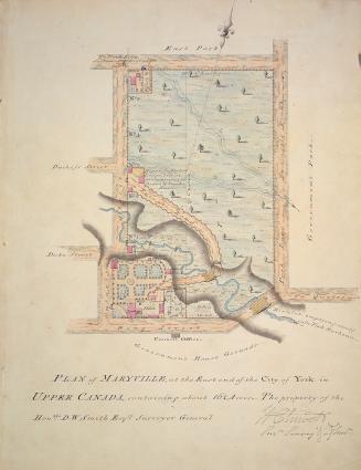
Plan of Maryville, at the east end of the City of York in Upper Canada, containing about 16 1/4 acres - the property of the Honble. D.W. Smith Esqre. Surveyor General
1802
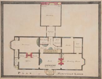
Plan of Maryville Lodge
1802
Plan of Maryville Lodge
1802
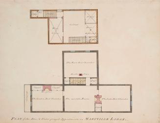
Plan of the attic and underground appartments in Maryville Lodge.
1802
/ 2
Next
RDF
XML
JSON