Skip to main content
Chas. E. Goad, Ltd.
Close
Refine Results
Show Only Public Domain
Format
Map
(184)
Book
(2)
Date
to
Names
Chas. E. Goad, Ltd.
(186)
Goad, Charles E.
(186)
Moulthrop Lumber Co
(1)
VanKleek Hill
(1)
Subject
Fire insurance
(186)
Maps
(186)
Aerial views
(2)
Historical geography
(2)
History
(2)
Real property
(2)
Fires
(1)
Insurance
(1)
Maps and surveys
(1)
Collection
Baldwin Collection of Canadiana
(186)
Language
English
(185)
No linguistic content
(1)
Building, monument or park
Moulthorp Lumber Company
(1)
City, town or township
Toronto
(160)
Arran-Elderslie (Ont. : Township)
(1)
Beaverton
(1)
Brock (Ont. : Township)
(1)
Cambridge
(1)
Champlain (Ont. : Township)
(1)
Chatham-Kent
(1)
James (Ont. : Township)
(1)
Kawartha Lakes
(1)
North Dundas
(1)
Load all
Neighbourhood
Downtown
(14)
King-Spadina
(9)
Rosedale-Moore Park
(8)
Trinity Bellwoods
(8)
Cabbagetown
(7)
Deer Park
(7)
Junction
(7)
High Park
(6)
Railway Lands
(6)
Annex
(5)
Load all
North-south street
Woodbine Avenue
(2)
Yonge Street
(2)
Bay Street
(1)
East-west street
Bloor Street West
(4)
Danforth Avenue
(2)
Kingston Road
(2)
Esplanade
(1)
Front Street West
(1)
Wellington Street
(1)
Sort:
Title (A–Z)
Date (Older First)
Date (Newer First)
Title (Z–A)
Last Updated (Ascending)
Last Updated (Descending)
List
Images
Table
/ 10
Next
Filters
186
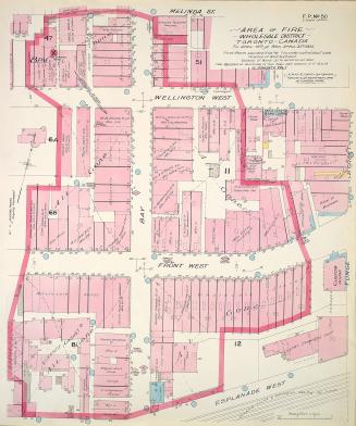
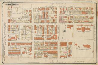
Area of fire wholesale district Toronto Canada Tu. April 19th and Wed. April 20th 1904
1904
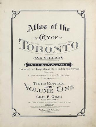
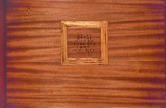
Atlas of the City of Toronto and suburbs founded on registered plans and special surveys showing plan numbers, lots & buildings
1910
Atlas of the City of Toronto and suburbs : founded on registered plans and special surveys showing plan numbers, lots & buildings (volume I)
1912
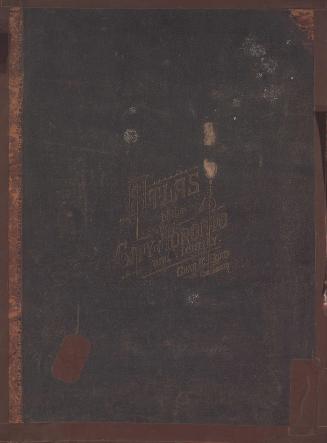
Atlas of the city of Toronto and suburbs from special survey and registered plans showing all buildings and lot numbers
1884
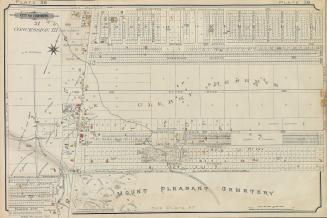
Atlas of the City of Toronto and suburbs(volume I, plate 18)
1912
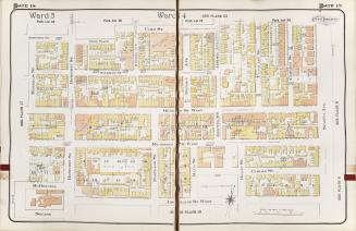
Atlas of the city of Toronto and vicinity from special survey founded on registered plans and showing all building and lot numbers
1893
Atlas of the city of Toronto and vicinity from special survey founded on registered plans and showing all building and lot numbers
1899
Atlas of the city of Toronto and vicinity from special survey founded on registered plans and showing all building and lot numbers
1890
Atlas of the city of Toronto and vicinity from special survey founded on registered plans and showing all building and lot numbers.
1893
Atlas of the city of Toronto and vicinity from special survey founded on registered plans and showing all building and lot numbers.
1893
Atlas of the city of Toronto and vicinity from special survey founded on registered plans and showing all building and lot numbers.
1893
Atlas of the city of Toronto and vicinity from special survey founded on registered plans and showing all building and lot numbers.
1893
Atlas of the city of Toronto and vicinity from special survey founded on registered plans and showing all building and lot numbers.
1893
Atlas of the city of Toronto and vicinity from special survey founded on registered plans and showing all building and lot numbers.
1893
Atlas of the city of Toronto and vicinity from special survey founded on registered plans and showing all building and lot numbers.
1893
Atlas of the city of Toronto and vicinity from special survey founded on registered plans and showing all building and lot numbers.
1893
Atlas of the city of Toronto and vicinity from special survey founded on registered plans and showing all building and lot numbers.
1893
Atlas of the city of Toronto and vicinity from special survey founded on registered plans and showing all building and lot numbers.
1893
Atlas of the city of Toronto and vicinity from special survey founded on registered plans and showing all building and lot numbers.
1893
Atlas of the city of Toronto and vicinity from special survey founded on registered plans and showing all building and lot numbers.
1893
/ 10
Next
RDF
XML
JSON