Skip to main content
Cary, John, approximately 1754-1835
Close
Refine Results
Show Only Public Domain
Format
Map
(7)
Date
to
Names
Cary, John, approximately 1754-1835
(7)
J. Cary
(5)
Subject
Maps
(7)
Collection
Baldwin Collection of Canadiana
(7)
Language
English
(7)
Sort:
Title (A–Z)
Date (Older First)
Date (Newer First)
Title (Z–A)
Last Updated (Ascending)
Last Updated (Descending)
List
Images
Table
/ 1
Filters
7
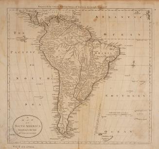
A map of South America, from the latest authorities
1795
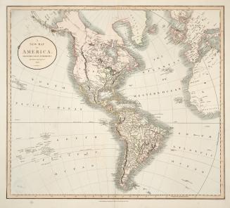
A new map of America, from the latest authorities
1806
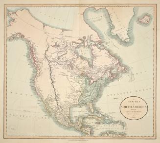
A new map of North America, from the latest authorities
1806
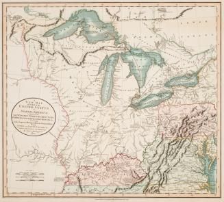
A new map of part of the United States of North America, exhibiting the Western Territory, Kentucky, Pennsylvania, Maryland, Virginia &c.
1805
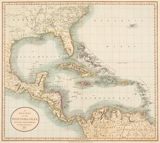
A new map of the West India Isles, from the latest authorities
1803
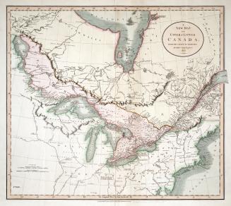
A new map of Upper & Lower Canada from the latest authorities
1807
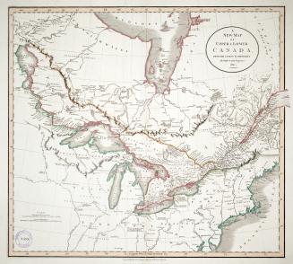
A new map of Upper & Lower Canada from the latest authorities
1811
/ 1
RDF
XML
JSON