Skip to main content
Toronto Lithographing Company
Close
Refine Results
Show Only Public Domain
Format
*
Map
(5)
Date
to
Names
Toronto Lithographing Company
(5)
Canada. Department of Agriculture
(1)
Canadian Bank of Commerce
(1)
Hunter, Rose & Company
(1)
Jennings, W. T. (William Tyndale), 1846-1906
(1)
Rust, C. H. (Charles Henry), 1852-1927
(1)
Speight & Van Nostrand
(1)
McCuaig & Mainwaring (firm)
(1)
Land Security Company
(1)
Subject
Maps
(5)
Bank buildings
(1)
Land subdivision
(1)
Libraries
(1)
Maps and surveys
(1)
Real estate
(1)
Real property
(1)
Roads
(1)
Statistics
(1)
Collection
Baldwin Collection of Canadiana
(5)
Language
English
(5)
City, town or township
Toronto
(3)
Neighbourhood
Dovercourt
(1)
Earlscourt
(1)
Financial District
(1)
North-south street
Jarvis Street
(1)
East-west street
King Street East
(1)
Sort:
Title (A–Z)
Date (Older First)
Date (Newer First)
Title (Z–A)
Last Updated (Ascending)
Last Updated (Descending)
List
Images
Table
/ 1
Filters
5
Map
Clear All Filters
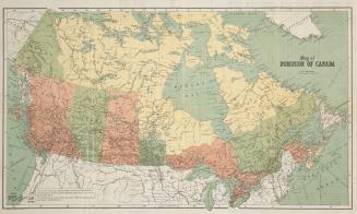
Map of Dominion of Canada
Approximately 1906
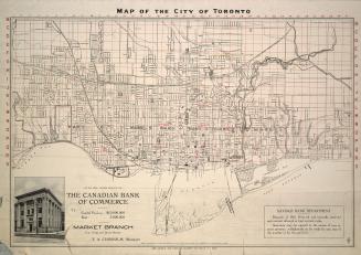
Map of the city of Toronto, with the compliments of the Canadian Bank of Commerce, Market branch
1908
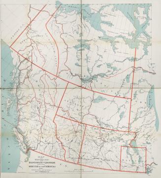
Map of the western part of the Dominion of Canada shewing various routes to the Yukon District
1898
Plan of subdivision of part of lot no. 32, conn. II, now in the City of Toronto ... the property of the Land Security Co.y.
1890
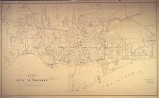
Plan of the City of Toronto.
1907
/ 1
RDF
XML
JSON