Skip to main content
Thomas Jefferys
Close
Refine Results
Show Only Public Domain
Format
Map
(13)
Book
(3)
Picture
(1)
Date
to
Names
Thomas Jefferys
(17)
Jefferys, Thomas, -1771
(16)
Mead, Braddock
(2)
Captain in his majesties navy
(1)
De Braham, William Gerard, 1717-1799
(1)
Fuentes, Bartolomé de, 17th century
(1)
Fry, Joshua Jefferson, Peter
(1)
Fuller, William
(1)
De Brahm, John
(1)
Brion de la Tour, Louis
(1)
Load all
Subject
Maps
(13)
Maps and surveys
(4)
Administrative and political divisions
(3)
Discovery and exploration
(1)
First Nations
(1)
Fisheries
(1)
French and Indian War, 1755-1763
(1)
History
(1)
Indians of North America
(1)
Natural history
(1)
Load all
Collection
Baldwin Collection of Canadiana
(17)
Building Monument Park
Fort Ticonderoga (N.Y.)
(1)
City, town, township
Gaspé
(1)
New Orleans
(1)
Language
English
(16)
French
(1)
Sort:
Title (A–Z)
Date (Older First)
Date (Newer First)
Title (Z–A)
Last Updated (Ascending)
Last Updated (Descending)
List
Images
Table
/ 1
Filters
17 results
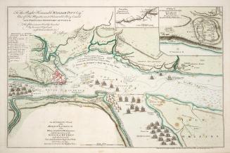
An authentic plan of the River St
Captain in his majesties navy
1759
The conduct of the French, with regard to Nova Scotia, from its first settlement to the present time
Jefferys, Thomas, -1771
1754
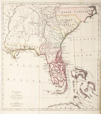
Florida from the Latest Authorities
Jefferys, Thomas, -1771
Approximately 1768
The great probability of a north west passage
Fuentes, Bartolomé de, 17th century
1768
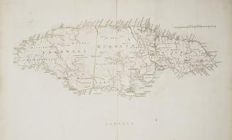
Jamaica
Jefferys, Thomas, -1771
Approximately 1760
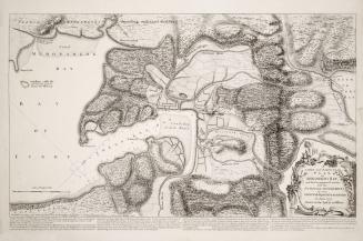
A large and particular plan of Shegnekto Bay, and the circumjacent country, with the forts and settlements of the French till dispossess'd by the English in June 1755 Drawn on the spot by an Officer
Jefferys, Thomas, -1771
1755
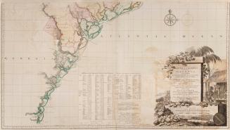
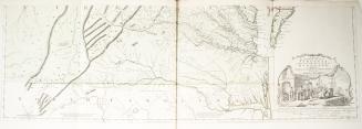
A map of South Carolina and a part of Georgia containing the whole sea coast, all the Islands, Inlets, Rivers, Creeks, Parishes, Townships, Boroughs, (...)
De Braham, William Gerard, 1717-1799
1757
A map of the most inhabited part of New England containing the provinces of Massachusets Bay and New Hampshire, with the colonies of Connecticut and Rhode Island, Divided into Counties and Townships: The Whole composed from Actual Surveys and its Situation adjusted by Astronomical Observations
Jefferys, Thomas, -1771
1774
A map of the most inhabited part of New England containing the provinces of Massachusets Bay and New Hampshire, with the colonies of Connecticut and Rhode Island, Divided into Counties and Townships: The Whole composed from Actual Surveys and its situation adjusted by Astronomical Observations
Jefferys, Thomas, -1771
1755
A map of the most inhabited part of Virginia containing the whole Province of Maryland with part of Pensilvania, New Jersey and North Carolina Drawn by Joshua Fry & Peter Jefferson in 1751
Fry, Joshua Jefferson, Peter
1755
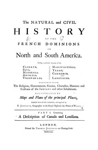
The natural and civil history of the French dominions in North and South America, giving a particular account of the climate, soil, minerals, animals,(...)
Jefferys, Thomas, -1771
1760
Plan de L'Isle de la Grenade, ou sont marques dans leur juste position le Ports et mouillages les Ville et Bourgs, les Rivieres, les Chemins Royaux et(...)
Jefferys, Thomas, -1771
1763
Plan of Amelia Island in East Florida Taken from De Brahm's map of South Carolina & Georgia, A chart of the entrance into St. Mary's River, A chart of(...)
De Brahm, John
1770
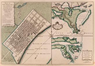
Plan of New Orleans the capital of Louisiana, with the Disposition of its Quarters and Canals as they have been traced by Mr de la Tour, in the Year 1720
Brion de la Tour, Louis
1759
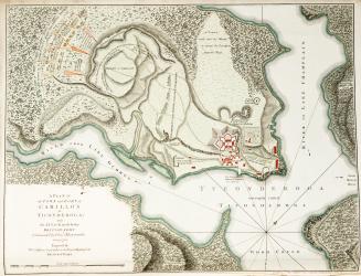
A Plan of the Town and Fort of Carillon at Ticonderoga, with the attack made by the British Army Commanded by Genl Abercrombie, 8 July 1758
Jefferys, Thomas, -1771
1758
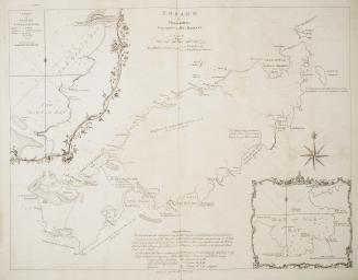
Tobago by Thomas Jefferys, Geographer to his Majesty
Jefferys, Thomas, -1771
1765
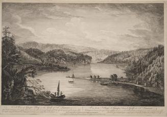
A View of Gaspe Bay in the Gulf of St
Mazell, Peter, active 1761-1797
1760
/ 1
RDF
XML
JSON