Skip to main content
Search
Objects
(181,123)
People
(41,122)
Close
Refine Results
Show Only Public Domain
Format
*
Map
(16)
Date
to
Names
Moll, Herman, -1732
(2)
Tardieu, P. F.
(2)
Unknown
(2)
Bowles, John
(1)
Bew, John, -1793
(1)
Blaeu, Johannes, 1596-1673
(1)
G. Humble
(1)
J. Bew
(1)
Las Cases, Emmanuel, comte de, 1766-1842
(1)
Salmon, Thomas
(1)
Load all
Subject
Maps
(15)
Colonies
(3)
History
(2)
War of 1812
(2)
Boundaries
(1)
Discovery and exploration
(1)
First Nations
(1)
French and Indian War, 1755-1763
(1)
Indians of North America
(1)
Collection
Baldwin Collection of Canadiana
(16)
Language
English
(12)
French
(4)
Sort:
Relevance
Date (Older First)
Date (Newer First)
Title (A–Z)
Title (Z–A)
Last Updated (Ascending)
Last Updated (Descending)
List
Images
Table
/ 1
Filters
16 results for
*
Result type
Objects
People
Map
Canada||United States
Clear All Filters
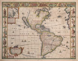
America with those known parts in that unknowne worlde both people and manner of buildings discribed and inlarged by I
1626
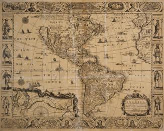
Americae nova descriptio impensis Anae Seile 1663
1663
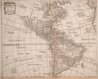
A new and most exact map of America, described by N
1668
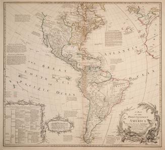
A map of the whole continent of America particularly shewing the British empire in the northern part of America with the divisions of the new governments since the accession of Canada and Florida
1765
De L'Amerique moderne en 1812
1824
Amerique Septentrionale, dressee sur les Relations les plus modernes des voyageurs et navigateurs, et divisee suivant les differentes possessions des (...)
1750
A new and correct map of North America in which the Places of the Principal Engagements during the Present War are accurately inserted
1780-04-26
Carte des pays situes à l'ouest du Canada 1791
1794
Carte des Pays connus sous le nom de Canada dans laquelle sont distinguees les possessions francoises & angl
1753
North America
1814
United States of America exhibiting the seat of war on the Canadian frontier from 1812 to 1815
1816-08-05
To the officers of the Army and the citizens of the United States This map of Upper and Lower Canada and United States contigious Contracted from the (...)
1812
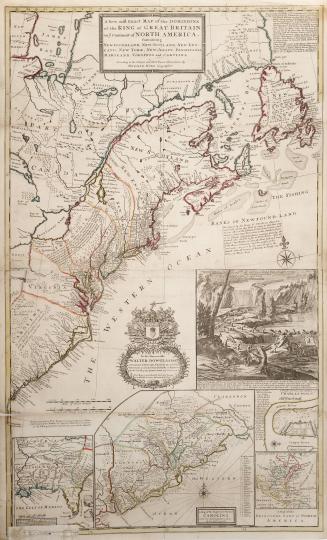
A new and exact map of the Dominions of the King of Great Britain on ye Continent of North America, Containing Newfoundland, New Scotland, New England(...)
1715
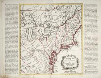
An accurate map of the British Colonies in North America bordering on the River Ohio
Approximately 1760
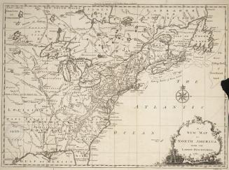
A New Map of North America from the Latest Discoveries
1761
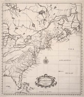
A map of the Brittish plantations on the continent of America
1739
/ 1
RDF
XML
JSON