Skip to main content
Search
Objects
(181,111)
People
(41,119)
Close
Refine Results
Show Only Public Domain
Format
*
Map
(20)
Date
to
Names
Robertson, J. Ross (John Ross), 1841-1918
(5)
Smyth, David William, Sir, 1764-1837
(3)
Chewett, James G. (James Grant), 1793-1862
(2)
Beavis & Browne
(1)
Browne, John Ownsworth, 1808-1881
(1)
Chewitt, William, 1753-1849
(1)
City Engineer's Office
(1)
Copp Clark Company
(1)
Aitken, Alexander, -1800
(1)
Canadian Institute
(1)
Load all
Subject
Maps
(20)
Maps and surveys
(10)
Harbour
(9)
Land subdivision
(8)
Government buildings
(4)
Wharves
(4)
Buildings
(3)
Civic improvement
(3)
Military buildings
(3)
Railroads
(3)
Load all
Collection
Baldwin Collection of Canadiana
(20)
Language
English
(20)
Building, monument or park
Toronto Harbour
(6)
Fort York
(1)
Union Station (Toronto, Ont. : 1852-1870)
(1)
City, town or township
Toronto
(20)
Neighbourhood
*
St. Lawrence
(20)
Harbour
(14)
Railway Lands
(11)
Financial District
(7)
King-Spadina
(7)
Port Lands
(5)
Exhibition
(4)
Garrison
(4)
Toronto Islands
(4)
Leslieville
(3)
Load all
North-south street
Leslie Street
(2)
Parliament Street
(2)
Yonge Street
(2)
Bay Street
(1)
John Street
(1)
Peter Street
(1)
East-west street
Front Street East
(3)
Queen Street East
(3)
Front Street West
(2)
King Street East
(2)
Esplanade
(1)
King Street West
(1)
Sort:
Relevance
Date (Older First)
Date (Newer First)
Title (A–Z)
Title (Z–A)
Last Updated (Ascending)
Last Updated (Descending)
List
Images
Table
/ 1
Filters
20 results for
*
Result type
Objects
People
Map
St. Lawrence
Clear All Filters
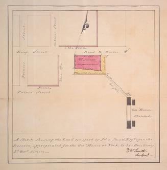
A sketch shewing the land occupied by John Small Esqr
1802
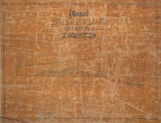
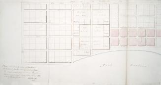
Plan of building lots abutting upon Queen Street East in the city of Toronto
1850
Toronto
1837
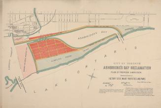
City of Toronto Ashbridge's Bay reclamation, plan of proposed subdivision shewing location of factory sites, wharf properties, and parks
1896
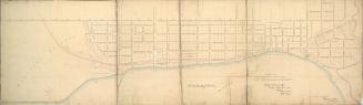
General plan of arrangements for railway termini in the city of Toronto
1853
Plan of that portion of the marsh and water frontage, situate southward of lots no5 to 15 inclusive in the broken front con. in the township of York
1889
(1818) Plan of the Town of York
Approximately 1910
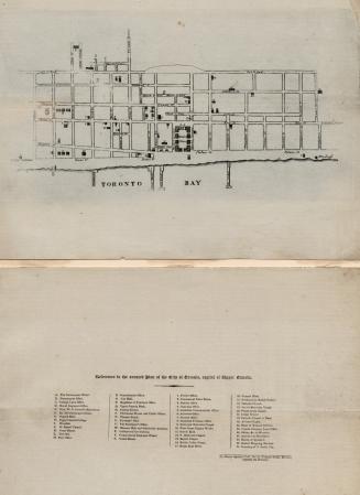
City of Toronto
1834
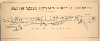
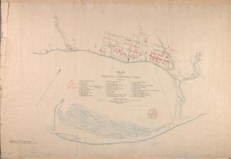
Plan of water lots in the city of Toronto
1860
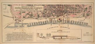
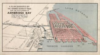
A plan suggested by the Toronto Board of Trade for the development of Ashbridge Bay showing provisions for the entry of all railways under city control
1910
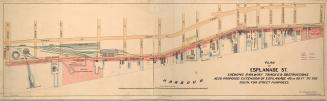
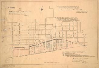
Plan of Esplanade St., shewing railway tracks & obstructions, also proposed extension of Esplanade 40 or 60 ft. to the south, for street purposes
1884
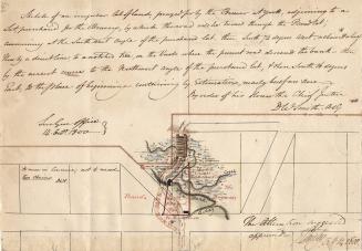
Sketch of an irregular lot of land, prayed for by the Brewer at York, adjoining to a lot, purchased for the Brewery, by which the road will be turned through the Pound Lot,
1800-09-14
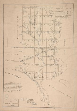
(1810) A plan shewing the survey of the land reserved for government buildings, east end of the town of York
Approximately 1908
Toronto in 1834
1834
(1814) Plan of the town and harbour of York
Approximately 1908
Copy of part of the ''Plan of improvements'' to be made in front of the City of Toronto shewing the water lots granted to the City Corporation (...)
1860
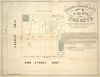
Plan of park lot no. 2, in the city of Toronto, the property of A.H. St. Germain, formerly belonging to Captn. Irvin and Mr. James Francis.
1855
Plan submitted by Order of His Honor the President for the enlargement of York
1797
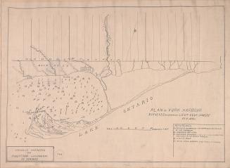
(1793) Plan of York harbour surveyed by order of Lieut. Govr. Simcoe by A. Aitken
1908
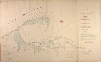
(1833) No. 1 plan of the town and harbour of York Upper Canada and also of the Military Reserves
1907
/ 1
RDF
XML
JSON