Skip to main content
Search
Objects
(181,123)
People
(41,125)
Close
Refine Results
Show Only Public Domain
Format
*
Map
(4)
Date
to
Names
Chalifour, Joseph Epiphane, 1863-
(1)
Chas. E. Goad, Ltd.
(1)
Canada. Department of the Interior
(1)
Government Printing Bureau
(1)
Goad, Charles E.
(1)
Cory, William Wallace, 1865-1943
(1)
Québec (Province)
(1)
Meighen, Arthur, 1874-1960
(1)
Québec (Province). Département de la colonization, des mines et des pêcheries
(1)
Lumsden Steamboat Line
(1)
Load all
Subject
Maps
(4)
Cartes
(1)
Fire insurance
(1)
Collection
Baldwin Collection of Canadiana
(4)
Language
English
(3)
French
(1)
City, town or township
James (Ont. : Township)
(1)
Timmins
(1)
Neighbourhood
Elk Lake (Clearview, Ontario)
(1)
Sort:
Relevance
Date (Older First)
Date (Newer First)
Title (A–Z)
Title (Z–A)
Last Updated (Ascending)
Last Updated (Descending)
List
Images
Table
/ 1
Filters
4 results for
*
Result type
Objects
People
Map
Timiskaming (Ont. : District)
Clear All Filters
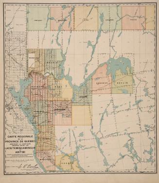
Carte régionale de la Province de Québec montrant le territoire compris entre les lacs Temiscamingue et Abitibi
17 March 1910
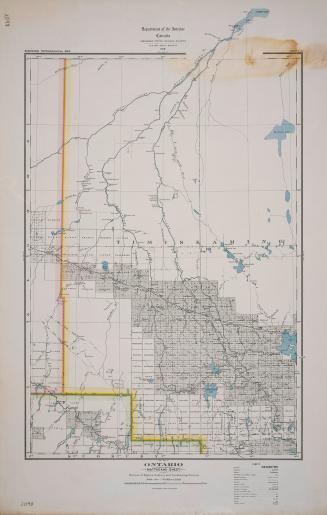
Ontario Mattagami sheet portions of Algoma, Sudbury and Timiskaming Districts
1919
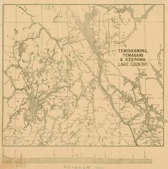
Temiskaming, Temagami & Keepawa Lake Country
Approximately 1900
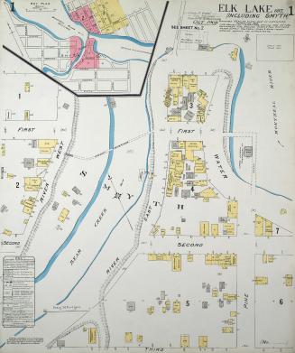
Fire insurance plan of Elk Lake, Ont
1909
/ 1
RDF
XML
JSON