Skip to main content
Search
Objects
(181,123)
People
(41,125)
Close
Refine Results
Show Only Public Domain
Format
*
Map
(29)
Date
to
Names
*
Copp Clark Company
(29)
Ontario. Department of Crown Lands
(10)
City Engineer's Office
(3)
City Survey Office (Winnipeg, Man.)
(2)
Canada. Department of Agriculture
(2)
G.B. Bemister
(2)
McPhillips, George D.L.S
(2)
Pardee, Timothy Blair, 1830-1889
(2)
Bolger, Francis
(1)
Bowman, C.D.
(1)
Load all
Subject
Maps
(29)
Maps and surveys
(9)
Railroads
(5)
Roads
(5)
Election districts
(4)
Land subdivision
(4)
City planning
(2)
Real estate
(2)
Real property
(2)
Agriculture
(1)
Load all
Collection
*
Baldwin Collection of Canadiana
(29)
Language
English
(29)
Building, monument or park
Toronto Harbour
(1)
City, town or township
Toronto
(12)
Neighbourhood
Annex
(2)
Yorkville
(2)
Bloor West Village
(1)
Deer Park
(1)
Dovercourt
(1)
Harbour
(1)
High Park
(1)
Junction
(1)
Kensington-Grange
(1)
Railway Lands
(1)
Load all
North-south street
Bathurst Street
(1)
Christie Street
(1)
Huron Street
(1)
Queen's Park Crescent
(1)
Sherbourne Street
(1)
Spadina Road
(1)
Yonge Street
(1)
East-west street
Bloor Street West
(2)
Davenport Road
(2)
Bloor Street East
(1)
Dupont Street
(1)
Esplanade
(1)
St. Clair Avenue East
(1)
St. Clair Avenue West
(1)
Sort:
Relevance
Date (Older First)
Date (Newer First)
Title (A–Z)
Title (Z–A)
Last Updated (Ascending)
Last Updated (Descending)
List
Images
Table
/ 2
Next
Filters
29 results for
*
Result type
Objects
People
Map
Copp Clark Company
Baldwin Collection of Canadiana
Clear All Filters
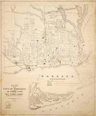
Plan of the City of Toronto, shewing the general system of the new water works and position of all the new pipe laid
1876
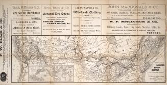
Map of the Canadian Pacific Railway, and its connections
1887
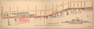
Plan of Esplanade St., shewing railway tracks & obstructions, also proposed extension of Esplanade 40 or 60 ft. to the south, for street purposes
1884
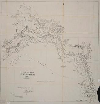
Plan of the north shore of Lake Superior 1872
1872
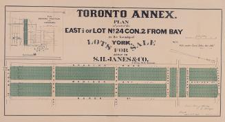
Toronto Annex. Plan of part of the east 1/2 of lot no. 24 con. 2 from bay in the township of York. Lots for sale apply to S. H. Janes & Co
1885
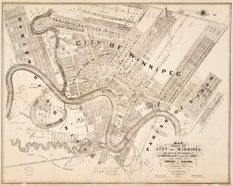
Map shewing the city of Winnipeg, and parts of the parishes of St
1881
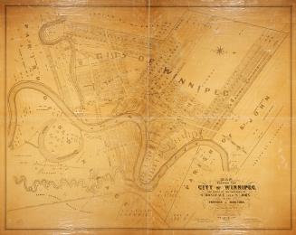
Map shewing the city of Winnipeg, and parts of the parishes of St
1881
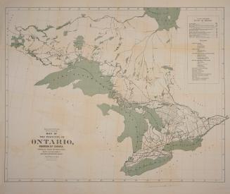
Map of the Province of Ontario, Dominion of Canada, exhibiting the counties and districts therein, also the unsurveyed portions of Northern & Northewestern Ontario
1884
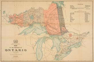
Map of the province of Ontario Canada
1901
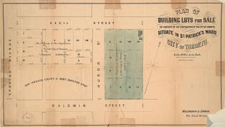
Plan of building lots for sale, the property of the corporation of the City of Toronto, situate in St. Patrick's ward, City of Toronto
1872
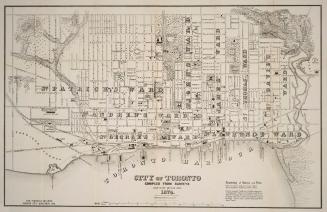
City of Toronto compiled from surveys made to the present date 1874
1874
Map of the village of Yorkville and vicinity, compiled from plans & filed in the Registry Office
1877
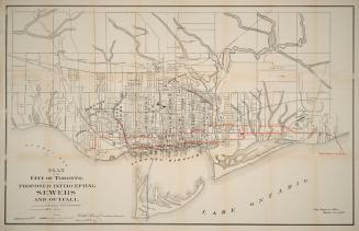
Plan of the city of Toronto, proposed intercepting sewers and outfall
1889
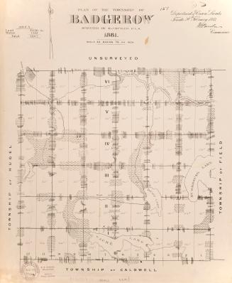
Plan of the township of Badgerow surveyed by M.J. Butler, P.L.S. 1887
1881
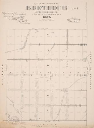
Plan of the township of Brethour Nipissing District, surveyed by B.J. Saunders, P.L.S. 1887
1887
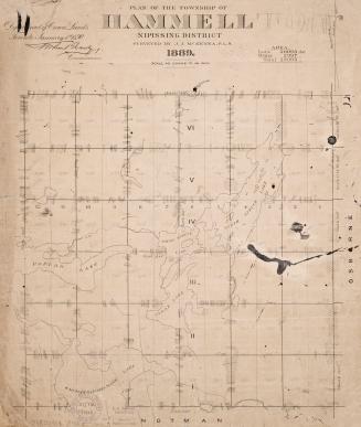
Plan of the township of Hammell Nipissing District surveyed by J.J. Kenna, P.L.S.
1889
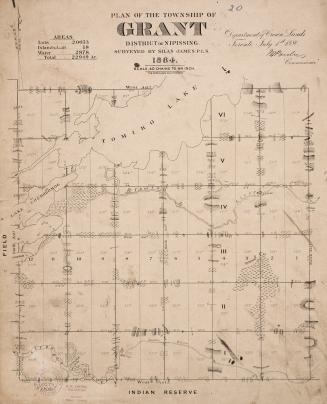
Plan of the township of Grant district of Nipissing, surveyed by Silas James, P.L.S. 1887
1881
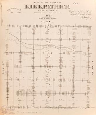
Plan of the township of Kirkpatrick district of Nipissing surveyed by C.D. Bowman, P.L.S.
1882
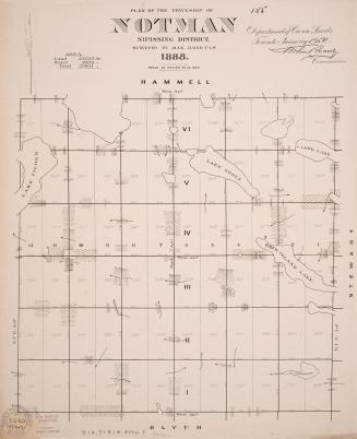
Plan of the township of Notman district of Nipissing surveyed by Alex Baird, P.L.S.
1888
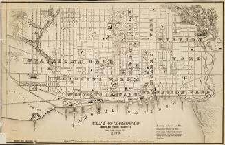
City of Toronto compiled from surveys made to the present date, 1873
1873
/ 2
Next
RDF
XML
JSON