Skip to main content
Search
Objects
(180,943)
People
(41,105)
Close
Refine Results
Show Only Public Domain
Format
Ephemera
(2)
Map
(2)
Date
to
Names
Unknown
(2)
E. & C. Gurney Co.
(1)
Fitzgerald, W. J.
(1)
Maclear & Co.
(1)
Strachan, James McGill
(1)
Wakefield, Coate & Co.
(1)
Subject
Maps
(2)
Maps and surveys
(2)
Advertising cards
(1)
Conferences and Conventions
(1)
Land subdivision
(1)
Protests
(1)
Real estate
(1)
Real property
(1)
Stoves
(1)
Collection
Baldwin Collection of Canadiana
(4)
Language
English
(4)
Building, monument or park
City Hall
(1)
Provincial Lunatic Asylum
(1)
City, town or township
Toronto
(4)
Neighbourhood
Trinity Bellwoods
(3)
Downtown
(2)
Kensington-Grange
(2)
King-Spadina
(2)
Brockton
(1)
Dufferin Grove-Bickford Park
(1)
Palmerston-Sussex Ulster
(1)
Parkdale
(1)
St. Lawrence
(1)
University
(1)
Load all
North-south street
Bathurst Street
(1)
Dovercourt Road
(1)
Jarvis Street
(1)
Lippincott Street
(1)
Markham Street
(1)
Ossington Avenue
(1)
Yonge Street
(1)
East-west street
*
College Street
(4)
Queen Street West
(4)
Bloor Street West
(2)
Dundas Street West
(2)
Davenport Road
(1)
Dundas Street East
(1)
Harbord Street
(1)
King Street East
(1)
Sort:
Relevance
Date (Older First)
Date (Newer First)
Title (A–Z)
Title (Z–A)
Last Updated (Ascending)
Last Updated (Descending)
List
Images
Table
/ 1
Filters
4 results for
*
Result type
Objects
People
Queen Street West
College Street
Clear All Filters
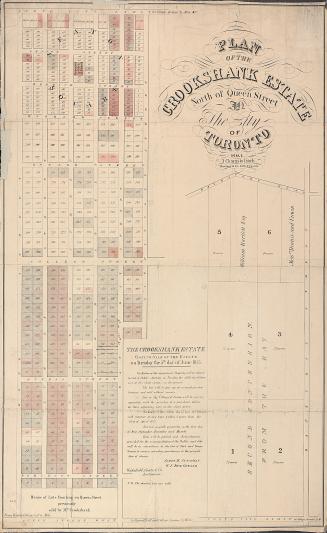
Plan of the Crookshank estate, north of Queen Street in the city of Toronto
1855
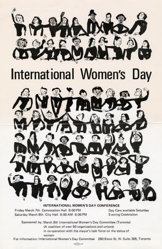
International Women's day
1975
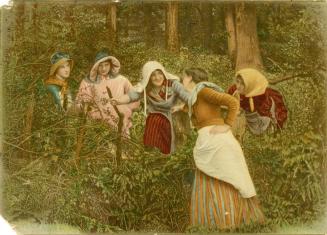
Gurney's standard stoves & ranges
1889
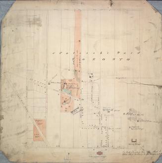
St. Patrick's Ward, Toronto
Approximately 1860
/ 1
RDF
XML
JSON