Skip to main content
Search
Objects
(181,123)
People
(41,122)
Close
Refine Results
Show Only Public Domain
Format
Picture
(40)
Map
(39)
Ephemera
(2)
Date
to
Names
Snider, C.H.J. (Charles Henry Jeremiah), 1879-1971
(35)
Robertson, J. Ross (John Ross), 1841-1918
(11)
Royal Engineers Office (Quebec)
(5)
Unknown
(5)
MacDiarmid, F. G.
(3)
McLean, W. A. (Deputy Minister of Highways, Ont.)
(3)
Ontario. Department of Public Highways
(3)
Nicolls, Gustavus
(3)
Alexander, Clare & Cable Lithographing (Toronto, Ont.)
(2)
Bonnycastle, Richard Henry, Sir, 1791-1847
(2)
Load all
Subject
Maps
(39)
Steamboats
(21)
Harbour
(17)
Maps and surveys
(17)
Steamships
(15)
Military buildings
(11)
Railroads
(9)
Government buildings
(6)
Land subdivision
(6)
Wharves
(6)
Load all
Collection
Baldwin Collection of Canadiana
(80)
Humanities and Social Sciences department
(1)
Language
English
(52)
No linguistic content
(27)
French
(1)
Italian
(1)
Building, monument or park
Toronto Harbour
(13)
Fort York
(4)
Hanlan's Point (Centre Island)
(3)
Canadian National Exhibition (CNE)
(1)
City, town or township
Toronto
(36)
Ottawa
(3)
King (Ont. : Township)
(2)
Kingston
(2)
Montréal
(2)
Vaughan
(2)
Barrie
(1)
Belleville
(1)
Brockville
(1)
Collingwood
(1)
Load all
Neighbourhood
Harbour
(17)
Toronto Islands
(15)
Exhibition
(11)
Garrison
(11)
Railway Lands
(10)
Port Lands
(9)
St. Lawrence
(9)
King-Spadina
(5)
Leslieville
(4)
Financial District
(3)
Load all
North-south street
Leslie Street
(2)
Parliament Street
(2)
Bathurst Street
(1)
Keele Street
(1)
Yonge Street
(1)
East-west street
Queen Street East
(2)
Bloor Street West
(1)
Dundas Street West
(1)
Esplanade
(1)
Front Street East
(1)
King Street East
(1)
King Street West
(1)
Lakeshore Boulevard West
(1)
Sort:
Relevance
Date (Older First)
Date (Newer First)
Title (A–Z)
Title (Z–A)
Last Updated (Ascending)
Last Updated (Descending)
List
Images
Table
/ 5
Next
Filters
81 results for
*
Result type
Objects
People
Lake Ontario
Clear All Filters
(1816) Plan of the harbour, fort and town of York, the capital of Upper Canada, March 16th 1816
Approximately 1908
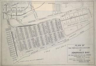
Plan of the proposed reclamation of Ashbridges Bay as suggested by Mr. Jas. Oborne superintendent of the Canadian Pacific Railway
1908
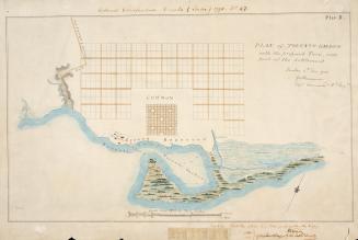
(1788) Plan of Toronto Harbour with the proposed town and part of the settlement, Québec 6th Dec. 1788, Gothermann, Capn. Commandg. Rl. Engrs. Colonial Correspondence Canada (Québec) 1790 no. 47 Plan B
Approximately 1908
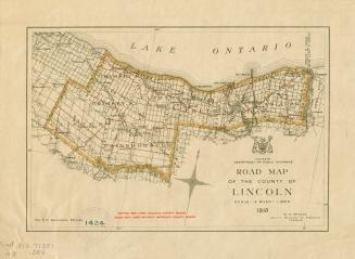
Road map of the County of Lincoln
1918
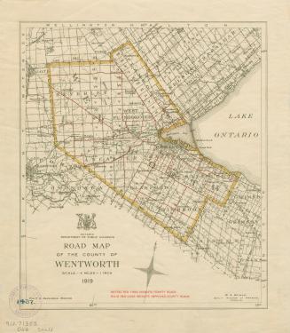
Road map of the County of Wentworth
1919
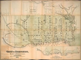
Hart & Rawlinson's Map of the City of Toronto, with Suburbs of Yorkville, Parkdale, Seaton Village, Brockton, and Ben-Lamond
1878
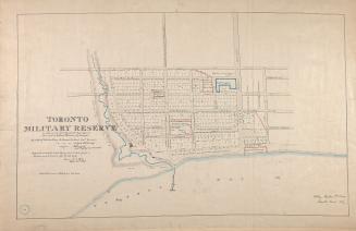
(1837) Toronto military reserve as laid out by Captn Bonnycastle Royal Engineers and resurveyed by William Hawkins Dy. Surveyor
Approximately 1908
Casa Loma Motel
Approximately 1954
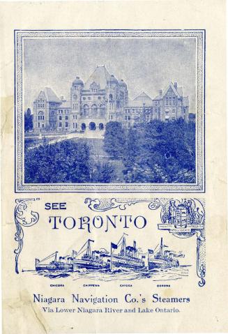
See Toronto
Approximately 1910
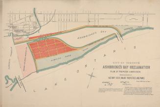
City of Toronto Ashbridge's Bay reclamation, plan of proposed subdivision shewing location of factory sites, wharf properties, and parks
1896
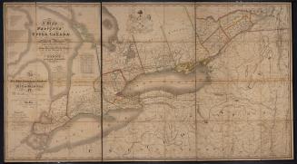
Map of the Province of Upper Canada and the adjacent territories in North America
1825
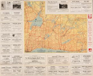
Guidal indexed four color tourist road map
Approximately 1927
A few comments upon Mr. Macaulay's remarks on the internal water communications of the Canadas as published in the Quebec gazette of the 8th February
1837
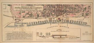
General plan of arrangements for railway termini in the city of Toronto
1853
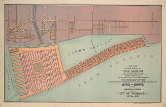
Plan of that portion of the marsh and water frontage, situate southward of lots no5 to 15 inclusive in the broken front con. in the township of York
1889
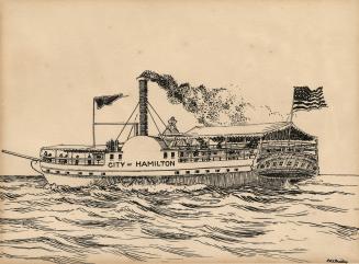
Steamer "City of Hamilton", 1850-77 (Lake Ontario)
approximately 1915
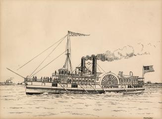
Steamer "Champion", 1850-80 (St. Lawrence River & Lake Ontario)
approximately 1915
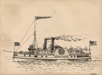
Steamer "Ocean Wave", 1852-53 (St. Lawrence River & Lake Ontario)
approximately 1915
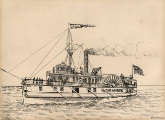
Steamer "Highlander", 1850-71 (St. Lawrence River & Lake Ontario)
approximately 1915
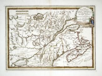
Gli Stati Uniti dell' America delineati sulle ultime osservazioni, secondo foglio che comprende parte della Nuovo Inghilterra ed inoltre la Nuova Scotia e porzione del Canada
1797
/ 5
Next
RDF
XML
JSON