Skip to main content
Search
Objects
(181,123)
People
(41,125)
Close
Refine Results
Show Only Public Domain
Format
Picture
(46)
Date
to
Names
Unknown
(45)
Rowntree Mackintosh Canada Ltd. (Toronto, Ont.)
(2)
Arts & Mirrors Ltd. (Toronto, Ont.)
(1)
Clover Meadow Creamery Ltd. (Toronto, Ont.)
(1)
Arthurs-Jones Lithographing Ltd. (Toronto, Ont.)
(1)
College Rentals & Hardware (Toronto, Ont.)
(1)
Brill-Lite Neon Signs Ltd. (Toronto, Ont.)
(1)
Augie's Cycles Ltd. (Toronto, Ont.)
(1)
City council members
(1)
Ruprecht, Tony
(1)
Load all
Subject
Streets
(20)
Dwellings
(9)
Church buildings
(7)
Factories
(4)
High schools
(4)
Service stations
(3)
Catholic schools
(2)
Electric substations
(2)
Variety stores
(2)
Barbershops
(1)
Load all
Collection
Local History Collection, Bloor/Gladstone branch
(44)
Baldwin Collection of Canadiana
(1)
Local History Collection, Sanderson branch
(1)
Language
*
No linguistic content
(46)
City, town or township
Toronto
(46)
Neighbourhood
*
Brockton
(46)
North-south street
Sterling Road
(9)
Brock Avenue
(7)
Lansdowne Avenue
(6)
St. Clarens Avenue
(6)
Dufferin Street
(3)
Margueretta Street
(3)
Sheridan Avenue
(2)
Awde Street
(1)
Croatia Street
(1)
St. Helens Avenue
(1)
Load all
East-west street
College Street
(10)
Dundas Street West
(6)
Bloor Street West
(2)
College Street||Lansdowne Avenue
(1)
Croatia Avenue||Awde Street
(1)
Dundas Street West||Lansdowne Avenue
(1)
Lindsey Avenue
(1)
Sort:
Relevance
Date (Older First)
Date (Newer First)
Title (A–Z)
Title (Z–A)
Last Updated (Ascending)
Last Updated (Descending)
List
Images
Table
/ 3
Next
Filters
46 results for
*
Result type
Objects
People
Brockton
Ontario
No linguistic content
Clear All Filters
Moloney Electric Co. of Canada Limited Transformers, Sterling Road, east side, between Dundas Street West and Bloor Street West, Toronto, Ont.
1980
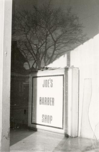
Joe's Barber Shop sign, College Street, north side, between Margueretta Street and St. Clarens Avenue, Toronto, Ont.
1980
Bloor Street West, south side, between Lansdowne Avenue and St. Helens Avenue, Toronto, Ont.
1980
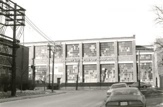
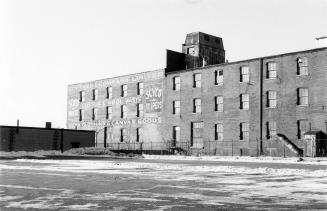
Toronto Fabricating Co., Sterling Road, east side, between Perth Avenue and Dundas Street West, Toronto, Ont.
1980
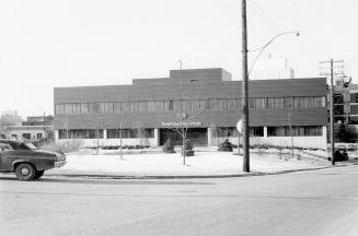
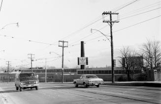
Rowntree Mackintosh Canada Ltd., Sterling Road, west side, between Dundas Street West and Perth Avenue, Toronto, Ont.
1980
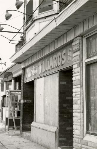
Carlos Billiards, Lansdowne Avenue, west side, between College Street and Lumbervale Avenue, Toronto, Ont.
1980
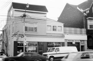
Augie's Cycles Ltd., College Street, southwest corner of St. Clarens Avenue, Toronto, Ont.
1980
Lansdowne Avenue, southeast corner of College Street , Toronto, Ont.
1980
Looking northeast from Dundas Street West bridge and Canadian Pacific Railway tracks, Toronto, Ont, showing house at the southeast corner of Lumbervale Avenue and St. Helens Avenue on right and West Toronto Secondary School on left.
1980
Sterling Road, looking south from south of Bloor Street West to Perth Avenue, Toronto, Ont.
1980
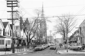
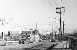
St. Clarens Avenue looking south from College Street to Dundas Street West, showing St. Helen's Church, Toronto, Ont.
1980
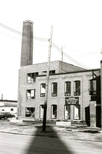
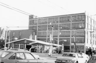
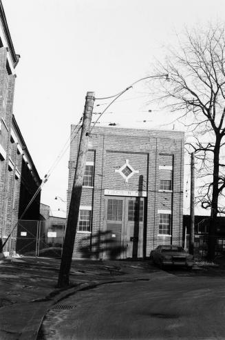
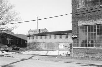
Toronto Hydro-Electric System substation, Sterling Road, west side, north of Perth Avenue, Toronto, Ont.
1980
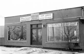
Freedman Harness, Dundas Street West, south side, between Lansdowne Avenue and Sorauren Avenue, Toronto, Ont.
1980
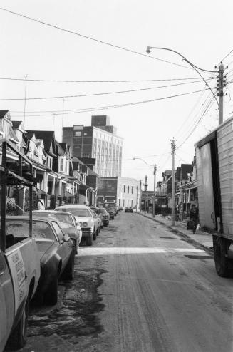
Dundas Street West, looking east of CPR tracks to St. Clarens Avenue, Toronto, Ont.
1980
Knob Hill Farms, Lansdowne Avenue, southwest corner of Dundas Street West, Toronto, Ont.
1980
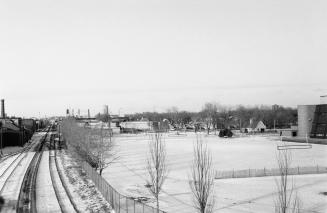
Looking north from Dundas Street West and the Canadian Pacific Railway tracks showing West Toronto Secondary School and MacGregor Playground on right, Toronto, Ont.
1980
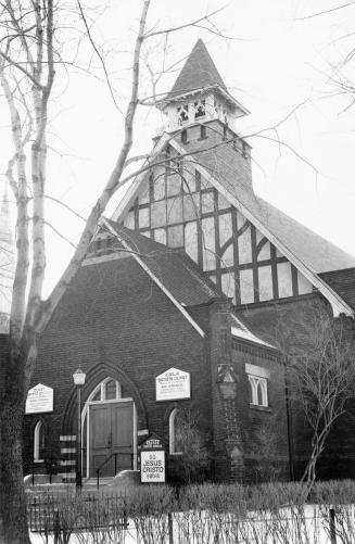
Olivet Baptist Church, Margueretta Street, west side, between Moutray Street and College Street, Toronto, Ont.
1980
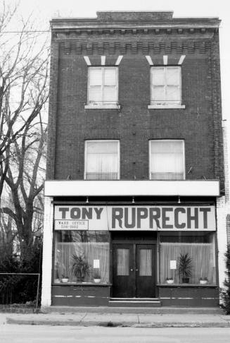
Tony Ruprecht Ward Office, College Street, north side, between Margueretta Street and St. Clarens Avenue, Toronto, Ont.
1980
Scythes & Company Limited, Sterling Road, west side, between Dundas Street West and Perth Avenue, Toronto, Ont.
1980
Sterling Road, east side, between Dundas Street West and Bloor Street West, Toronto, Ont.
1980
/ 3
Next
RDF
XML
JSON