Skip to main content
Search
Objects
(181,263)
People
(41,132)
Close
Refine Results
Show Only Public Domain
Format
Map
(13)
Ephemera
(3)
Date
to
Names
Chewett, James G. (James Grant), 1793-1862
(3)
Chewitt, William, 1753-1849
(2)
Russell, Peter, 1733-1808
(2)
Smyth, David William, Sir, 1764-1837
(2)
Troy & Company (Toronto, Ont.)
(2)
Browne, John Ownsworth, 1808-1881
(1)
Chas. E. Goad, Ltd.
(1)
Canadian Institute
(1)
Canadian Bank of Commerce
(1)
Goad, Charles E.
(1)
Load all
Subject
*
Maps
(16)
Maps and surveys
(6)
Land subdivision
(5)
Harbour
(4)
Civic improvement
(3)
Publishers and publishing
(3)
Railroads
(3)
Advertising
(2)
Commercial agents
(2)
Door-to-door selling
(2)
Load all
Collection
*
Baldwin Collection of Canadiana
(16)
Language
English
(16)
Building, monument or park
Toronto Harbour
(3)
Fort York
(1)
City, town or township
Toronto
(13)
Neighbourhood
*
Financial District
(16)
Railway Lands
(10)
Harbour
(9)
King-Spadina
(8)
St. Lawrence
(7)
Exhibition
(3)
Garrison
(3)
Downtown
(1)
Kensington-Grange
(1)
North-south street
Bay Street
(2)
John Street
(2)
Peter Street
(2)
Yonge Street
(2)
Bathurst Street
(1)
Church Street
(1)
Jarvis Street
(1)
Portland Street
(1)
Simcoe Street
(1)
York Street
(1)
Load all
East-west street
Front Street West
(3)
King Street East
(2)
Esplanade
(1)
Front Street East
(1)
King Street West
(1)
Richmond Street
(1)
Wellington Street
(1)
Sort:
Relevance
Date (Older First)
Date (Newer First)
Title (A–Z)
Title (Z–A)
Last Updated (Ascending)
Last Updated (Descending)
List
Images
Table
/ 1
Filters
16 results for
*
Result type
Objects
People
Financial District
Baldwin Collection of Canadiana
Maps
Clear All Filters
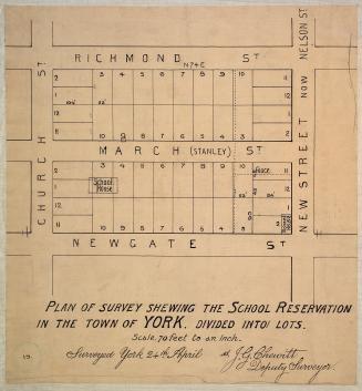
Plan of survey shewing the school reservation in the town of York
1837
Toronto
1837
His Honor the Presdt approval of the town plot of York. 2nd addition
1798
Sketch of a design for laying out the north shore of the Toronto Harbour in pleasure drives walks and shrubbery for the recreation of the citizens
1852
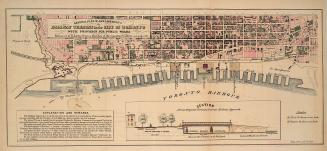
General plan of arrangements for railway termini in the city of Toronto
1853
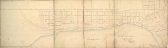
(1818) Plan of the Town of York
Approximately 1910
City of Toronto
1834
New railway & postal map of the province of Ontario
1875
Toronto in 1834
1834
Copy of part of the ''Plan of improvements'' to be made in front of the City of Toronto shewing the water lots granted to the City Corporation (...)
1860
Plan of the proposed railway termini in connection with the harbour of the city of Toronto
1853
[Letter] Your application for an agency for our new map of Canada is received
1870 circa
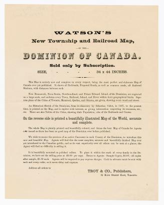
Watson's new township and railroad map, of the Dominion of Canada : sold only by subscription, size 34 x 44 inches
1870 circa
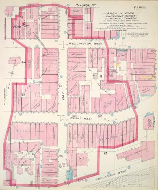
Area of fire wholesale district Toronto Canada Tu. April 19th and Wed. April 20th 1904
1904
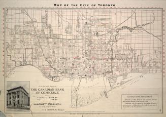
Map of the city of Toronto, with the compliments of the Canadian Bank of Commerce, Market branch
1908
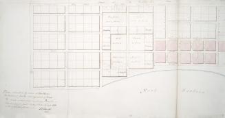
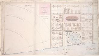
Plan submitted by Order of His Honor the President for the enlargement of York
1797
/ 1
RDF
XML
JSON

![[Letter] Your application for an agency for our new map of Canada is received](/internal/media/dispatcher/2040546/thumbnail)