Skip to main content
Search
Objects
(181,123)
People
(41,125)
Close
Refine Results
Show Only Public Domain
Format
Map
(9)
Picture
(8)
Date
to
Names
Unknown
(8)
Robertson, J. Ross (John Ross), 1841-1918
(3)
Bouchette, J. (Joseph), 1774-1841
(2)
Royal Engineers Office (Quebec)
(2)
Nicolls, Gustavus
(2)
Bonnycastle, Richard Henry, Sir, 1791-1847
(1)
Great Britain. Admiralty
(1)
Ford, E. T.
(1)
J. Walker
(1)
Weller & Addison
(1)
Load all
Subject
Harbour
(11)
Maps
(9)
Maps and surveys
(5)
Military buildings
(4)
Factories
(3)
Government buildings
(3)
Harbors
(3)
Wharves
(3)
Buildings
(2)
Construction
(2)
Load all
Collection
*
Baldwin Collection of Canadiana
(17)
Language
English
(17)
Building, monument or park
Toronto Harbour
(5)
Keating Channel
(2)
Fort York
(1)
City, town or township
Toronto
(17)
Neighbourhood
*
Harbour
(17)
Port Lands
(17)
Toronto Islands
(7)
Exhibition
(6)
Garrison
(5)
Railway Lands
(4)
St. Lawrence
(4)
Beach
(2)
Leslieville
(2)
Cabbagetown
(1)
Load all
North-south street
Leslie Street
(1)
Parliament Street
(1)
Yonge Street
(1)
East-west street
Front Street East
(1)
King Street East
(1)
Queen Street East
(1)
Sort:
Relevance
Date (Older First)
Date (Newer First)
Title (A–Z)
Title (Z–A)
Last Updated (Ascending)
Last Updated (Descending)
List
Images
Table
/ 1
Filters
17 results for
*
Result type
Objects
People
Harbour
Port Lands
Baldwin Collection of Canadiana
Clear All Filters
(1816) Plan of the harbour, fort and town of York, the capital of Upper Canada, March 16th 1816
Approximately 1908
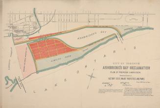
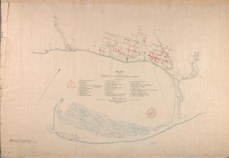
City of Toronto Ashbridge's Bay reclamation, plan of proposed subdivision shewing location of factory sites, wharf properties, and parks
1896
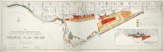
The Toronto Harbor Commissioners Waterfront Development Progress Plan 1914-1918
Between 1914 and 1918
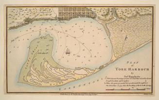
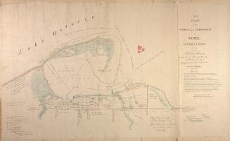
Plan of York Harbour
1815
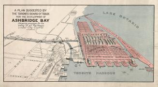
A plan suggested by the Toronto Board of Trade for the development of Ashbridge Bay showing provisions for the entry of all railways under city control
1910
(1814) Plan of the town and harbour of York
Approximately 1908
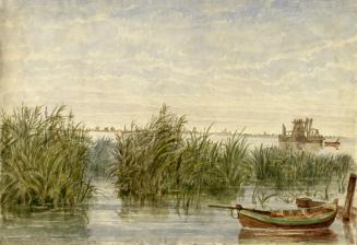
The Island, Lake Ontario, Toronto, Canada West (Ontario)
1860 circa
Canada Lake Ontario Toronto Harbour from plans supplied by the Canadian Government, 1906
1907
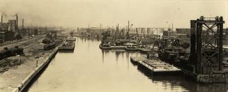
View looking southeast, showing Keating channel at left
1914
Toronto Ashbridge's Bay 1920, looking west
10/6/1920
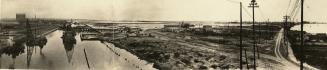
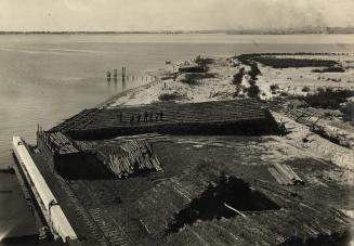
Dredging and filling for the expansion of the Port Lands. Toronto, Ontario
1914?
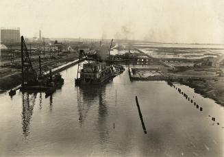
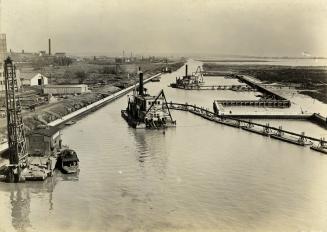
Keating Channel, looking east during construction
1914?
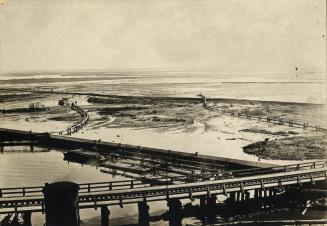
Showing temporary Don Channel
191-?
Keating Channel, looking east during construction
10/31/1914
Oil storage tanks, Keating Street, Port Lands. Toronto, Ont.
192-?
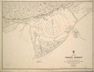
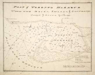
Plan of Toronto Harbour with the rocks, shoals & Soundings
1792
(1833) No. 1 plan of the town and harbour of York Upper Canada and also of the Military Reserves
1907
/ 1
RDF
XML
JSON