Skip to main content
Search
Objects
(181,123)
People
(41,125)
Close
Refine Results
Show Only Public Domain
Format
Map
(21)
Picture
(19)
Date
to
Names
Unknown
(11)
Robertson, J. Ross (John Ross), 1841-1918
(6)
Bonnycastle, Richard Henry, Sir, 1791-1847
(3)
Chewett, James G. (James Grant), 1793-1862
(2)
Royal Engineers Office (Quebec)
(2)
Salmon, James V. (James Victor)
(2)
Smyth, David William, Sir, 1764-1837
(2)
Browne, John Ownsworth, 1808-1881
(1)
Bank of Montreal
(1)
Chewitt, William, 1753-1849
(1)
Load all
Subject
Maps
(21)
Harbour
(13)
Maps and surveys
(12)
Land subdivision
(7)
Military buildings
(7)
Wharves
(7)
Factories
(6)
Government buildings
(6)
Buildings
(3)
Civic improvement
(3)
Load all
Collection
Baldwin Collection of Canadiana
(39)
Toronto Star Photograph Archive
(1)
Language
English
(40)
Building, monument or park
Toronto Harbour
(6)
Fort York
(4)
Union Station (Toronto, Ont. : 1852-1870)
(1)
City, town or township
Toronto
(40)
Neighbourhood
*
Harbour
(40)
Railway Lands
(40)
Garrison
(13)
King-Spadina
(13)
Exhibition
(10)
St. Lawrence
(10)
Financial District
(9)
Toronto Islands
(7)
Port Lands
(4)
Cabbagetown
(1)
Load all
North-south street
Bathurst Street
(2)
Peter Street
(2)
Spadina Avenue
(2)
John Street
(1)
Portland Street
(1)
Simcoe Street
(1)
Yonge Street
(1)
York Street
(1)
East-west street
Front Street West
(3)
Esplanade
(2)
King Street West
(2)
Front Street East
(1)
Sort:
Relevance
Date (Older First)
Date (Newer First)
Title (A–Z)
Title (Z–A)
Last Updated (Ascending)
Last Updated (Descending)
List
Images
Table
/ 2
Next
Filters
40 results for
*
Result type
Objects
People
Harbour
Railway Lands
Canada
Clear All Filters
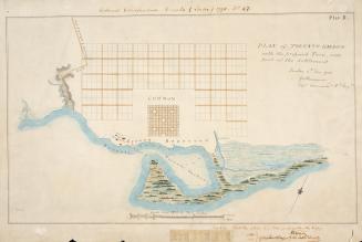
(1788) Plan of Toronto Harbour with the proposed town and part of the settlement, Québec 6th Dec. 1788, Gothermann, Capn. Commandg. Rl. Engrs. Colonial Correspondence Canada (Québec) 1790 no. 47 Plan B
Approximately 1908
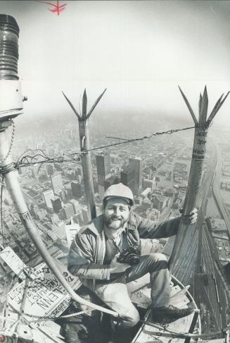
View from the top. A 45-minute climb took Star photographer Graham Bezant from restaurant pod to the top of the CN Tower. Photo was taken by one of tower painters, Norman LaPointe
5/3/1975
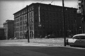
Walker House, York St., south west corner Front St. W., Toronto, Ont.
8/1/1954
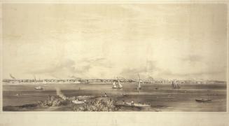
Toronto Harbour 1856, view from Hanlan's Point, showing from west of foot of Spadina Avenue on the left, to about foot of Parliament St. on the right
1856
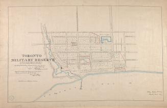
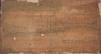
(1837) Toronto military reserve as laid out by Captn Bonnycastle Royal Engineers and resurveyed by William Hawkins Dy. Surveyor
Approximately 1908
Toronto
1837
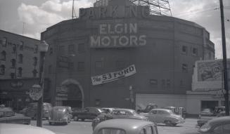
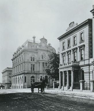
Cyclorama, Front Street West, south side, west of York St., Toronto, Ontario
1953-02
His Honor the Presdt approval of the town plot of York. 2nd addition
1798
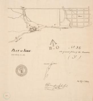
(1823) Plan of York
Approximately 1908
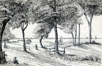
Sketch of a design for laying out the north shore of the Toronto Harbour in pleasure drives walks and shrubbery for the recreation of the citizens
1852
Yonge St., S. of King St., west side, looking south from north of Front St., Toronto, Ont.
1880 circa
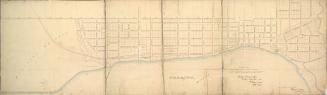
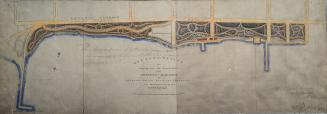
General plan of arrangements for railway termini in the city of Toronto
1853
St. James Hotel, York St., east side, between Esplanade W. & Front St. W., Toronto, Ont.
1896
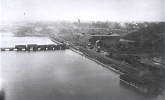
Toronto Harbour, looking west from foot of John St
1884
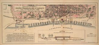
City of Toronto
1834
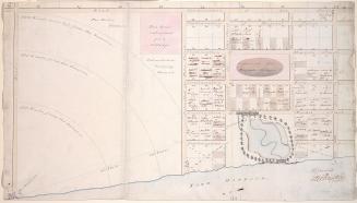
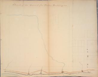
Sketch of the ground for public buildings
1796
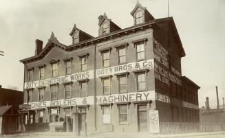
Front St. W., 184-? Looking south east from the north east corner of Peter St., showing military storehouse, foot of John St., at left. Toronto, Ontario
Approximately 1890
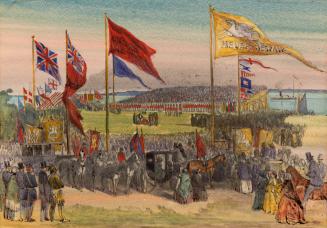
Ontario, Simcoe & Huron Railroad, Lady Elgin turning first sod, south side Front Street West, west of Simcoe St.; looking south east. Toronto, Ontario
1851-10-15
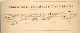
Plan of water lots in the city of Toronto
1860
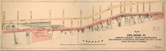
Plan of Esplanade St., shewing railway tracks & obstructions, also proposed extension of Esplanade 40 or 60 ft. to the south, for street purposes
1884
/ 2
Next
RDF
XML
JSON