Skip to main content
Search
Objects
(181,263)
People
(41,132)
Close
Refine Results
Show Only Public Domain
Format
Picture
(4)
Map
(3)
Date
to
Names
Unwin, Browne & Sankey
(2)
Unknown
(2)
Alexander, Clare & Cable Lithographing (Toronto, Ont.)
(1)
Rumsey & Co.
(1)
Richmonde Sales Co., Ltd., Toronto
(1)
S.F. Piggott, Photographer
(1)
Subject
Land subdivision
(3)
Maps
(3)
Streets
(3)
Maps and surveys
(2)
Real estate
(2)
Real property
(2)
Construction
(1)
Hotels, motels, etc.
(1)
Railroads
(1)
Roads
(1)
Load all
Collection
Baldwin Collection of Canadiana
(6)
Local History Collection, Annette branch
(1)
Language
English
(5)
No linguistic content
(2)
City, town or township
Toronto
(7)
Neighbourhood
*
High Park
(7)
Junction
(1)
Lambton
(1)
Seaton Village
(1)
University
(1)
Weston
(1)
Yorkville
(1)
North-south street
Keele Street
(2)
Bathurst Street
(1)
Indian Road
(1)
Roncesvalles Avenue
(1)
Royce Avenue
(1)
Yonge Street
(1)
East-west street
*
Dundas Street West
(7)
Bloor Street West
(2)
Annette Street
(1)
Davenport Road
(1)
Dundas Street East
(1)
Humberside Avenue
(1)
Kingston Road
(1)
Sort:
Relevance
Date (Older First)
Date (Newer First)
Title (A–Z)
Title (Z–A)
Last Updated (Ascending)
Last Updated (Descending)
List
Images
Table
/ 1
Filters
7 results for
*
Result type
Objects
People
High Park
Ontario
Dundas Street West
Clear All Filters
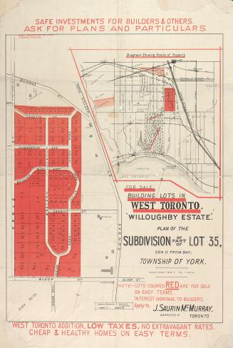
"Willoughby estate"; plan of the subdivision of part of lot 35, con. II from bay, township of York
1880
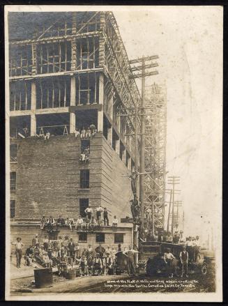
Wells and Grey, Toronto, circa 1911
Approximately 1911
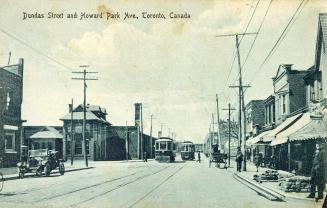
Dundas Street and Howard Park Ave., Toronto, Canada
Approximately 1910
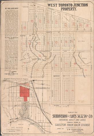
Plan of the subdivision of parts of lots 36, 37, 38 and 39 containing about 240 acres formerly known as Carlton Park Race Course.
1883
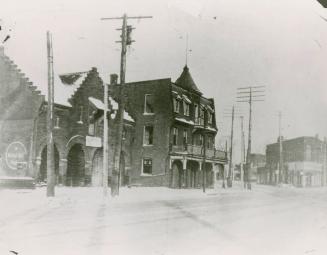
Peacock Hotel, Dundas Street West, west side, opposite Royce Avenue (Dupont Street), between Brad Street and Old Weston Road, Toronto, Ontario.
1925?
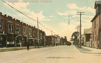
Roncesvalles Avenue, Toronto
Approximately 1920
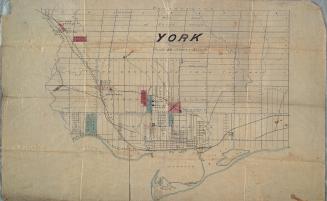
York
Approximately 1872
/ 1
RDF
XML
JSON