Skip to main content
Search
Objects
(181,123)
People
(41,122)
Close
Refine Results
Show Only Public Domain
Format
Map
(22)
Date
to
Names
Bellin, Jacques Nicolas, 1703-1772
(3)
Cassini, Giovanni Maria
(2)
Society for the Diffusion of Useful Knowledge (Great Britain)
(2)
Arrowsmith, John, 1790-1873
(1)
Canadian Pacific Railway Company
(1)
Burland Lith. Company Montreal
(1)
Bew, John, -1793
(1)
Chicago : Poole Brothers
(1)
Duluth, South Shore, and Atlantic Railway Company
(1)
H. Overton
(1)
Load all
Subject
*
Maps
(22)
Colonies
(2)
Cables, Submarine
(1)
Description and travel
(1)
Discovery and exploration
(1)
Early maps
(1)
Guides
(1)
Harbour
(1)
Railroads
(1)
Railways
(1)
Load all
Collection
Baldwin Collection of Canadiana
(22)
Language
English
(15)
French
(3)
Italian
(2)
German
(1)
Dutch
(1)
Building, monument or park
Louisbourg (N.S.)
(1)
City, town or township
Halifax
(1)
Sault Ste. Marie (Ontario)
(1)
Sort:
Relevance
Date (Older First)
Date (Newer First)
Title (A–Z)
Title (Z–A)
Last Updated (Ascending)
Last Updated (Descending)
List
Images
Table
/ 2
Next
Filters
22 results for
*
Result type
Objects
People
Nova Scotia
Maps
Clear All Filters
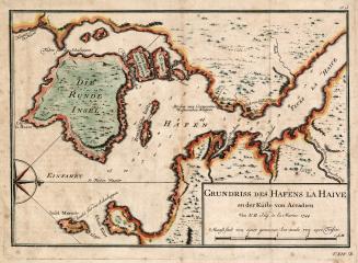
Grundriss des Hafens la Haive an der Kufte von Accadien
1756
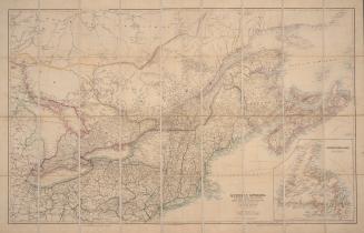
Quebec, Ontario, New Brunswick, Nova Scotia, Prince Edward Id. and Newfoundland with the adjacent parts of the United States
20 March 1879
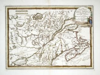
Gli Stati Uniti dell' America delineati sulle ultime osservazioni, secondo foglio che comprende parte della Nuovo Inghilterra ed inoltre la Nuova Scotia e porzione del Canada
1797
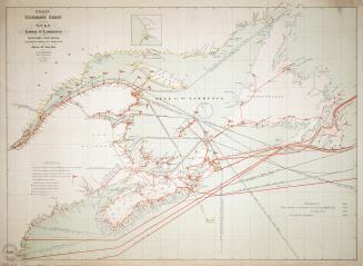
Coast telegraph chart of the Gulf and lower St. Lawrence and Maritime Provinces
1881
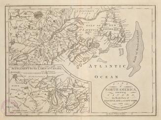
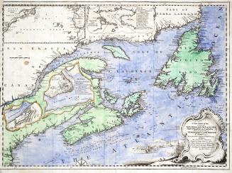
Part of North America, containing Canada, the north parts of New England and New York, with Nova Scotia and Newfoundland
1755
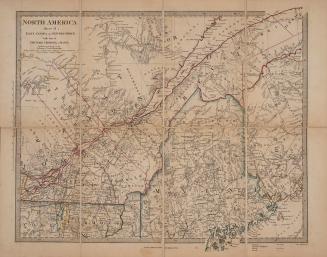
North America sheet II East Canada and New Brunswick with part of New York, Vermont and Maine
1832
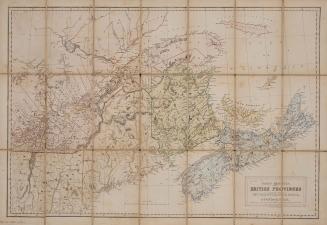
North America British Provinces New Brunswick, Nova Scotia, & part of Canada compiled from recent surveys and adjusted to the latest astronomical observations
Approximately 1842
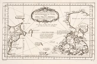
Carte reduite des parties septentrionales du globe situées entre l'Asie et l'Amerique
1758
Halifax the sunrise city of Canada commercial & guide map
Approximately 1912
Pascaarte vande Noorder Zee custen van America vande west-hoeck van ysland doorde straet Davis en Hudson tot aen Terra Neuf
Approximately 1695
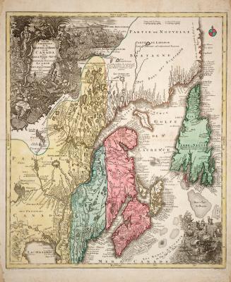
Carte Nouvelle contenant la Partie d'Amérique la plus septentrionale, où sont exactement décrites les Provinces suivantes comme le Canada ou Nouvelle (...)
Approximately 1700
A map of the British Empire in America with the French and Spanish settlements adjacent thereto (sheet 7)
1733
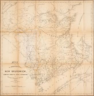
Map of the province of New Brunswick compiled from the latest authorities
1853
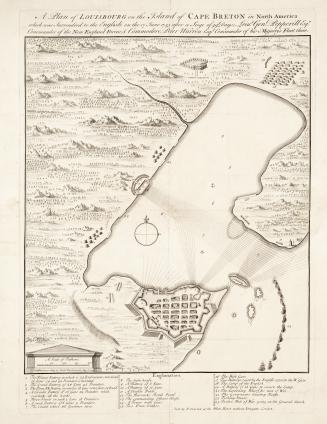
A plan of Louisbourg on the Island of Cape Breton in North America which was surrendered to the English on the 17 June 1745 after a seige of 49 days, (...)
1745
North America sheet 1 Nova Scotia with part of New Brunswick and East Canada
1855
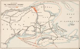
Map shewing Temiscouata Railway and its connection with the railways of Canada
Approximately 1890
Partie orientale de la Nouvelle France ou du Canada
Approximately 1756
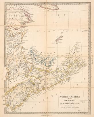
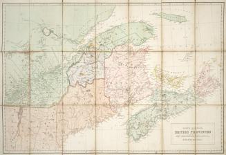
North America, British Provinces of New Brunswick, Nova Scotia & Part of Canada
Approximately 1840
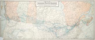
Map of the Canadian Pacific Railway : the Minneapolis, St. Paul & Sault Ste. Marie Railway, the Duluth, South Shore and Atlantic Railway and connections
1919
A new chart of the coast of New England, Nova Scotia, New France or Canada with the islands of Newfoundland, Cape Breton, St. John's &c.
1746
/ 2
Next
RDF
XML
JSON