Skip to main content
Search
Objects
(181,263)
People
(41,132)
Close
Refine Results
Show Only Public Domain
Format
Picture
(7)
Date
to
Names
Unknown
(6)
Hastings, Brocchy
(1)
Subject
*
Streets
(7)
Cable cars (Streetcars)
(1)
Funeral homes
(1)
Hotels, motels, etc.
(1)
Collection
*
Local History Collection, Annette branch
(7)
Language
No linguistic content
(7)
City, town or township
Toronto
(7)
Neighbourhood
Junction
(5)
High Park
(2)
North-south street
Mavety Street
(1)
McMurray Avenue
(1)
Royce Avenue
(1)
East-west street
Dundas Street West
(6)
Bloor Street West
(1)
Sort:
Relevance
Date (Older First)
Date (Newer First)
Title (A–Z)
Title (Z–A)
Last Updated (Ascending)
Last Updated (Descending)
List
Images
Table
/ 1
Filters
7 results for
*
Result type
Objects
People
Ontario
Streets
Local History Collection, Annette branch
Clear All Filters
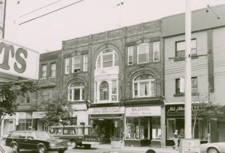
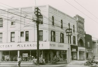
Dundas Street West, north side, between Pacific Avenue and McMurray Avenue, Toronto, Ontario.
1982
Dundas Street West, north side, looking east to Pacific Avenue, Toronto, Ontario.
1982
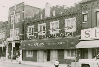
W. M. Speers Funeral Chapel, Dundas Street West, north side, between Keele Street and Pacific Avenue, Toronto, Ontario.
1982
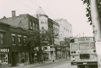
Dundas Street West, looking west from the northwest corner of McMurray Avenue, Toronto, Ontario.
1982
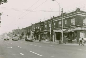
Dundas Street West, south side, looking west from Mavety Street, Toronto, Ontario.
1982
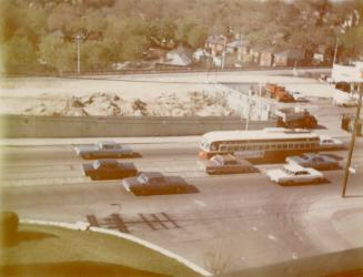
Bloor Street West, looking north from the southwest corner of Ellis Park Road showing the last streetcar on Bloor Street West, travelling westbound between Clendenan Avenue and Runnymede Road, Toronto, Ontario.
1968-05
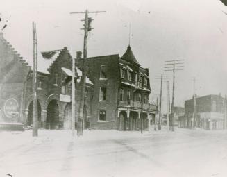
Peacock Hotel, Dundas Street West, west side, opposite Royce Avenue (Dupont Street), between Brad Street and Old Weston Road, Toronto, Ontario.
1925?
/ 1
RDF
XML
JSON