Skip to main content
Search
Objects
(181,123)
People
(41,122)
Close
Refine Results
Show Only Public Domain
Format
Map
(11)
Date
to
Names
Lowry, John Wilson, 1803-1879
(2)
Unknown
(2)
Chapman and Hall
(1)
Buchon, Jean Alexandre, 1791-1846
(1)
D. Lizars
(1)
Carey, Mathew, 1760-1839
(1)
Lewis, Samuel, -1865
(1)
Martin, Robert Montgomery
(1)
Johnson, J. Hugh
(1)
Longman & Co.
(1)
Load all
Subject
*
Colonies
(11)
Maps
(11)
Collection
Baldwin Collection of Canadiana
(11)
Language
English
(11)
Sort:
Relevance
Date (Older First)
Date (Newer First)
Title (A–Z)
Title (Z–A)
Last Updated (Ascending)
Last Updated (Descending)
List
Images
Table
/ 1
Filters
11 results for
*
Result type
Objects
People
Regional maps
Colonies
Clear All Filters
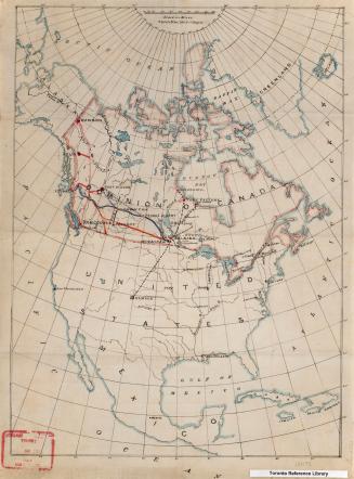
North America
Approximately 1905
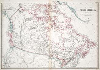
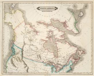
British North America
1865
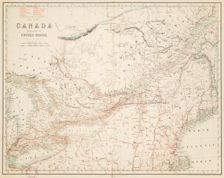
British Possessions in North America, with part of the United States, compiled from official sources
1840
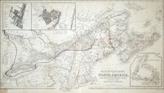
British North America. Sheet II, West. Canada with part of the United States.
1862
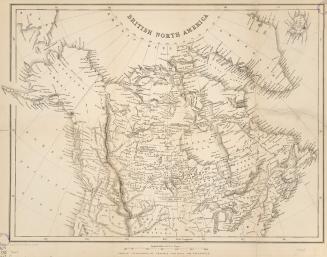
British North America
Approximately 1850
North America British possessions
1831
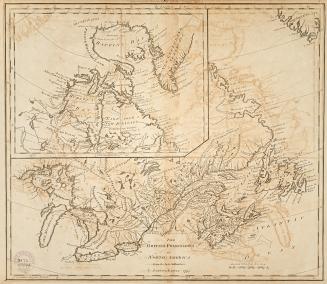
British Possessions in North America from the best authorities
1794
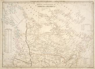
British possessions in North America
1836
Carte Geographique, Statistique et Historique des Posessions Anglaises
1825
North America, British Provinces of New Brunswick, Nova Scotia & Part of Canada
Approximately 1840
Extracted from ''Map of British possessions in North America, compiled from documents in the Colonial Department
1827
/ 1
RDF
XML
JSON