Skip to main content
Search
Objects
(181,123)
People
(41,122)
Close
Refine Results
Show Only Public Domain
Format
Map
(4)
Date
to
Names
Canada. Crown Lands Department
(1)
Dawson Brothers
(1)
Devine, Thomas (Draughtsman)
(1)
Lean, Alex
(1)
Lionais, E. H. Charles
(1)
Roberts, Edward
(1)
Holland, W.H.
(1)
Mortimer & Co.
(1)
Selkirk, Thomas Douglas, Earl of, 1771-1820
(1)
Smith, Rae
(1)
Load all
Subject
*
Historical geography
(4)
Maps
(4)
History
(2)
Administrative and political divisions
(1)
Real property for sale
(1)
Red River Rebellion, 1869-1870
(1)
Riel Rebellion, 1885
(1)
Collection
Baldwin Collection of Canadiana
(4)
Language
English
(4)
Sort:
Relevance
Date (Older First)
Date (Newer First)
Title (A–Z)
Title (Z–A)
Last Updated (Ascending)
Last Updated (Descending)
List
Images
Table
/ 1
Filters
4 results for
*
Result type
Objects
People
Regional maps
Historical geography
Clear All Filters
Map of the seat of Riel's insurrection showing the connection of Prince Albert with other points in the North West
1885
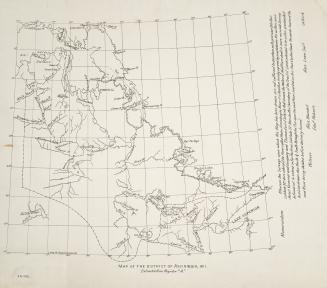
Map of the district of Assiniboia, 1811
1811
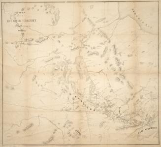
Map of the Red River Territory
1870
Government map of Canada
1859
/ 1
RDF
XML
JSON