Skip to main content
Search
Objects
(181,123)
People
(41,122)
Close
Refine Results
Show Only Public Domain
Format
Map
(17)
Date
to
Names
Canadian Pacific Railway Company
(5)
Grand Trunk Railway Company of Canada
(3)
Unknown
(3)
Poole Brothers
(2)
Burland Lithographic Co.
(1)
Brockville and Ottawa Railway Company
(1)
Copp Clark Company
(1)
C.S. Lott, Draughtsman
(1)
Doupe, J.L.
(1)
Griffin, F.T.
(1)
Load all
Subject
*
Maps
(17)
Railroads
(17)
Automobile travel
(1)
Explorers
(1)
Fur traders
(1)
Post offices
(1)
Railways
(1)
Road maps
(1)
Collection
Baldwin Collection of Canadiana
(17)
Language
English
(17)
City, town or township
Toronto
(3)
Ottawa
(2)
Barrie
(1)
Belleville
(1)
Brockville
(1)
Collingwood
(1)
King (Ont. : Township)
(1)
Kingston
(1)
Montréal
(1)
Orillia
(1)
Load all
Sort:
Relevance
Date (Older First)
Date (Newer First)
Title (A–Z)
Title (Z–A)
Last Updated (Ascending)
Last Updated (Descending)
List
Images
Table
/ 1
Filters
17 results for
*
Result type
Objects
People
Regional maps
Railroads
Clear All Filters
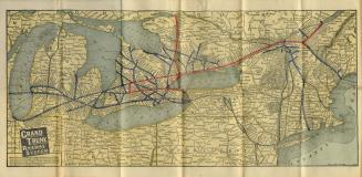
Map of Grand Trunk Railway system and connections
Approximately 1901
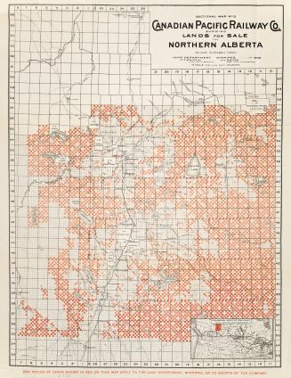
Sectional map no.6 Canadian Pacific Railway Co. shewing lands for sale in Northern Alberta
1902
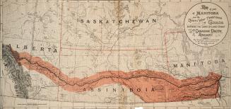
Map of part of Manitoba and the North West Territories of Canada Shewing the Line and Land Grant of the Canadian Pacific Railway
1889
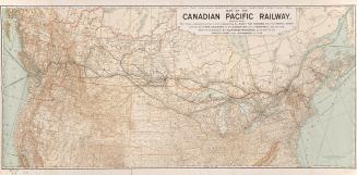
Map of the Canadian Pacific Railway, showing the routes (indicated by lines in red) followed by the early fur traders
1893
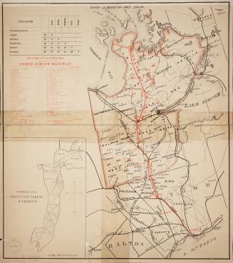
Map of the North Simcoe Railway
1874
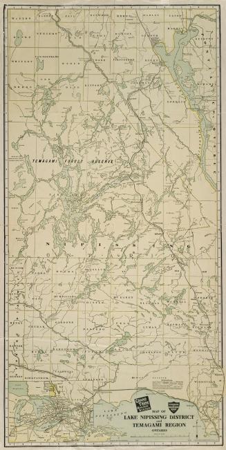
Map of Lake Nippissing District and Temagami Region Ontario
Approximately 1905
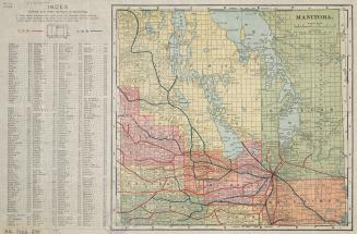
Manitoba
Approximately 1910
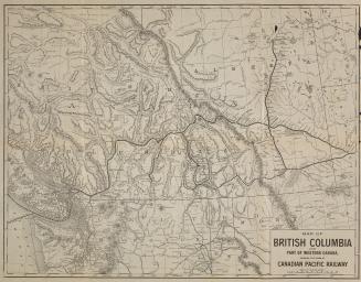
Map of British Columbia and part of Western Canada
Approximately 1890
Prince Arthur's Landing
Approximately 1880
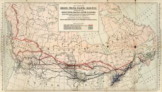
Map showing Grand Trunk Pacific Railway
1903
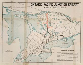
Ontario Pacific Junction Railway and connections
1875
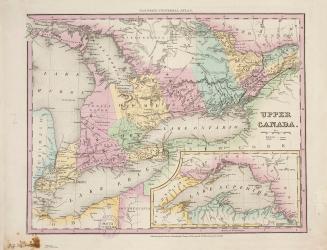
Upper Canada
Approximately 1840
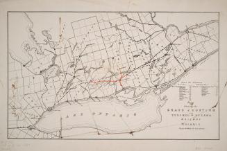
Map shewing the Grand Junction and Toronto & Ottawa Railway
1880
The Rand-McNally new commercial atlas map of Ontario
Approximately 1915
Map of the North Simcoe Railway, and its connections
Approximately 1878
Canada map of Brockville & Ottawa Railway
Approximately 1856
Map of part of the province of Ontario
Approximately 1882
/ 1
RDF
XML
JSON