Skip to main content
Search
Objects
(181,123)
People
(41,125)
Close
Refine Results
Show Only Public Domain
Format
Picture
(37)
Date
to
Names
*
Toronto Star (Firm)
(37)
Unknown
(20)
Bezant, Graham
(2)
Beaty, Keith
(2)
James, Norman
(2)
Spremo, Boris
(2)
F.W. Woolworth Co
(1)
Innell, Reg, 1926-2018
(1)
James, W. H.
(1)
Cranston, J.M.
(1)
Load all
Subject
*
Streets
(37)
Cobalt
(4)
Automobiles
(3)
Historical
(3)
Homes and haunts
(2)
Stores, Retail
(2)
Aerial views
(1)
Bank buildings
(1)
Banks
(1)
Bridges
(1)
Load all
Collection
Toronto Star Photograph Archive
(37)
Language
English
(26)
No linguistic content
(11)
Building, monument or park
Toronto Public Library. Riverdale branch
(1)
City, town or township
Toronto
(23)
Cobalt
(4)
New Tecumseth
(2)
East Gwillimbury
(1)
Kapuskasing
(1)
Kawartha Lakes
(1)
Kirland Lake
(1)
Priceville
(1)
Neighbourhood
Financial District
(7)
Danforth
(4)
Leaside
(3)
Riverdale
(3)
Alliston (New Tecumseth, Ontario)
(2)
Downtown
(2)
Cedarvale
(1)
Deer Park
(1)
Holland Landing (East Gwillimbury, ONt.)
(1)
Lindsay (Kawartha Lakes, Ont.)
(1)
Load all
North-south street
Broadview Avenue
(3)
Victoria Street
(2)
Avenue Road
(1)
Church Street
(1)
Southlea Avenue
(1)
Yonge Street
(1)
East-west street
Danforth Avenue
(5)
Richmond Street
(2)
Wellington Street East
(2)
Adelaide Street East
(1)
Carlton Street
(1)
Dundas Street East
(1)
Gerrard Street East
(1)
King Street
(1)
St. Clair Avenue West
(1)
Temperance Street
(1)
Load all
Sort:
Relevance
Date (Older First)
Date (Newer First)
Title (A–Z)
Title (Z–A)
Last Updated (Ascending)
Last Updated (Descending)
List
Images
Table
/ 2
Next
Filters
37 results for
*
Result type
Objects
People
Toronto Star (Firm)
Canada
Streets
Clear All Filters
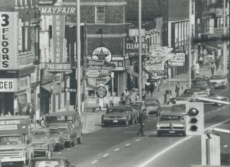
Danforth Avenue, north side, looking east from east of Pape Avenue, Toronto, Ontario.
10/9/1970
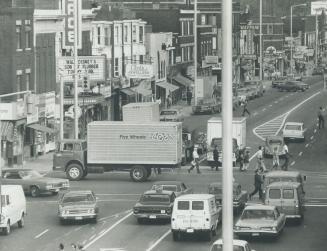
Angled lines still confuse some drivers
10/9/1970
Robert A. Allen real estate and insurance office and drug store, Danforth Avenue, north side, between Langford Avenue and Dewhurst Boulevard, opposite Jones Avenue, Toronto, Ontario
12/3/1934
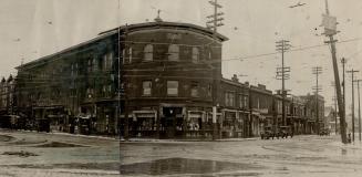
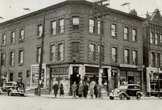
Broadview Avenue and Danforth Avenue, southeast corner, Toronto, Ontario
1920?
Richmond Street West, south side, looking west from Yonge Street, Toronto, Ontario
12/7/1927
Elizabeth Street and Louisa Street, looking north on Elizabeth Street, Toronto, Ontario. Young Sai Tong and Co., teas, is shown on Elizabeth Street, northeast corner of Louisa Street.
1925
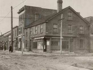
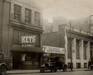
Adelaide Street East, southeast corner of Victoria Street, Toronto, Ontario
24 July 1926
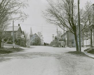
Alliston, Ontario
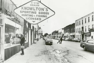
3 October 1974
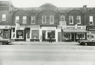
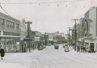
Knowlton's Sporting Goods, one of the many vacant stores on the main street
3 October 1974
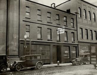
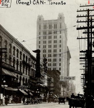
Yonge Street, east side, looking south from south of Adelaide Street East to south of Canadian Pacific Railway Building, southwest corner of King Street East, Toronto, Ontario
8/21/1912
Richmond Street East, north side, looking east from Victoria Street, Toronto, Ontario
12/10/1927
Queen Street West, south side, between Bay Street and York Street, looking south from the north side of Queen Street West.
5/25/1963
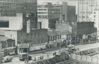
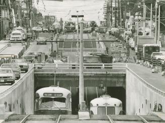
It's the St. Clair connection. The camera's telephoto lens makes it appear St. Clair Ave. streetcars are disappearing into the bowels of the earth, bu(...)
10/24/1977
Streetview of Kirkland Lake, Ont.
1/20/1951
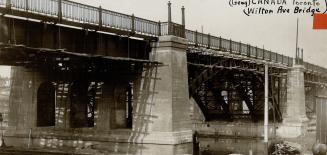
Wilton Avenue Bridge over the Don River, Toronto, Ontario
5/26/1911
Priceville, Ontario
10/28/1953
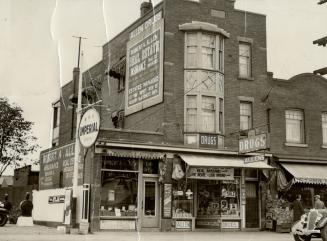
Church Street, southeast corner of Carlton Street, Toronto, Ontario
12/3/1934
Danforth Avenue, north side, looking east from Broadview Avenue, Toronto, Ontario
9/4/1937
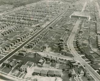
Aerial view of Leaside, looking northeast from Bessborough Drive, between Divadale Drive and Glenvale Boulevard, showing Northlea Public School, Rumsey Road, east side, on upper right, Toronto, Ontario
2/3/1950
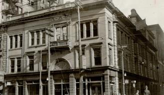
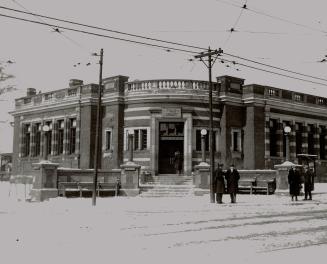
Toronto Public Library, Riverdale Branch, Broadview Avenue, northwest corner of Gerrard Street East, Toronto, Ontario.
3/8/1925
/ 2
Next
RDF
XML
JSON