Skip to main content
Search
Objects
(181,123)
People
(41,125)
Close
Refine Results
Show Only Public Domain
Format
Map
(59)
Book
(9)
Manuscript
(1)
Picture
(1)
Date
to
Names
*
Unknown
(70)
Intelligencer Printing and Publishing House (Belleville, Ont.)
(4)
Canadian Pacific Railway Company
(2)
Blondel la Rougery
(2)
Franklin, John, 1786-1847
(2)
Robertson, J. Ross (John Ross), 1841-1918
(2)
Stanford's Geographical Establishment
(2)
Toronto Star (Firm)
(2)
Amherst, Jeffery Amherst, Baron, 1717-1797
(1)
Alexander & Cable Lithographing Co. Ltd
(1)
Load all
Subject
*
Maps
(70)
Maps and surveys
(10)
Land subdivision
(9)
World War, 1914-1918
(8)
Railroads
(7)
Directories
(4)
Roads
(4)
Discovery and exploration
(3)
History
(3)
British
(2)
Load all
Collection
*
Baldwin Collection of Canadiana
(70)
Language
English
(63)
French
(5)
Latin
(2)
Building, monument or park
Canadian National Exhibition (CNE)
(1)
Fort Frontenac
(1)
Provincial Lunatic Asylum
(1)
Toronto Harbour
(1)
City, town or township
Toronto
(19)
Belleville
(4)
King (Ont. : Township)
(3)
Vaughan
(3)
Ameliasburgh (Ont.: Township)
(1)
Aurora
(1)
Barrie
(1)
Collingwood
(1)
Hamilton
(1)
Kingston
(1)
Load all
Neighbourhood
Brockton
(2)
Exhibition
(2)
Parkdale
(2)
Toronto Islands
(2)
Bloor West Village
(1)
Cabbagetown
(1)
Dufferin Grove-Bickford Park
(1)
East York
(1)
Garrison
(1)
Harbour
(1)
Load all
North-south street
Bathurst Street
(1)
Christie Street
(1)
Dovercourt Road
(1)
Dufferin Street
(1)
Ossington Avenue
(1)
Yonge Street
(1)
East-west street
Bloor Street West
(2)
Davenport Road
(2)
Dundas Street West
(2)
College Street
(1)
Dundas Street East
(1)
Kingston Road
(1)
Queen Street West
(1)
Sort:
Relevance
Date (Older First)
Date (Newer First)
Title (A–Z)
Title (Z–A)
Last Updated (Ascending)
Last Updated (Descending)
List
Images
Table
/ 4
Next
Filters
70 results for
*
Result type
Objects
People
Unknown
Baldwin Collection of Canadiana
Maps
Clear All Filters
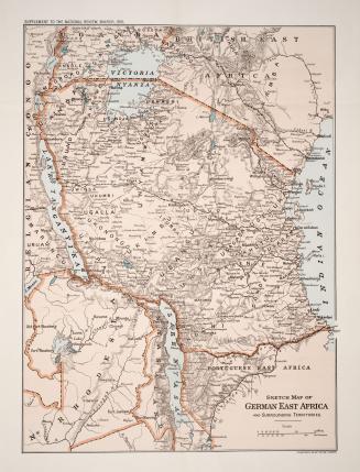
Sketch map of German East Africa and surrounding territories
1916
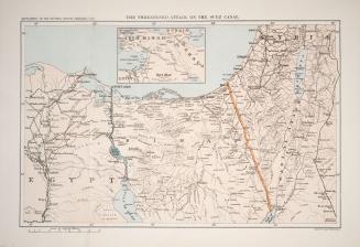
The threatened attack on the Suez Canal
1916
Plan of subdivision of lots 7 and 8, plan 446 West Toronto Junction
1887
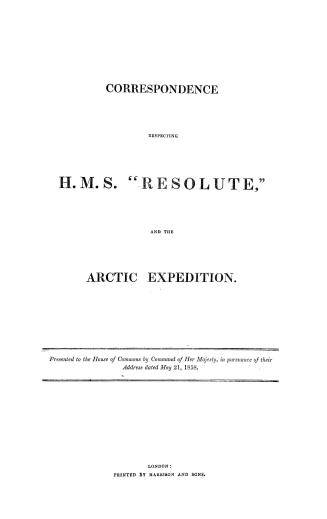
Correspondence respecting H.M.S. ''Resolute, '' and the Arctic expedition
1858
Plan of villa lots for sale, part of lots nos. 36 & 37, con. 2 from bay, in the township of York
1890
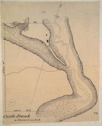
Castle Frank (1794)
Approximately 1908
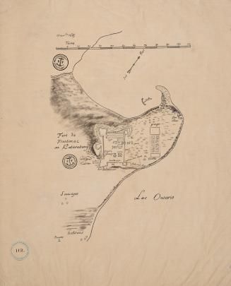
Fort Frontenac ou Katarakouy (November 13 1685)
Approximately 1910
Map of the counties of Russell and Prescott
Approximately 1870
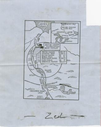
Map of Abitibi Canyon power project. 275,000 HP generator now being installed. Abitibi Canyon, Ontario
1930?
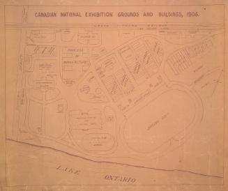
Canadian National Exhibition grounds and buildings, 1906
1906
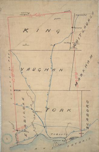
Toronto
Approximately 1872
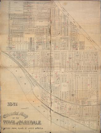
Edwards' map of the town of Parkdale compiled from plans of latest surveys
1887
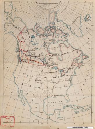
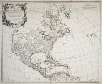
North America
Approximately 1905
Plan of part of Dummer Street and William Street, north of Lot St.
1816
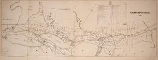
Railway map of Canada 1853
1853
Original plan of the Toronto Purchase from the Indians, 1787-1805
1911
Charlton's simplified road maps of Ontario
n.d.
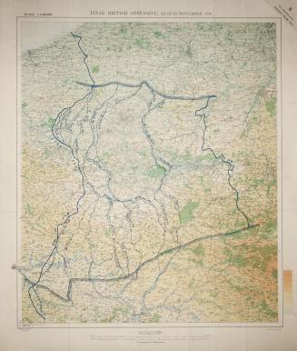
Final British offensive August-November 1918
1919
Amerique Septentrionale, dressee sur les Relations les plus modernes des voyageurs et navigateurs, et divisee suivant les differentes possessions des (...)
1750
Carte générale du Canada ou de la Nouvelle France, 1753
1753
/ 4
Next
RDF
XML
JSON