Skip to main content
Advanced Search Objects: results
Close
Refine Results
Show Only Public Domain
Format
*
Map
(11)
Date
to
Names
Alexander & Cable Lithographing Co. Ltd
(1)
Chewitt, William, 1753-1849
(1)
Chas. E. Goad, Ltd.
(1)
Copp Clark Company
(1)
Dovercourt Land Building & Savings Company Limited
(1)
James, Silias, 1834-1915
(1)
Goad, Charles E.
(1)
Cotterell, Alfred
(1)
Map Specialty Co.
(1)
Macaulay, J. S., 1792-1857
(1)
Load all
Subject
Maps
(11)
Land subdivision
(9)
Maps and surveys
(6)
Real property
(3)
Railroads
(2)
Real estate
(2)
Fire insurance
(1)
Fires
(1)
Harbour
(1)
Industrial sites
(1)
Load all
Collection
Baldwin Collection of Canadiana
(11)
Language
English
(11)
Building, monument or park
Rosedale Ravine (Toronto, Ontario)
(1)
Toronto Harbour
(1)
City, town or township
Toronto
(11)
Neighbourhood
Rosedale-Moore Park
(3)
Seaton Village
(3)
Yorkville
(3)
Deer Park
(2)
Financial District
(2)
North Toronto
(2)
Railway Lands
(2)
St. Lawrence
(2)
Annex
(1)
Bridle Path-Sunnybrook
(1)
Load all
North-south street
*
Yonge Street
(11)
Bay Street
(3)
Bathurst Street
(2)
Bayview Avenue
(1)
Christie Street
(1)
John Street
(1)
Leslie Street
(1)
Parliament Street
(1)
Peter Street
(1)
Sherbourne Street
(1)
Load all
East-west street
Bloor Street East
(3)
Bloor Street West
(2)
Davenport Road
(2)
Dundas Street West
(2)
Front Street East
(2)
Front Street West
(2)
King Street East
(2)
St. Clair Avenue East
(2)
St. Clair Avenue West
(2)
Davisville Avenue
(1)
Load all
Sort:
Relevance
Date (Older First)
Date (Newer First)
Title (A–Z)
Title (Z–A)
Last Updated (Ascending)
Last Updated (Descending)
List
Images
Table
/ 1
Advanced Search
Filters
Title
Names
Subject
Call Number / Accession Number
Date Range
to
Collection
All
Archives of Ontario
Arthur Conan Doyle Collection
Arts department
Baldwin Collection of Canadiana
Business, Science, and Technology department
Chinese Canadian Archive
City of Toronto Archives
Humanities and Social Sciences department
IBBY Collection for Young People with Disabilities
Languages and Literature department
Local History Collection, Annette branch
Local History Collection, Beaches branch
Local History Collection, Bloor/Gladstone branch
Local History Collection, Dufferin/St. Clair branch
Local History Collection, Gerrard/Ashdale branch
Local History Collection, Leaside branch
Local History Collection, North York Central Library branch
Local History Collection, Northern District branch
Local History Collection, Palmerston branch
Local History Collection, Parkdale branch
Local History Collection, Riverdale branch
Local History Collection, Sanderson branch
Local History Collection, Weston branch
Local History Collection, Wychwood branch
Merril Collection of Science Fiction, Speculation and Fantasy
Ontario History Quest
Osborne Collection of Early Children's Books
Special Collections in the Arts
Toronto Public Library Archives
Toronto Reference Library
Toronto Star Photograph Archive
zTEST
Formats
All
Artifact (an object in our collections)
Book
Ephemera
Fonds
Manuscript
Map
Photo Album
Picture
Language
All
Abenaki
Algonquin (other)
Athapascan
Beothuk
Catalan
Chinese
Chinook jargon
Cree
Croatian
Dakota
Danish
Dene Suline
Dené
Dogrib
Dutch
English
French
Gaelic, Scottish
German
Greek, Ancient (to 1453)
Greek, Modern (1453- )
Haida
Haudenosaunee
Hungarian
Innu-aimun
Inuktitut
Irish
Italian
Japanese
Language
Latin
Maliseet–Passamaquoddy
Miꞌkmaq
Mohawk
No linguistic content
Norwegian
Ojibwa
Oneida
Portugese
Russian
Seneca
Serbian
Siksika
Spanish
Swedish
Tsimshian
Ukrainian
Welsh
Wendat
Yiddish
Clear
11 for
Language
:
English
Map
Yonge Street
Clear All Filters
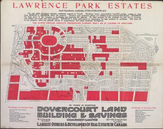
Lawrence Park estates and southern addition Strathgowan, Toronto, Ontario
1910
Map of Yorkville and its vicinity
1878
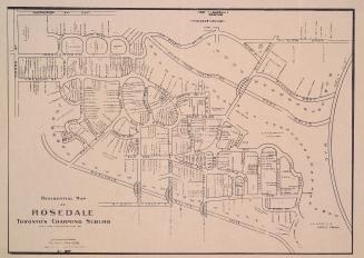
Residential map of Rosedale Toronto's charming suburb
1905
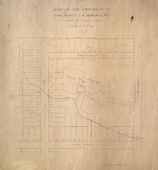
Map of the property of the Hon. J.S. Macaulay situated on Yonge Street Toronto.
1845
(1818) Plan of the Town of York
Approximately 1910
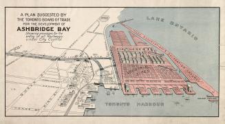
A plan suggested by the Toronto Board of Trade for the development of Ashbridge Bay showing provisions for the entry of all railways under city control
1910
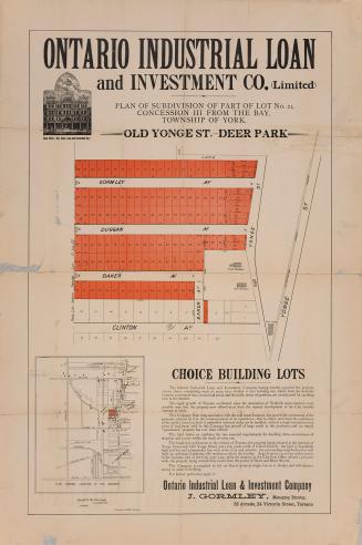
Plan of the subdivision of part of lot no. 21, concession III from the bay, township of York. - Old Yonge St. - Deer Park
1885
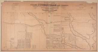
Map of the village of Yorkville and vicinity, compiled from plans & filed in the Registry Office
1877
Plan of lots Glebe Manor Estate
1912
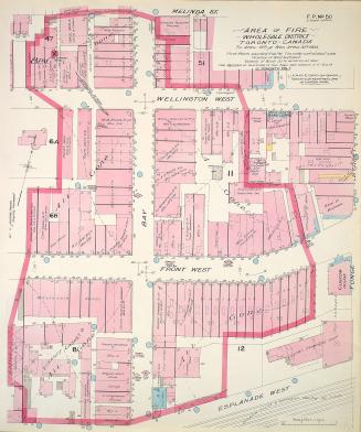
Area of fire wholesale district Toronto Canada Tu. April 19th and Wed. April 20th 1904
1904
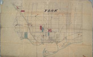
York
Approximately 1872
/ 1
RDF
XML
JSON