Skip to main content
Advanced Search Objects: results
Close
Refine Results
Show Only Public Domain
Format
*
Map
(113)
Date
to
Names
Robertson, J. Ross (John Ross), 1841-1918
(14)
Unknown
(10)
Copp Clark Company
(9)
Alexander & Cable Lithographing Co. Ltd
(7)
Unwin, Browne & Sankey
(7)
Bayfield, Henry Wolsey, 1795-1885
(5)
Denison, George T. (George Taylor), 1839-1925
(5)
J & C Walker
(5)
Dennis, John Stoughton, 1820-1885
(5)
Hydrographic Office
(5)
Load all
Subject
*
Maps
(113)
Maps and surveys
(113)
Land subdivision
(57)
Real estate
(19)
Real property
(19)
Roads
(15)
Harbour
(12)
Military buildings
(12)
Government buildings
(9)
Election districts
(8)
Load all
Collection
Baldwin Collection of Canadiana
(113)
Language
English
(113)
Building, monument or park
Toronto Harbour
(10)
Fort York
(6)
Canadian National Exhibition (CNE)
(1)
Osgoode Hall (Toronto, Ontario)
(1)
Provincial Lunatic Asylum
(1)
Queen's Park (Toronto, Ont.)
(1)
Rosedale Ravine (Toronto, Ontario)
(1)
City, town or township
Toronto
(96)
Québec
(7)
Argenteuil
(1)
Detroit
(1)
Montréal
(1)
Walkerville (Windsor, Ont.)
(1)
Windsor
(1)
Windsor||Ojibway
(1)
Neighbourhood
Harbour
(19)
Garrison
(14)
Railway Lands
(13)
King-Spadina
(12)
Exhibition
(10)
St. Lawrence
(10)
Seaton Village
(9)
Port Lands
(8)
Toronto Islands
(8)
Brockton
(6)
Load all
North-south street
Bathurst Street
(6)
Yonge Street
(6)
Dovercourt Road
(5)
Dufferin Street
(4)
Christie Street
(3)
Spadina Avenue
(3)
Leslie Street
(2)
Lippincott Street
(2)
Peter Street
(2)
Rusholme Road
(2)
Load all
East-west street
Bloor Street West
(16)
College Street
(6)
Davenport Road
(6)
Queen Street West
(5)
King Street West
(4)
Bloor Street East
(3)
Dundas Street West
(3)
Annette Street
(2)
Dundas Street East
(2)
Dupont Street
(2)
Load all
Sort:
Relevance
Date (Older First)
Date (Newer First)
Title (A–Z)
Title (Z–A)
Last Updated (Ascending)
Last Updated (Descending)
List
Images
Table
/ 6
Next
Advanced Search
Filters
Title
Names
Subject
Call Number / Accession Number
Date Range
to
Collection
All
Archives of Ontario
Arthur Conan Doyle Collection
Arts department
Baldwin Collection of Canadiana
Business, Science, and Technology department
Chinese Canadian Archive
City of Toronto Archives
Humanities and Social Sciences department
IBBY Collection for Young People with Disabilities
Languages and Literature department
Local History Collection, Annette branch
Local History Collection, Beaches branch
Local History Collection, Bloor/Gladstone branch
Local History Collection, Dufferin/St. Clair branch
Local History Collection, Gerrard/Ashdale branch
Local History Collection, Leaside branch
Local History Collection, North York Central Library branch
Local History Collection, Northern District branch
Local History Collection, Palmerston branch
Local History Collection, Parkdale branch
Local History Collection, Riverdale branch
Local History Collection, Sanderson branch
Local History Collection, Weston branch
Local History Collection, Wychwood branch
Merril Collection of Science Fiction, Speculation and Fantasy
Ontario History Quest
Osborne Collection of Early Children's Books
Special Collections in the Arts
Toronto Public Library Archives
Toronto Reference Library
Toronto Star Photograph Archive
zTEST
Formats
All
Artifact (an object in our collections)
Book
Ephemera
Fonds
Manuscript
Map
Photo Album
Picture
Language
All
Abenaki
Algonquin (other)
Athapascan
Beothuk
Catalan
Chinese
Chinook jargon
Cree
Croatian
Dakota
Danish
Dene Suline
Dené
Dogrib
Dutch
English
French
Gaelic, Scottish
German
Greek, Ancient (to 1453)
Greek, Modern (1453- )
Haida
Haudenosaunee
Hungarian
Innu-aimun
Inuktitut
Irish
Italian
Japanese
Language
Latin
Maliseet–Passamaquoddy
Miꞌkmaq
Mohawk
No linguistic content
Norwegian
Ojibwa
Oneida
Portugese
Russian
Seneca
Serbian
Siksika
Spanish
Swedish
Tsimshian
Ukrainian
Welsh
Wendat
Yiddish
Clear
113 for
Language
:
English
Map
Maps and surveys
Clear All Filters
Plan of subdivision of part of lot no. 32, conn. II, now in the City of Toronto ... the property of the Land Security Co.y.
1890
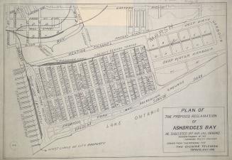
Plan of the proposed reclamation of Ashbridges Bay as suggested by Mr. Jas. Oborne superintendent of the Canadian Pacific Railway
1908
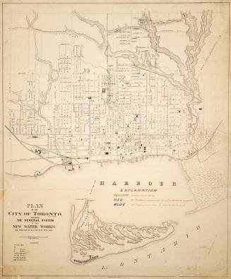
Plan of the City of Toronto, shewing the general system of the new water works and position of all the new pipe laid
1876
Plan of subdivision of lots 7 and 8, plan 446 West Toronto Junction
1887
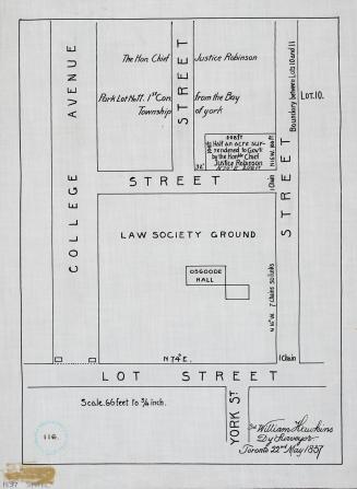
Plan showing property of the Law Society and of the Hon. Chief Justice Robinson
1916
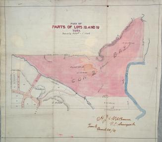
Plan of parts of lots 18 and 19 York
1881
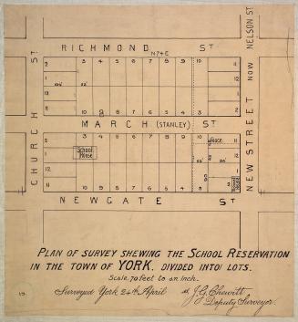
Plan of survey shewing the school reservation in the town of York
1837
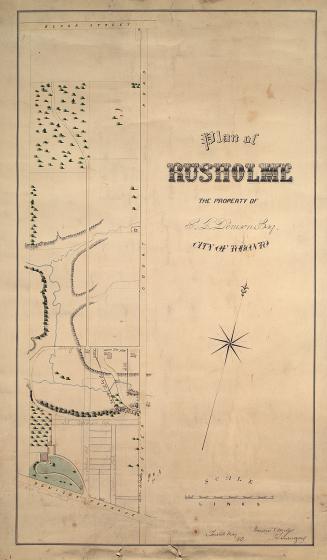
Plan of Rusholme the property of G.T. Denison Esq. city of Toronto
1862
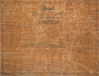
Plan of building lots abutting upon Queen Street East in the city of Toronto
1850
Plan of villa lots for sale, part of lots nos. 36 & 37, con. 2 from bay, in the township of York
1890
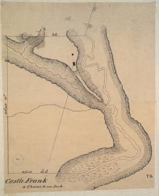
Castle Frank (1794)
Approximately 1908
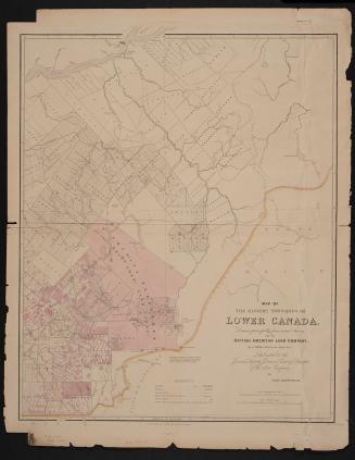
Map of the Eastern Townships of Lower Canada, drawn principally from actual survey for the British American Land Company
22 May 1839
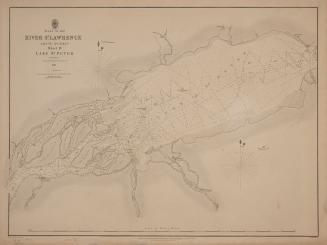
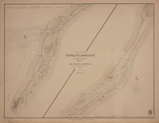
Plans of the River St. Lawrence above Québec sheet IV Lake St. Peter
1831
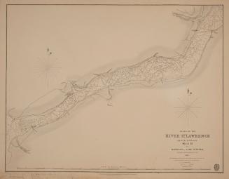
Plans of the River St. Lawrence above Québec sheet III Batiscan to Lake St. Peter
1831
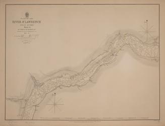
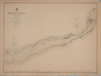
Plans of the River St. Lawrence above Québec sheet II St. Croix to Batiscan
1837
Plans of the River St. Lawrence above Québec sheet I Québec to St Croix
1837
Plans of the River St. Lawrence above Québec sheet V from Lake St. Peter to Montréal
1834
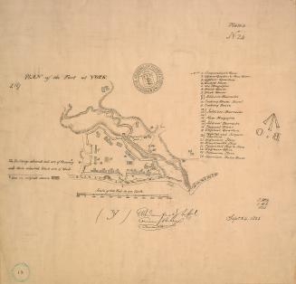
(1823) Plan of the fort at York, no. 24
Approximately 1908
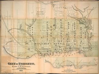
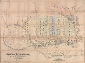
Hart & Rawlinson's Map of the City of Toronto, with Suburbs of Yorkville, Parkdale, Seaton Village, Brockton, and Ben-Lamond
1878
City of Toronto
1878
/ 6
Next
RDF
XML
JSON