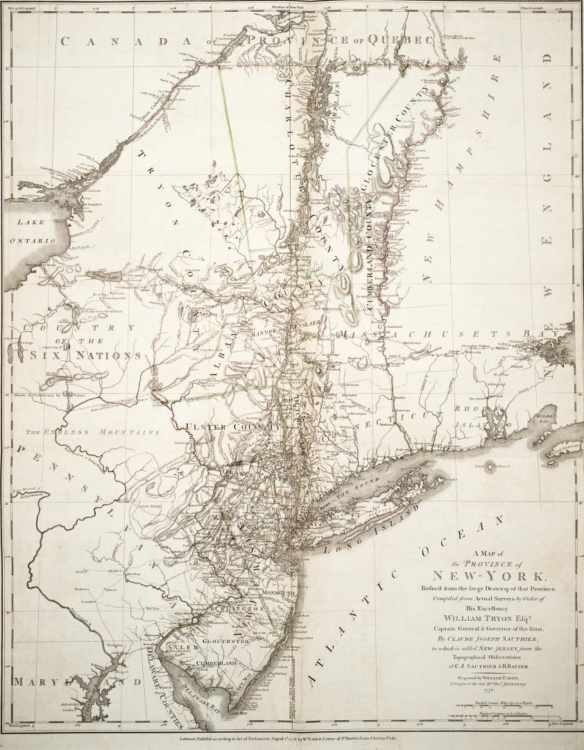

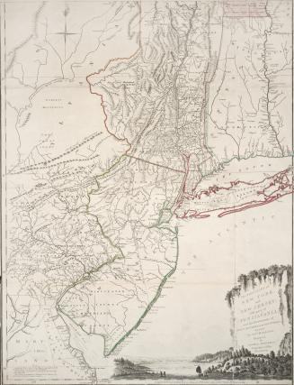
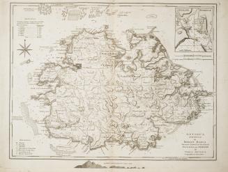
A map of the province of New-York, Reduc'd from the large drawing of that Province, Compiled from Actual Surveys by Order of His Excellency William Tr(...)
Date1776
Names
Faden, William, 1750-1836
(contributor)
Ratzer, B.
(contributor)
Sauthier, Claude Joseph, 1736-1802
(author)
Wm. Faden
(publisher)
FormatMap
Medium
Dimensions1"=16 miles : 72 x 57.5 cm on sheet 79 x 61 cm
Language
ProvenanceGift of James Bain family, 2008
CollectionBaldwin Collection of Canadiana
Usage Rights
Public Domain
(Learn More)
Call Number / Accession Number912.747S134
Robert Sayer and John Bennett (Firm)
1775

De Braham, William Gerard, 1717-1799
1757
