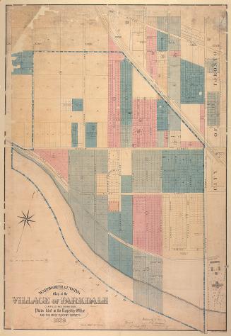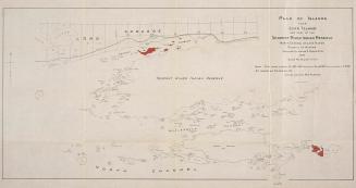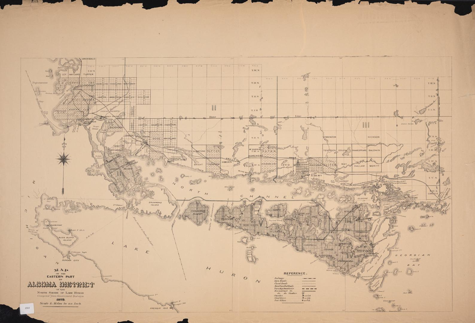

Map of the eastern part of Algoma District on the north shore of Lake Huron compiled from Government surveys
Date1879
Names
Canada. Department of the Interior
(author)
FormatMap
Subject
Medium
Dimensions60 x 92 cm
Scale1 inch = 6 miles
Language
CollectionBaldwin Collection of Canadiana
Usage Rights
Public Domain
(Learn More)
Object Number912-71313-M12
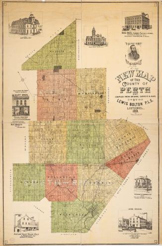
Bolton, Lewis O.L.S.
1888
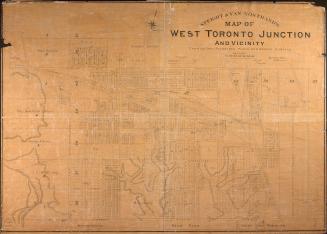
Star Eng. Co. (Toronto, Ont.)
1887