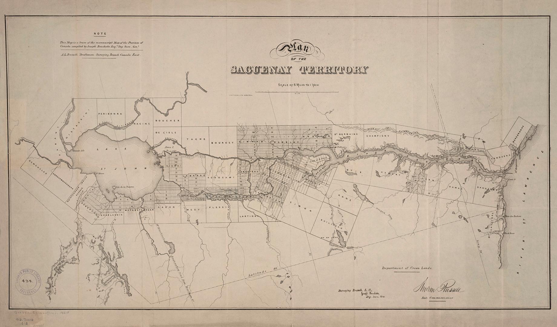

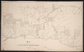
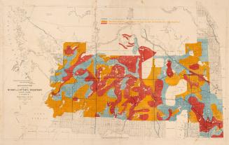
Plan of the Saguenay Territory
Date1861
Names
Crown lands department
(author)
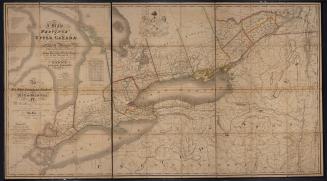
Bouchette, Joseph, 1774-1841
(contributor)
G. Matthews Litho. Montréal
(lithographer)
FormatMap
Notes| This map is a trace of the manuscript Map of the Province of Canada compiled by Joseph Bouchette Esq. Dep. Surv. Gen. A.L. Russell, Draftsman Surveying Branch Canada East, Assistant Commissioner for the Department of Crown Lands |
Subject
Dimensions40 cm x 69 cm (15 3/4 in. x 27 3/16 in.)
Scale1 inch = 6 miles
Language
CollectionBaldwin Collection of Canadiana
Usage Rights
Public Domain
(Learn More)
Object Number912-71416-C12-SMALL
1759

F. Buisson, Libraire
1774 or 1795