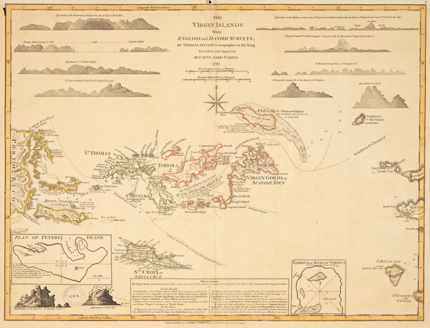

The Virgin Islands from English and Danish surveys
Date1797
Names
Jefferys, Thomas, -1771
(cartographer)
Waring, James, 1781-1847
(contributor)
Laurie & Whittle
(publisher)
FormatMap
NotesIncludes illustrated profiles of the islands, insets of the Harbour of Tortola, Plan of Peters Island, and observations.
Subject
Dimensions50 cm x 72 cm (19 11/16 in. x 28 3/8 in.)
ScaleBar scale; sea leagues 20 to 1 degree
ScaleBar scale; statute miles 69.5 to 1 degree
Language
CollectionBaldwin Collection of Canadiana
Usage Rights
Public Domain
(Learn More)
Object Number912-72972-J24-SMALL


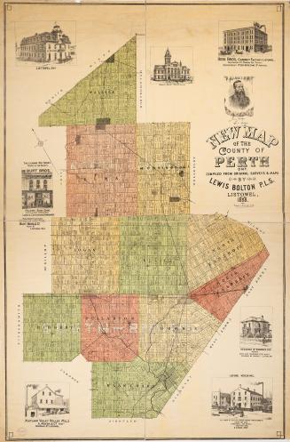
Bolton, Lewis O.L.S.
1888
Star Eng. Co. (Toronto, Ont.)
1887