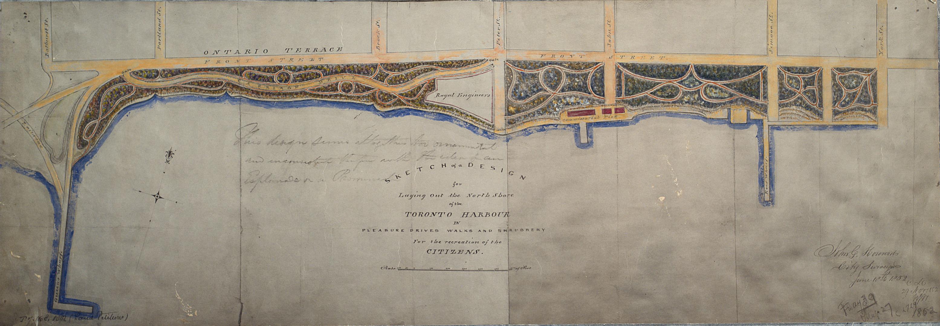

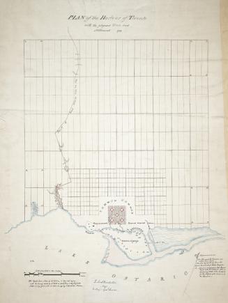
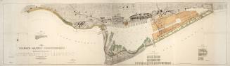
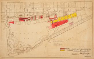
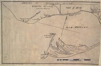
Sketch of a design for laying out the north shore of the Toronto Harbour in pleasure drives walks and shrubbery for the recreation of the citizens
Date1852
Names
Howard, John G. (John George), 1803-1890
(contributor)
Howard, John George, 1803-1890
(author)
Format
Photostat reproduction of original manuscript map held at Library and Archives Canada.
Country:Canada
City, town or township:Toronto
East-west street:Front Street West
Neighbourhood:King-Spadina
North-south street:York Street
Province or state:Ontario
Dimensions25.7 cm x 75 cm (10 1/8 in. x 29 1/2 in.)
Scale1 inch = 200 feet
Language
CollectionBaldwin Collection of Canadiana
Usage Rights
Public Domain
(Learn More)
Call Number / Accession NumberMsX.1921.6

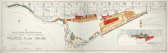
Between 1914 and 1918
Approximately 1908