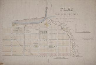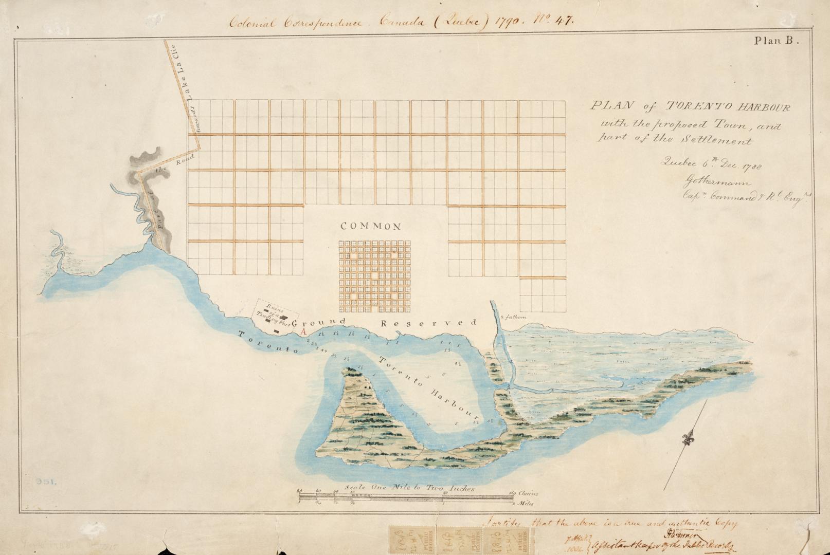

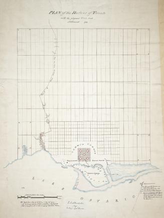
(1788) Plan of Toronto Harbour with the proposed town and part of the settlement, Québec 6th Dec. 1788, Gothermann, Capn. Commandg. Rl. Engrs. Colonial Correspondence Canada (Québec) 1790 no. 47 Plan B
DateApproximately 1908
Names
Mann, Gother, 1747-1830
(cartographer)
Royal Engineers Office (Quebec)
(contributor)
Robertson, J. Ross (John Ross), 1841-1918
(contributor)
Format
Copies of Captain Mann’s map and report were sent in 1884 by Mr. Thomas Hodgins, Q.C., from London, to Mr. W. B. McMurrich, Chairman of the General [Toronto] Semi-Centennial Committee. This is a reproduction of an original owned by W.B. McMurrich.
Subject
Country:Canada
City, town or township:Toronto
Geograhical feature:Lake Ontario
Neighbourhood:Exhibition
Province or state:Ontario
Dimensions40 cm x 60 cm (15 3/4 in. x 23 5/8 in.)
Scale2 inches = 1 mile
Language
CollectionBaldwin Collection of Canadiana
Usage Rights
Public Domain
(Learn More)
Call Number / Accession NumberT-1788-SMALL
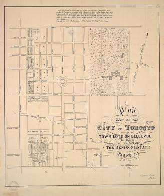
![With the exception of the lots on the Bay shore and those on Dundas or Lot Street coming under the head of sections A and C this plan is merely a proposed sketch of an intended addition to the town of York, His Excellency not having yet decided upon this internal arrangement [1833]](/internal/media/dispatcher/2109749/thumbnail)