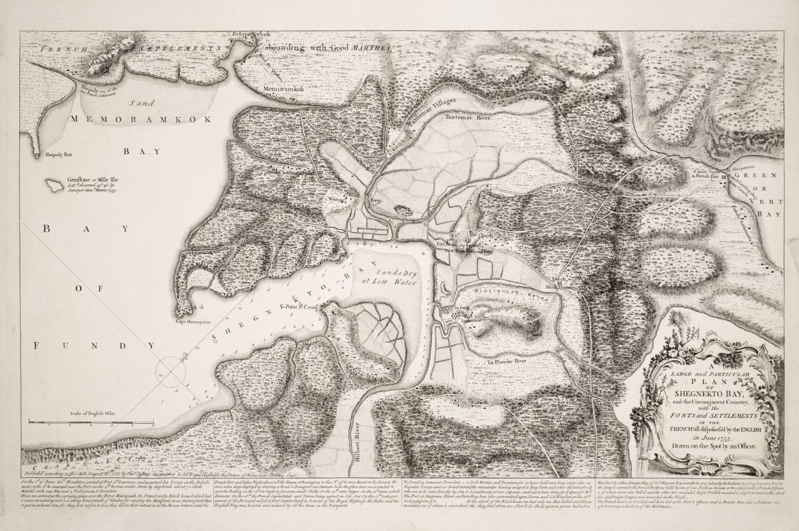

A large and particular plan of Shegnekto Bay, and the circumjacent country, with the forts and settlements of the French till dispossess'd by the English in June 1755 Drawn on the spot by an Officer
Date1755
Names
Jefferys, Thomas, -1771
(author)
Thomas Jefferys
(publisher)
FormatMap
Medium
Dimensionsca 1:102 000 : 45 x 62 cm
Language
CollectionBaldwin Collection of Canadiana
Usage Rights
Public Domain
(Learn More)
Object Number912-71611-J24
Overton, Henry, 1706-1764
Approximately 1760
Montcalm de Saint-Véran, Louis-Joseph, marquis de, 1712-1759
1882
Casgrain, H. R. (Henri Raymond), 1831-1904
1895